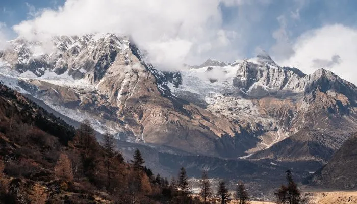
Tsum Valley Trek
Hidden within the pristine beauty of Gorkha, the TSUM valley trek lies before the Manaslu range of Nepal. Manaslu is the world’s eighth-highest mountain, with a height of 8,163 meters (26,781.5 ft.). The Valley lies in the central north of Nepal, in the northern part of Manaslu.
This pristine mountain harbours many beautiful valleys that lie within a few hundred kilometers range from Kathmandu. One such remote valley in Nepal is the Tsum Valley. The tourists have recently recognized the unbelievable natural beauty and the rich culture of Tsum.
The Tsum Valley trek is the most underrated adventure in Nepal. The name Tsum represents a Tibetan word that marks “Tsombo”; meaning is Vivid. Even the name reflects the diverse culture, unique lifestyle, and myth/ mystery of this village. From the insight into the polyandry system (off-course illegal) to the tales of Yeti or Abominable snowmen, the valley has so much to uncover.
The Tsum Valley Trek with Manaslu is a one-of-a-kind trek during which you can see panoramic mountain vistas. You can see Manaslu, Ganesh Himal, Himalchuli, and dozens of other peaks on the journey.
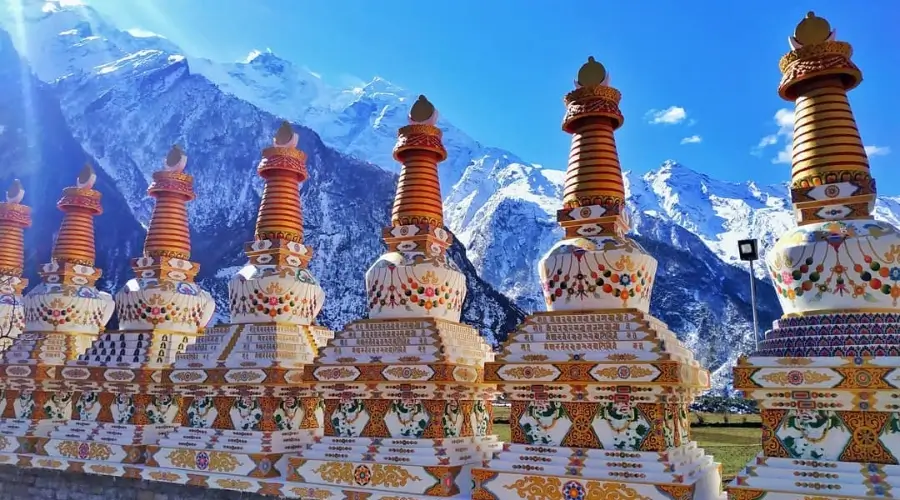
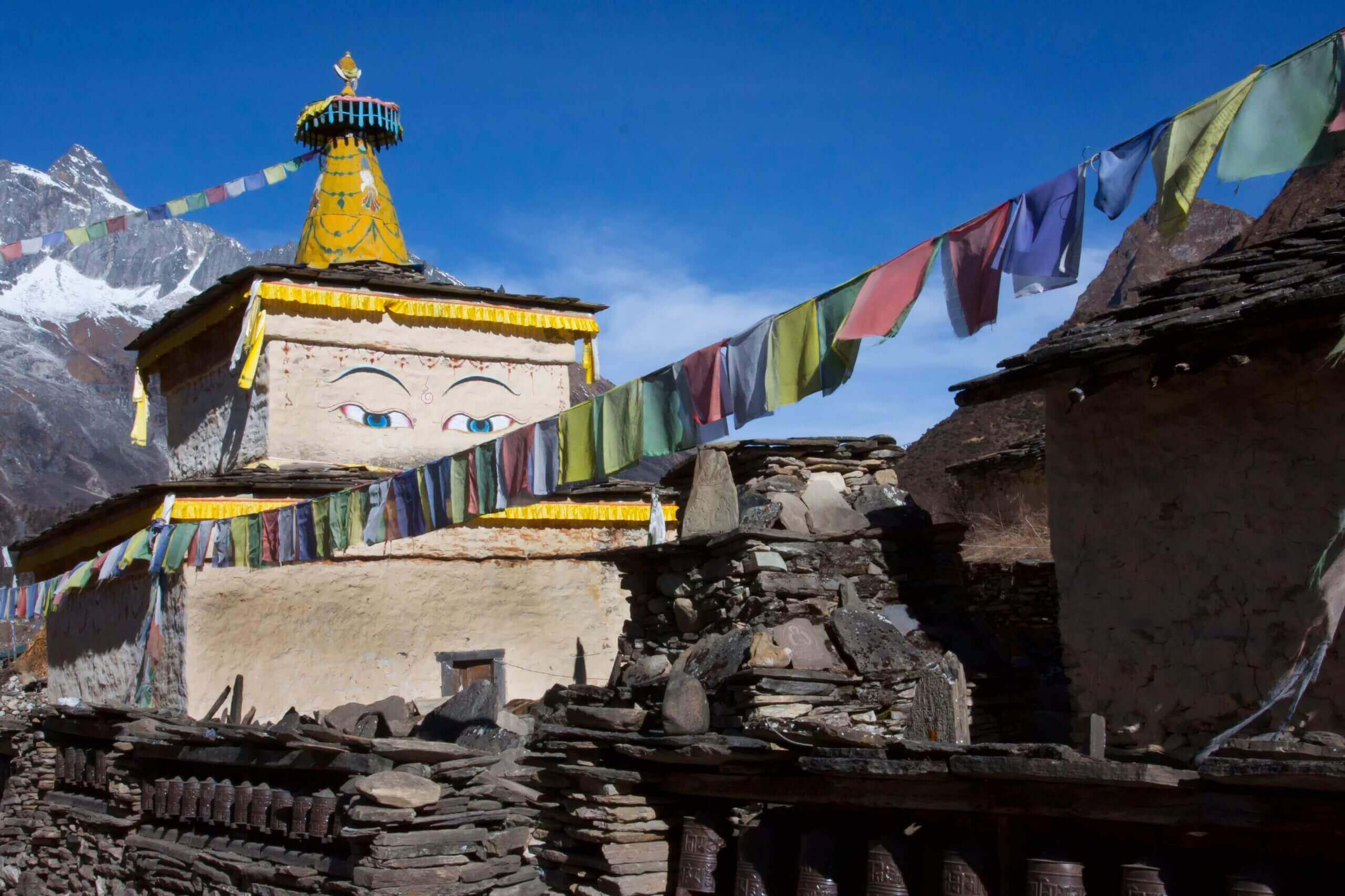
This trek is a hidden jewel of Nepal, where its visitors can see several ancient monasteries, gompas, Mani Walls, rotating prayer wheels, and fluttering prayer flags along the route. The rich Tibet culture will surely give you salvation and peace.
Recently upgraded to a teahouse trekking trail, you can now conquer Tsum’s beauty while enjoying the comfort and luxury of newly built teahouses.
Tsum Valley Trek Overview
This 12-day Tsum Valley trek begins with an exciting drive from Kathmandu to Machha Khola and then to the Nile via Jagat. Walking through the thick tropical forest, cascading rivers, and pristine lakes, you will soon be wandering in the deserted land of the mountain.
On the 7th day, you will reach Mu Gompa, the major highlight of the trek, and get back to Machha Khola via Lokpa. The feeling of achievement of reaching Tsum will bring a sense of happiness, peace, and a life-long lesson, a pure, rejuvenating experience.
Where is Tsum Valley Trek located?
Tsum Valley lies within the Tsum Nubri Rural Municipality in the Gorkha district. The Valley lies to the north-west of Kathmandu, within the Manaslu Conservation Area. This “Hidden Valley” lies right next to the famous Manaslu circuit trek in the northeast for about 50 km. TSUM Valley nestles between Ganesh Himal and Shringi Himal mountain ranges.
How are People and Cultures during the Tsum Valley Trek?
The region around the Manaslu Tsum Valley Trek is home to Gurung, Tibetan, and Tamang communities. Here, the women of Tsum Valley are known for weaving traditional fabrics called Baku and Pangden using wool from local sheep.
The area is quite isolated, surrounded by mountains, and the people, both men and women, wear thick woollen clothes to stay warm in the chilly temperatures.
Despite the modern world advancing rapidly, people still hold onto their ancient customs and traditions. They celebrate Buddhist festivals, perform ceremonies like burning juniper berries to cleanse the air and honour nature, hang prayer flags, and build Mani Walls to spread happiness to all living beings.
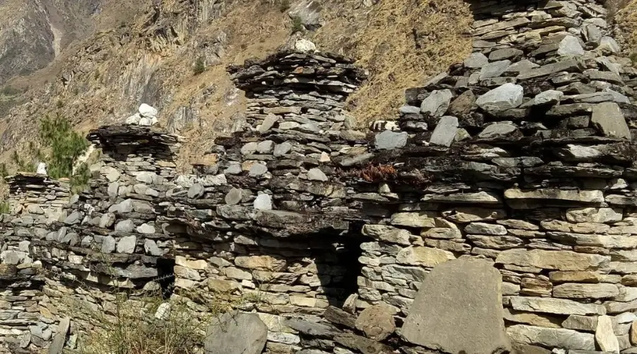
This preservation of culture is largely due to the region being somewhat forgotten by modern development. This area is a fascinating destination for adventurers and trekkers to explore and experience firsthand.
Trek Facts
- Total Duration of the trek: 12 days
- Total Distance of the Trip: Around 430 km (267 miles) from Kathmandu
- Total Trekking Distance: Around 130 km (80.8 miles) from Machha Khola
- Beginning/Ending Point: Kathmandu
- Trek Beginning/Ending Point: Machha Khola
- Maximum Elevation: 3705 meters (12,155.5 ft.) at Mu Gompa
- Best Season to Visit: Autumn (September to November) and Spring (March to May)
- Accommodation: Teahouse
- Transportation: Public bus
- Trek Category: Moderate
- Permits: Tsum Restricted Permit, MCAP, ACAP
- Cost: $899
Tsum Valley Trek Highlights
- A delightful experience of high-altitude trekking, i.e. our final destination, Mu Gompa, at 3700 meters above sea level.
- Avoid the crowd of other popular treks like Everest Base Camp Trek, ABC Trek, or Langtang Valley Trek, and enjoy the solitude of nature all by yourself.
- Visit historic century-old monasteries and dive into the core of the Buddhist culture.
- Experience the unique Tibetan culture of Gurung and Tamang people, including polyandry.
- Discover the true hidden settlements like Philim Gaon, Samagaon, Shambo, and many more.
- Wander through the rich sub-tropical forest and explore many rare and endangered Himalayan wildlife- a jungle safari-like experience.
- Comfortable accommodation is available in the newly built teahouses of Tsum.
Himalaya/Mountains View from Tsum Valley
- Ganesh Himal (7422 m/24,350 ft) and other mountains in Ganesh Himal range
- Shringi Himal (7165 m/23,507 ft)
- Churke Himal range
- Kipu Himal range
- Tara Himal range
- Pashuwo Himal (6177 m/20,266 ft)
- Kiyong Peak (5232 m/17,165 ft)
- Sar Peak (5266 m/17,277 ft)
How long is the Manaslu Tsum Valley trek itinerary with Tsum Valley?
Exploring the Manaslu region can take up to 26 days to see both the Manaslu Circuit and Tsum Valley. However, you can shorten the Manaslu Tsum Valley trek itinerary if you prefer.
Consider an 18-day Manaslu Tsum Valley trek itinerary for a relaxed journey, but some might find it too lengthy.
If you’re in a hurry, you can skip side trips and cut the duration by about 7 days. If your main goal is to conquer the Larke La pass, you can do it in 14 days with the Manaslu Circuit Trek. Adding Tsum Valley will require an extra 7 days, providing an ultimate Manaslu experience.
Alternatively, if you’re interested only in the Tsum Valley trek, it typically takes around 12 days. Similarly, the shortest version of the Manaslu Circuit Trek can also be completed in an 11-day itinerary.
So, depending on your preferences and time constraints, you can choose the Tsum Valley trek itinerary that suits you best.
A Typical Day in Tsum Valley Trek
Normally, a typical day in the Tsum Valley Trek begins early, with crisp mountain air, a beautiful sunrise above the mountain, and the sound of the village life.
After a delightful breakfast at around 7:30 am, we begin our trek at 8 am. Remember to order breakfast the day before so you can have it on time and as you wish.
We will be trekking on the rugged yet exciting trail in the Tsum Valley region. Walking up and down the hill, via several small villages and jungle, along the sound of the Bhotekoshi River, will be the journey of a lifetime.
After walking for about 3 hours, you can ask your guide to stop anywhere for lunch or a short tea/coffee break. Or, your guide will stop by a teahouse for lunch in one of the teahouses, where you will be able to see a beautiful panoramic mountain view and its surroundings.
Then, we will continue to trek to the day’s final destination, where you will stay overnight. Throughout the trek, you can visit several stupas, monasteries, and local villages and even interact with the local people.
By 4 or 5 pm, you will reach the final destination of the day. Upon arrival, we will order our dinner and freshen up or stroll around the teahouse. Finally, at around 7-8 pm, you will have dinner and go to sleep by 10 pm.
Benefits of Booking with Himalayan Masters
At Himalayan Masters, we prioritize ensuring you’re safe, secure, and happy during your adventure. Safety always comes first for us. We’re fully prepared for anything that comes our way, equipped with all the necessary gear, tools, and first aid kits. Our team leaders and guides have undergone thorough training in first aid.
In case of emergencies, like someone getting seriously ill or injured, we’ve got you covered. We look after all the arrangements to help you. If needed, we will arrange an evacuation helicopter, and don’t worry about the cost — it’s all covered by insurance.
Plus, when trekking, we work together to ensure everyone stays safe. It’s all about looking out for each other and having a great time exploring the fantastic landscapes together. So, rest assured, when you trek with us, you’re in good hands.
12-day Tsum Valley Trekking Elevation Chart
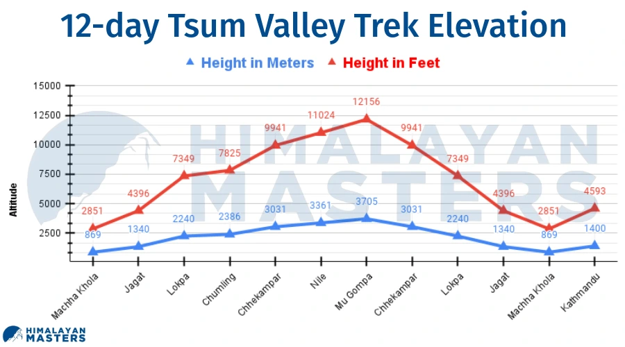
12-day Tsum Valley Trekking Itinerary Outline
| Day | Route | Sleep Altitude | Distance | Time |
| 01 | Drive to Machha Khola | 869 m/2851 ft. | 160 km/100 miles | 7-8 hrs |
| 02 | Trek to Jagat | 1340 m/4396 ft. | 20 km/12.43 miles | 6-7 hrs |
| 03 | Trek to Lokpa | 2240 m/7349 ft. | 12 km/7.4 miles | 5-6 hrs |
| 04 | Trek to Chumling | 2386 m/7825 ft. | 8 km/5 miles | 4 hrs |
| 05 | Trek to Chhekampar | 3031 m/9941 ft. | 9 km/5.5 miles | 4-5 hrs |
| 06 | Trek to Nile | 3361 m/11024 ft. | 7 km/4.3 miles | 3.5-4 hrs |
| 07 | Trek to Mu Gompa | 3705 m/12156 ft. | 5 km/3.1 miles | 2-3 hrs |
| 08 | Trek back to Chhekampar | 3031 m/9941 ft. | 12 km/7.5 miles | 4-5 hrs |
| 09 | Trek back to Lokpa | 2240 m/7349 ft. | 25 km/15.5 miles | 8-9 hrs |
| 10 | Trek back to Jagat | 1340 m/4396 ft. | 12 km/7.4 miles | 4-5 hrs |
| 11 | Trek back to Machha Khola | 869 m/2851 ft. | 20 km/12.4 miles | 4-5 hrs |
| 12 | Drive back to Kathmandu | 1400 m/4593 ft. | 160 km/100 miles | 7-8 hrs |
Detailed itinerary
Day 01: Drive from Kathmandu to Machha Khola (869 m)
Drive Route: Kathmandu → Naubise → Malekhu → Dhading Besi → Jyamire → Arughat Bazaar → Soti Khola → Machha Khola
Beginning Point: Kathmandu (1400 m/4593 ft)
Ending Point / Overnight: Machha Khola (869 m/2851 ft)
Lunch: Jyamire or on the way
Kathmandu to Machha Khola Distance: 160 km (100 miles)
Total Descent: 531 meters (1742 ft) from Kathmandu
Our trekking to Tsum Valley starts from Kathmandu via Prithvi Highway, along the Trishuli River. After driving for about 3-4 hours, you will reach Dhading Besi, from where we will leave Prithvi Highway and take on a gravelled road to Machha Khola.
After driving for about an hour from Dhading Besi, your bus driver will stop around Jyamire village for lunch. If you are diving in a private vehicle, you can ask the driver to stop anywhere for a short break, lunch, or to witness a beautiful view of the Trishuli River, jungles, Ganesh Himal, local villages, temples, gumbas, etc.
Once we have had our lunch, we will continue driving to Machha Khola via various local villages. On the way, you will pass villages like Arughat, Arkhet, Soti Khola, and many more.
Also, you will be able to see a beautiful jungle view and the local market situated on the bank of the Budi Gandaki River. Roads passing by local villages and jungle is going to be a different experience.
Finally, after driving for about 3-4 hours, we will reach Machha Khola, where we will stay overnight.
About Machha Khola
Machha Khola is a beautiful village on the way to Tsum Valley. The village, situated at an elevation of 930 meters (3051 ft), offers an excellent view of the Budi Gandaki River.
There are about 30-40 local houses in the villages, local temples and a small local market. There is also a police station, school, and Dharche Rural Municipality Executive Office.
Teahouses in Machha Khola
- 8-10 teahouses
- Wi-Fi, electricity, in-room charging plug, etc. are available
- Some teahouses have attached bathrooms and hot shower
- Private and shared rooms with twin beds are available
- Food from menu
Meal : Lunch and Dinner
Accomodation : Tea House
Walking / Driving : 7-8 hours drive
Day 02: Trek from Machha Khola to Jagat (1340 m)
Trek Route: Machha Khola → Tatopani → Dobhan → Yuru Khola → Jagat
Beginning Point: Machha Khola (869 m/2851 ft)
Ending Point / Overnight: Jagat (1340 m/4396 ft)
Lunch: Dobhan
Machha Khola to Jagat Distance: 20 km (12.4 miles)
Total Ascent: 471 meters (1545 ft) from Machha Khola
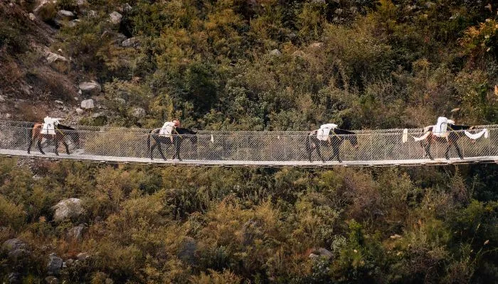
From day 2 only our actual trekking starts.
After having a delicious breakfast in the teahouse, we will begin trekking to Jagat at around 8 am.
At first, we need to cross a suspension bridge and then walk to Khorlabesi. After walking for about an hour, covering about 6 km, on a sloppy uphill route, we will reach Tatopani village. There is a small hot spring. If you wish to, you can take a dip and relax for a while.
Then, we will continue to walk along the Budi Gandaki River on off-road for another 1 hour (3 km) to reach Dobhan. Dobhan is our lunch station for today.
Once you arrive at Dobhan, you need to order your lunch. While your lunch is being prepared, you can visit around the village and interact with the locals.
After having lunch and spending a couple of hours, we will now head towards Jagat via Yuru Khola. We need to cross a suspension bridge again here in Yuru Khola.
Jagat is around 10 km away from Dobhan, which takes about 2.5-3 hours to cover. We will be staying overnight in Jagat.
About Dobhan
Dobhan is a small village situated at an elevation of 1070 meters. The village is located at the bank of Budi Gandaki River, offering an appealing river view and dense forest view.
There are about 3-4 basic teahouses offering Dal Bhat and other basic foods. The teahouses do not have attached rooms or Wi-Fi and have bucket showers.
About Jagat
Jagat is an important village in the Tsum Valley Trekking. The village is the entry point for various treks in the Manaslu region, including the famous Manaslu Circuit Trek. It is also a checkpoint for the Manaslu Conservation Area Permit, as Jagat is the starting point of the Manaslu Conservation Area.
There are about 40 local houses around here. Additionally, you can see mani walls all along the village, local temples, and an awe-inspiring view of Shringi Himal and lush forest. There is also a waterfall nearby, where you can go and take a bath.
Teahouses in Jagat
- 5-7 teahouses
- The attached bathroom, Wi-Fi, hot shower and water, electricity, etc., are available.
- Food from menu
- Neat and clean accommodation
- Charging plug in-room is available
Meal : Breakfast, Lunch and Dinner
Accomodation : Tea House
Walking / Driving : 6-7 hours walk
Day 03: Trek from Jagat to Lokpa (2240 m)
Trek Route: Jagat → Philim → Chisopani → Lokpa
Beginning Point: Jagat (1340 m/4396 ft)
Ending Point / Overnight: Lokpa (2240 m/7349 ft)
Lunch: Philim
Jagat to Lokpa Distance: 10-12 km (6.2-7.4 miles)
Total Ascent: 900 meters (2953 ft) from Jagat
Day 3 of this trek is quite interesting, as you can witness a jaw-dropping mountain view, with people engaged in traditional farming and other activities.
After savouring a delicious breakfast in Jagat, we will begin our trek on a gentle upslope route. You will be walking along the view of the Budi Gandaki River.
With just an hour’s hike, the first village you will see is Salleri. You can stop here for a few moments for a tea/coffee. Just before reaching Salleri, after crossing a suspension bridge, the path takes on a gentle uphill trail.
Then, with an additional 1-2 hours hike (about 3 km), we will reach Philim Village. It is going to be a lunch station for today. Philim is a popular and important village en route to the “Hidden Valley” of Tsum.
Now that you have rejuvenated, we will continue our trek to Lokpa via Chisapani.
Chisapani is a very good spot for river views. It is about 3 km away from Philim, about an hour’s hike. From Chisapani, Lokpa is just 5 km away, which takes about 2 hours to cover.
The route after Chisapani is very enjoyable and a bit challenging as you will have to hike a slightly uphill and a route on the cliff of the mountain. Though the route is on the cliff, it is wide and comfortable to walk.
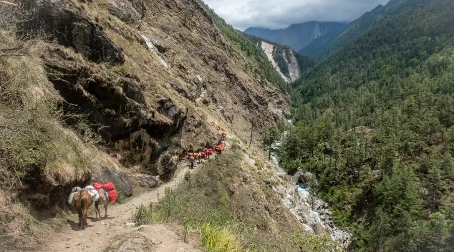
Just before reaching Lokpa, there is a long suspension bridge from where you can go on Manaslu Circuit Trek.
We are going to spend the night in Lokpa for today.
About Philim
Philim is one of the lively villages on the way to Tsum Valley. The village is situated at an elevation of 1570 meters (5151 ft), offering a breathtaking view of Shringi Himal. It is also a regional headquarters for Manaslu and Tsum Valley.
There is also a checkpoint where the Tsum Restricted Permit is checked and an MCAP visitor centre. Additionally, there are banks, post offices, Chyoling Sandu Gumba, local monasteries, etc. that you can visit. The village is also known for the Gurung community and their culture.
Teahouses in Philim
- 8-10 basic teahouses
- Food from the menu (usually prepared from local products)
- Rooms with attached bathroom and hot shower
- Wi-Fi, hot water, electricity, etc. are available
About Lokpa
Lokpa (2240 m/7349 ft) is another beautiful village in the middle of the jungle, offering alluring jungle views along the Budi Gandaki River. From the village, you can see a great view of Ganesh Himal and Shringi Himal.
There is a local temple, mani wall, stupa, etc. that you can visit. Further, you can experience Tibetan culture and communicate with Tibetan people.
Teahouses in Lokpa
- 2-3 simple teahouses
- Private and shared rooms with bathroom outside the room
- Wi-Fi, electricity, hot water, and a bucket shower are available
- Simple Nepali cuisine is available
- Centrally heated dining hall
Meal : Breakfast, Lunch and Dinner
Accomodation : Tea House
Walking / Driving : 5-6 hours walk
Day 04: Trek from Lokpa to Chumling (2385 m)
Trek Route: Lokpa → Sardi Danda → Chumling
Beginning Point: Lokpa (2240 m/7349 ft)
Ending Point / Overnight: Chumling (2385 m/7825 ft)
Lunch: Chumling
Lokpa to Chumling Distance: 8 km (5 miles)
Total Ascent: 145meters (476 ft) from Lokpa
Day 4 is one of the most exciting days of our trek. As of this day, the actual wild and remote route to Tsum Valley commences.
After having breakfast, we start our trek on a steep upward path to Sardi Danda. The section of the trek is particularly challenging for the trekkers.
After walking for nearly 4 hours, covering about 5-6 km, we will reach Sardi Danda. The path after Sardi Danda then takes a steep downward trail.
After walking down the hill for about 2 hours, covering almost 3 km, you will reach Chumling. There are no teahouses in between Lokpa and Chumling. So, you will have lunch and stay overnight in Chumling itself.
Despite the challenging path, the 4th day of trekking offers an astonishing view of the alpine forest and river and a few sheds on the way.
About Chumling
Chumling is a small village on the route to Tsum. The village, situated at an elevation of 2385 meters (7825 ft), is comprised of about 10-15 local houses.
There is a viewpoint nearby, from where you can see excellent views of Ganesh Himal and Shringi Himal, as well as valleys and rivers. There is other micro hydropower, local Gumba and monasteries that you can explore.
Teahouses in Chumling
- 2-3 basic teahouses (homestay)
- Neat and clean accommodation with no attached bathroom
- Bucket shower is available
- Local foods like Dal Bhat, potatoes, local seasonal vegetables, etc., are available
- No Wi-Fi
Meal : Breakfast, Lunch and Dinner
Accomodation : Tea House
Walking / Driving : 4 hours walk
Day 05: Trek from Chumling to Chhekampar (3030 m)
Trek Route: Chumling → Tumje → Chhekampar
Beginning Point: Chumling (2385 m/7825 ft)
Ending Point / Overnight: Chhekampar (3030 m/9941 ft)
Lunch: Chhekampar
Chumling to Chhekampar Distance: 9 km (5.6 miles)
Total Ascent: 645 meters (2116 ft) from Chumling
After having breakfast, the trek follows a sloppy uphill route. The trek route passes by lush jungle views, mani walls, and Buddhist prayer flags along the way.
After walking for about 1.5 hours, about 3 km, you will reach Tumje (Domje). There are 2-3 teashops/homestays serving basic food items. You can spend a few moments and rest here.
The route after Tumje, after crossing the Syar River, takes on a rather challenging, totally uphill path. After Tumje, no villages or teahouses are on the way until we reach Chhekampar, today’s destination. However, you can see stupas on the cliff.
Chhekampar is going to be our lunch and overnight station for the 5th day of Tsum Trek.
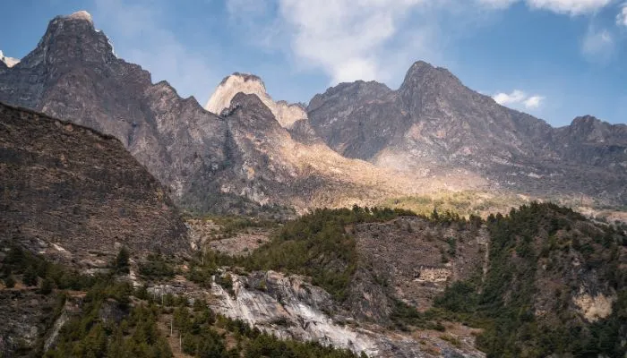
About Chhekampar
Chhekampar, also known as Chhokung Paro, is a remote picturesque village during the trek to Mu Gompa.
The village is situated at an elevation of 3030 meters (9941 ft) and has around 20-30 traditional houses made of mud and stone. The people living here are of Tibetan origin and follow Buddhism. These Tibetan people are generally engaged in seasonal crop farming and animal husbandry.
You can see mani walls, Buddhist flags, and prayer flags throughout the village, giving you a taste of Tibetan culture. Additionally, you can explore local gumbas and stupas nearby.
Teahouses in Chhekampar
- 3-4 basic teahouses (like homestay)
- Private and shared rooms with bathroom outside the room
- Wi-Fi and cellular networks for communication are available
- Bucket shower is available
- Local food prepared in “Daura Chulo”
Meal : Breakfast, Lunch and Dinner
Accomodation : Tea House
Walking / Driving : 4-5 hours walk
Day 06: Trek from Chhekampar to Nile (3360 m)
Trek Route: Chhekampar → Lamagaon → Nile
Beginning Point: Chhekampar (3030 m/9941 ft)
Ending Point / Overnight: Nile (3360 m/11,024 ft)
Lunch: Lamagaon
Chhekampar to Nile Distance: 7 km (4.3 miles)
Total Ascent: 330 meters (1083 ft) from Chhekampar
Day 6 is the most significant and exhilarating day of the trek. From here onwards, the actual Tsum Valley starts.
Today’s trek is easy, as you will need to walk for just around 3.5 hours, covering about 7 km.
After a delicious breakfast, we will walk for about 2-2.5 hours, about 5 km, on a sloppy uphill route to reach Lamagaon. There, we will rest for some time, or you can have lunch if you feel hungry.
After that, we will continue our trek to the Nile, where we will stay overnight. Nile is around an hour away from Lamagaon, about 2 km.
On the day, you will be welcomed by prayer flags in every village, with around 40-60 houses in between. The houses are made in Tibetan style, with stone and Buddhist flags in every house.
About Lamagaon
Lamagaon is a small local village on the route to Tsum Valley. There is a famous gumba nearby, Rachen Gumba, that you can visit. It is a monastery school with around 300 monk students.
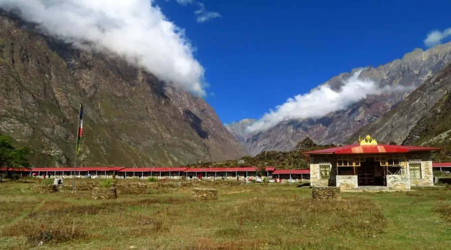
Additionally, there are about 2-3 basic teahouses that serve basic food items such as Dal Bhat, pasta, macaroni, Mo: Mo, pasta, etc. The teahouse also has a landline telephone service, which can be used to connect with your beloved.
About Nile
Nile (3360 m/11,024 ft) is a small, picturesque village in the region, with around 15-20 local, traditional houses. The village is particularly known for its panoramic view of several mountain peaks and the village.
You can see mountains like Ganesh Himal (7422 m/24,350 ft), Shringi Himal (7165 m/23,507 ft), Churke Himal range, Kipu Himal range, Tara Himal range, and Pashuwo Himal (6177 m/20,266 ft).
Teahouses in the Nile
- 2-3 basic homestays and 1-2 teahouses
- Neat and clean accommodation without an attached bathroom
- Wi-Fi, gas shower, electricity, etc. are available
- Centrally heated dining hall
Meal : Breakfast, Lunch and Dinner
Accomodation : Tea House
Walking / Driving : 3.5-4 hours walk
Day 07: Trek from Nile to Mu Gompa
Trek Route: Nile → Mu Gompa
Beginning Point: Nile (3360 m/11,024 ft)
Ending Point / Overnight: Mu Gompa (3705 m/12,156 ft)
Lunch: Mu Gompa
Nile to Mu Gompa Distance: 5 km (3 miles)
Total Ascent: 345 meters (1032 ft) from the Nile
Day 7 is the most significant day of our trek. Today, you will be reaching the final destination of the Tsum Valley Trek, Mu Gompa.
The trek to Mu Gompa takes about 2.5-3 hours, around 5 km. We will walk closer to the Tibetan border on a sloppy uphill path.
There is nothing in between the way. However, the trek along the river is entertaining, with a mani wall, stupas, prayer flags, and many more during the trek.
Additionally, you can see the Chinese border on the way and several mountains during the trek from the Nile to Mu Gompa. Further, you might be able to see various wildlife such as Himalayan Tahr, blue sheep, yak (chauri gai), and different bird species like Danphe (national bird of Nepal), vulture, crow, eagle, etc.
We will stay overnight in Mu Gompa, eat and sleep in the Gompa itself.
About Mu Gompa
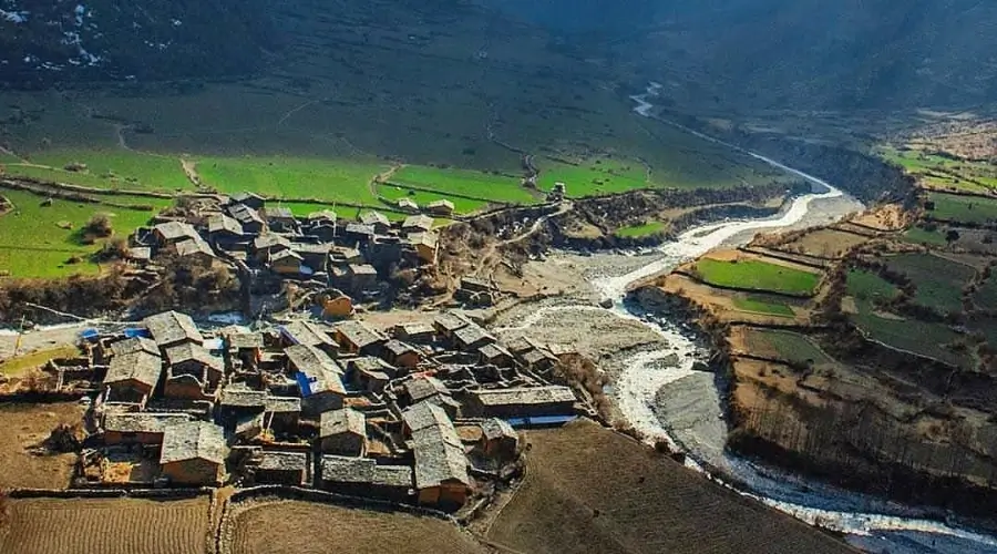
Mu Gompa, situated at 3705 meters (12,156 ft), is the biggest gompa in the entire Tsum Valley region. It is a monastery school that teaches the preachings of Lord Buddha. There are about 30-40 monks living there.
As you stay in Gompa itself, you will be able to explore the lifestyle of Gompa and the monks living there. Further, you can observe morning and evening prayer in the Gompa.
There is a nunnery Gompa nearby, Dhephu Doma Nunnery Gompa, that you can visit. It is a 10 to 15-minute hike from Mu Gompa.
From Mu Gompa, you can see awesome views of various villages, including the Nile and Chhule. Besides the village view, you can see extraordinary, panoramic views of various mountain ranges, such as the Tara Himal range, the Kipu Himal range, the Ganesh Himal range, the Churke Himal range, and the Shringi Himal.
Teahouses in Mu Gompa
- Basic food such as Dal Bhat, porridge, muesli, Tsampa porridge (prepared from wheat and barley), etc., are available.
- Sharing rooms without attached rooms and a simple heating system is available.
- There is no Wi-Fi, but there is electricity, and a bucket shower is possible.
Meal : Breakfast, Lunch and Dinner
Accomodation : Tea House
Walking / Driving : 2-3 hours walk
Day 08: Trek back from Mu Gompa to Chhekampar
Trek Route: Mu Gompa → Nile → Lamagaon → Chhekampar
Beginning Point: Mu Gompa (3705 m/12,156 ft)
Ending Point / Overnight: Chhekampar (3030 m/9941 ft)
Lunch: Lamagaon
Mu Gompa to Chhekampar Distance: 12 km (7.5 miles)
Total Descent: 675 meters (2215 ft) from Mu Gomp
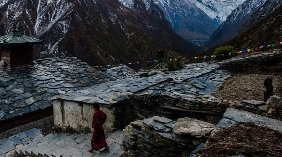
Now, it is time to return back from one of the most iconic treks in the Manaslu region.
After having a basic breakfast in Mu Gompa, we will begin our trek back to Chhekampar.
The route when returning is easier, as the road follows the downhill path. After walking for just around 1.5-2 hours, we will reach the Nile. We can stop here for a short tea/coffee break. Then, again, continue to trek for another 3 hours to Chhekampar.
If you feel hungry, we can stop at Lamagaon for a delicious lunch. From Nile, Lamagaon is just about 45 minutes’ walk.
Finally, after lunch, we will head towards Chhekampar. Lamagaon to Chhekampar is just around 2 hours trek. We will call it a day and spend the night today at Chhekampar.
Meal : Breakfast, Lunch and Dinner
Accomodation : Tea House
Walking / Driving : 4-5 hours walk
Day 09: Trek back from Chhekampar to Lokpa
Drive Route: Chhekampar → Chumling → Lokpa
Beginning Point: Chhekampar (3030 m/9941 ft)
Ending Point / Overnight: Lokpa (2240 m/7349 ft)
Lunch: Chumling
Chhekampar to Lokpa Distance: 25 km (15.5 miles)
Total Descent: 790 meters (2592 ft) from Chhekampar
As we embark on day 9 of our trek, we will follow the same route that we took before. We can reminisce about all the views of jungles, rivers, traditional villages, etc. while returning.
After a blissful breakfast in Chhekampar, we must cover about 25 km to Lokpa.
The route is easy yet entertaining. It is somewhat horizontal, slightly declining from Chhekampar to Chumling. You can see stupas and mani walls on the way if you have missed it previously.
After hiking for just 3 hours, we can reach Chumling, our lunch destination for today. Here, we can rest and savour a delicious meal, energizing ourselves for a challenging trek ahead.
The route after lunch is a little challenging. First, we must ascend a steep hill for around 1-1.5 hours (about 3 km) up to Sardi Danda. From this viewpoint, we’ll be rewarded with panoramic views of the surrounding terrain.
Then again, hike down the hill for another 2-2.5 hours (around 5-6 km) to Lokpa, our overnight destination for today.
Meal : Breakfast, Lunch and Dinner
Accomodation : Tea House
Walking / Driving : 7-9 hours walk
Day 10: Trek back from Lokpa to Jagat
Trek Route: Lokpa → Philim → Jagat
Beginning Point: Lokpa (2240 m/7349 ft)
Ending Point / Overnight: Jagat (1342 m/4403 ft)
Lunch: Philim
Lokpa to Jagat Distance: 17 km (10.6 miles)
Total Decent: 898 meters (2946 ft) from Lokpa
We will start our trek with a gradual downhill trek, offering stunning views of the Budi Gandaki River and valleys downhill.
The trek route passes through lush alpine forests, a thrilling yet comfortable path along the cliff between Lokpa and Chisapani.
After trekking for about 3 hours, covering about 8-9 km, we will reach Philim village via Chisapani. We will be having a hearty lunch here in Philim. While your lunch is being prepared, you can stroll around Philim’s markets and buy a few souvenirs.
After lunch, our journey continues to Jagat, along the Budi Gandaki River. The trail offers a perfect view of rivers rushing down between the hills. You can also see people engaged in farming and cultivation down on traditional terraced fields.
Finally, after walking for another 2-3 hours, covering about 7-8 km, we will reach Jagat. Jagat is the final destination for today; we will stay a night here.
Meal : Breakfast, Lunch and Dinner
Accomodation : Tea House
Walking / Driving : 4-5 hours walk
Day 11: Trek back from Jagat to Machha Khola
Trek Route: Jagat → Dobhan → Khorlabesi → Machha Khola
Beginning Point: Jagat (1342 m/4403 ft)
Ending Point / Overnight: Machha Khola (930 m/3051 ft)
Lunch: Machha Khola
Jagat to Machha Khola Distance: 20 km (12.4 miles)
Total Descent: 471 meters (1545 ft) from Jagat
Day 11 is the final day of our trekking in the Manaslu Tsum Valley region.
Today, we will enjoy a scenic trek from Jagat to Machha Khola. Also, it might be offset for a few trekkers, as you might encounter roads at some places.
After having breakfast, we start our trek at around 8 am. The trail takes on a gentle downhill path, offering a breathtaking view of Budi Gandaki and several charming villages like Dobhan and Tatopani on the way.
As we walk down the hill, the change in landscape is quite visible. The landscaper at higher altitudes used to be wide open with few bushes. While in lower altitudes, you can see tropical trees like chilaune, katus, and salla.
After trekking for nearly 4 hours (about 10-12 km), we reach Khorlabesi. Here, we will be having our last lunch of the trekking journey.
After refuelling ourselves, we continue to trek for another 2-3 hours to reach Machha Khola, about 8 km.
Now that we have come to the end of our trekking journey, we will drive back to Kathmandu the next day. So, you can enjoy a delicious dinner in the teahouse and share all the trekking experiences with your fellow trekkers over a cup of tea/coffee in the evening.
Finally, after dinner, we will call it a day and go to bed at around 10-11 pm.
Meal : Breakfast, Lunch and Dinner
Accomodation : Tea House
Walking / Driving : 4-5 hours walk
Day 12: Drive back to Kathmandu from Machha Khola
Drive Route: Machha Khola → Dhading Besi → Jyamire → Kathmandu
Beginning Point: Machha Khola (930 m/3051 ft)
Ending Point: Kathmandu (1400 m/4593 ft)
Lunch: Jyamire or on the way
Machha Khola to Kathmandu Distance: 160 km (100 miles)
Total Ascent: 470 meters (1542 ft)
Overnight: Kathmandu
Day 12 is the final day of our Tsum Valley Trek Nepal.
After having our breakfast, we hop on a public bus that will take us back to Kathmandu. You can also request to travel in a private shared vehicle at an additional charge.
It takes approximately 7-8 hours to reach Kathmandu. After driving for around 3 hours, the public bus will stop around Jyamire for lunch or anywhere in between the route.
Once you are in Kathmandu, you can rest for the remaining day or go to a relaxing spa. We recommend you take a rest for the rest of the day and go out on an evening stroll around Thamel or Kathmandu Durbar Square (a UNESCO World Heritage).
Upon your arrival in Kathmandu, if you have a few more days to spend in Nepal, we suggest you visit Kathmandu city for its historical significance. You can also visit Pokhara for its natural beauty and peaceful vibe.
If you wish to go on a relaxing yet adventurous tour, visiting Chitwan National Park or Bardiya National Park could be the best choice for you.
Meal : Breakfast and Lunch
Accomodation : Not Included
Walking / Driving : 7-8 hours drive
Include / Exclude
Trip Cost Includes
- International Airport is picked up and dropped off by private car.
- Kathmandu to Maccha Khola by public bus
- Maccha Khola to kathmandu by by public bus
- Tsum Valley restricted area permits
- Manaslu Conservation Area permits
- 1 set Breakfast, 1 set lunch, and 1 set dinner with tea and coffee for 12 days of trekking.
- Three cups of hot drinks a day
- best available private teahouse accommodation in the mountains for eleven nights in the mountains
- a professional English-speaking trekking guide during your 13-day trek.
- all government taxes and company service charges
Complementary services from Himalayan Masters:
- Himalayan Masters brand sleeping bag during the trip (We will provide a -20 degree sleeping bag)
- down jackets during the trip (We will provide a perfect winter down jacket can go until -20 degree temperature)
- A pulse oximeter monitors your oxygen saturation and heart rate at high altitudes.
- Himalayan Masters brand water bottles and purification tablets
- First aid kit box
- Seasonal fruits for dessert
- Himalayan Masters Brand Duffle Bag for the Trek
- Himalayan Masters Brand Trekking T-Shirt and Cap
- The guide keeps a bottle of oxygen on hand in an emergency.
- Manaslu tsum valley trekking maps
Trip Cost Excludes
- International flight airfare
- Nepal entry visa fees at Tribhuvan International Airport (paid in cash)
- All accommodations and meals in Kathmandu, before and after the journey
- Personal expenses (shopping, snacks, bottled water or boiled water, and cold drinks, hot showers, alcohol, Wi-Fi, telephone calls, battery re-charge fees, extra porters, etc
- Personal clothing and gear
- Travel insurance has to cover emergency helicopter high-altitude rescue, and evacuation along with medical costs (compulsory)
- Tips for guides and porters
- Additional costs due to delays caused by circumstances beyond our control, for example, landslides, lousy weather, itinerary modification due to safety concerns, illness, change of government policies, strikes, etc
- All the costs and expenses not listed in “What is included in this Trek package?” will be counted as excluded.
- Other things not mentioned above are also on the exclusion list.
Useful Info
Best Season to Trek Tsum Valley
The best seasons for trekking in Tsum Valley are autumn (September to November) and spring (March to May).
Spring is one of the best times to visit the valley as it provides beautiful natural scenography of red/colours rhododendrons against snowcapped mountains. The weather in this season is fairly good for hiking because the days are relatively warm while nights are not extremely cold. It also makes the sky clear, and the visibility of the mountain view is excellent.
Monsoons remain wet, while new greens appear after the rains in autumn. A clear blue sky during these times is the best time for a photo shoot of the landscape. The climate is temperate, with constant sunshine and moderate temperatures during the day and at night.
Trekking enthusiasts get to enjoy dry trails as well as well-surfaced trails in both spring and autumn seasons, which are characteristic of the two seasons.
Besides, there is little rainfall or Snowfall in September and October, so the trek might not be disturbed frequently. They both fulfil the best trekking weather factors and scenic beauty.
Weather/Temperature of Tsum Valley
The weather in Tsum Valley varies with the change in season. These changes in season affect the trekking conditions.
Spring (March to May) offers mild, pleasing temperatures for trekking, with temperatures ranging from 10-20°C during the day and 0-5°C at night. This season offers one of the best times to observe blooming rhododendrons and clear skies.
Meanwhile, the summer (June to August) has a warmer climate. The temperature during this season ranges around 20°C, with heavy monsoon rain. This makes the trail muddy and occasional mountain views, making trekking challenging.
Similarly, Autumn (September to November) is equally beautiful, with temperatures around 10-20°C during the day and -5 to 5°C at night. The weather during this season is stable, with clear skies, offering excellent mountains and surrounding views. The view of vibrant rhododendrons after monsoon rain is awe-inspiring.
Likewise, winter (December to February) is equally challenging due to cold weather, especially at higher altitudes. The daytime temperature ranges around 0-10°C and night temperature around -10°C to -15°C.
Difficulty of Tsum Valley
The fact that Tsum Valley was closed for many years and lies within a restricted region makes it sound scary. However, the fact is, it’s among the most leisurely treks in the Manaslu region.
Firstly, the trek’s highest point is 3,700 meters, which is very low compared to other big tours of Nepal. If you drink enough water and give yourself enough rest, the chances of altitude sickness in Tsum are almost rare.
During this trek, you need to walk on steep terrain for 10 days, covering 15 to 20 km distance each day. Also, the trekking route is located off the beaten track. Trekking in such conditions demands trekkers’ physical and mental fitness.
So, if you are not a professional/experienced trekker, you need to train your body with a few cardio exercises before trekking. Running, Jogging, Swimming, and cycling two months before the hike can be helpful.
Though the trek reaches a maximum elevation of 3,700 meters (12,139 ft) only, difficulty in accessing the area and lack of facilities and even some amenities make the trek challenging.
Why is Acclimatization Needed for Tsum Valley Trek?
Manaslu Circuit and Tsum Valley Trek offer a unique opportunity for adventurers to explore stunning landscapes while gradually ascending to higher altitudes. Starting from the low elevation of Machha Khola at 930 meters, we need to take our time climbing, allowing our bodies to safely adjust to the increasing altitude.
To prevent altitude sickness, it’s crucial to trek at a moderate pace and stay hydrated by drinking at least four litres of water daily. If someone in the group shows severe symptoms of altitude sickness, such as headaches, nausea, or dizziness, the best action is to descend to a lower altitude immediately.
Based on the group’s overall health, our trek leaders can decide whether to continue the Manaslu circuit and Tsum Valley trek or halt. Your safety is our top priority, and we encourage open communication about any concerns or symptoms you may experience.
It’s essential to recognise that some individuals are more susceptible to altitude sickness than others, so listening to your body and communicating discomfort to your trek leader is essential. By following these precautions and guidelines, we ensure that your Manaslu Circuit and Tsum Valley trek experience is enjoyable but also safe and unforgettable.
Roads/Route on the Tsum Valley Trek and How to Avoid
The Tsum Valley Trek normally follows a rugged trekking trail with some motorable roads up to Jagat. So, you are going to have a completely remote and traditional experience from the trek.
However, on the first and last day, from Kathmandu to Machha Khola and vice versa, you must travel by vehicle. Further, until Jagat, you might encounter few roads, especially in the lower section around Arughat or Soti Khola.
Our itinerary is prepared in such a way that you can walk amidst serene nature, apart from the hustle and bustle of motorable roads. After Philim, the trek diverges from the Manaslu Circuit and leads to deeper, secluded, untouched Tsum Valley.
This region is secluded from the advancement, offering you a once-in-a-lifetime experience. You can experience Tibetan culture and the village lifestyle. You will encounter people engaged in their diurnal activities, animal husbandry, and so on.
For a more scenic and pristine experience, you might want to hire a local guide who knows the area well.
Is Special Training Needed for Tsum Valley Trek?
No special training or climbing training is required for Tsum Valley Trek. But decent physical and mental stability is recommended.
This trek reaches up to an elevation of just 3700 meters, so there is not much climbing to be done. Nevertheless, you must be mentally prepared for the occurrences of altitude sickness or any other instances related to altitude.
Doing some cardio and leg training at least one month prior to trekking is advised. You can run, lunge, cycle, swim, etc., to build physical strength. You can also do yoga and meditation for mental stability and a peaceful mind.
Further, the trekker must consult with their physician before going out on a trek. Mainly, if you are asthmatic or pregnant, you should be extra careful.
Emergency and Evacuation
The region of Tsum Valley is a restricted area that has been recently opened for trekkers. Due to its limited access to modern medical facilities, rescue might be difficult.
Therefore, it is compulsory to have medical insurance for this trek. The insurance should cover medical expenses; in the worst case, you might also need to evacuate by helicopter.
Additionally, you need to be extra careful, eat healthy, and stay hydrated to avoid any chance of altitude sickness or diarrhea. Furthermore, you need to listen to your guide at all times. The guides and porters can assist you in case of any injuries or help you avoid them.
Also, our team is equipped with the first case kit and instruments for measuring your body oxygen level, ensuring your health and providing immediate support.
Insurance
Although trekking to Tsum Valley is not associated with high altitude, instances of altitude sickness and other dangers still exist. Likewise, due to the remoteness of the region, immediate medical help might not be possible.
So, travel insurance covering high-altitude trek rescue/evacuation and medical treatment is compulsory for this trek.
Permits
Along with your Nepal visa, you need three other permits for this trek. A tourist Visa to Nepal is available upon arrival at the airport and costs $50 for 30 days. Indian Manaslu trekkers do not need a visa, and a visa is free for citizens of SAARC.
Tsum Restricted Permit
Tsum Valley lies within the restricted region of Nepal, so you will need a restricted area permit. This permit is necessary to cross Jagat (there’s a check-post). This restricted area permit is only issued to group trekkers (more than two) accompanied by a licensed trek guide. The trekkers need to get this permit from the Department of Immigration, Kathmandu, and require a long list of documents. Your travel agency (Himalayan Masters) will assist you in getting the restricted area permit. The cost is:
- September – November: USD 40 per person/week and USD 7 per person/day (beyond one week)
- December – August: USD 30 per person/week and USD 7 per person/day (beyond one week)
Manaslu Conservation Area Permit (MCAP)
The Manaslu conservation area starts at Philim. You can get this permit from Kathmandu or even at the entry point. Only your passport-size photo and passport are needed to issue the permit, and it costs about USD 30 (Rs 600 for people of SAARC country).
Annapurna Conservation Area Permit (ACAP)
This permit is only needed if you take route three, as mentioned below. This permit is not needed for our Itinerary. The cost and rules are similar to those for the Manaslu Conservation area.
Route 1: Our Itinerary here is only 12 days long. This is a rather short route and goes via the places mentioned here in the Itinerary section.
Route 2: If you have a few more days in your holiday, you can take another route from Chhekampar (Day 08 in Itinerary) and then walk to Gumba Lundang and visit Ganesh Himal Base Camp. This gives you the true experience of the base camp trek. From Gumba Lundang, you walk to Lokpa and Jagat, joining the same route.
Route 3: You can also join the Annapurna Circuit Trek Route from the Domje village (above Chumling). For this, you first walk to Bihi, Namrung, and then to Sama Gaon. Joining Samdo and Larkya Phedi, you walk to Dharmsala, Bhimthang, and Dharapani. From Dharapani, you can drive to Besisahar and then to Kathmandu. This makes your Tsum Valley trek about 20 days.
Cost
The total cost for the Tsum Valley trekking can differ based on the trek route, number of days for trekking, season, and services that you take. The cost might range from $800 to $1500, depending on all those factors.
With Himalayan Masters, you can complete the trek in a 12-day itinerary at just $899. The trip package includes all the travel costs, permits, accommodation, food, etc.
Breakdown of trip cost:
Food: The food in Tsum Valley costs around $10-$15 per meal.
Accommodation: The accommodation costs around $10 per night.
Permits: You need to obtain a Manaslu Conservation Area Permit (MCAP), Annapurna Conservation Area Permit (ACAP), and Tsum Restricted Permit, which costs around $90 to $100 altogether.
Transport: If you travel in a public vehicle, it costs around $12-15 from Kathmandu to Machha Khola, and the same when returning.
Guide: Hiring a guide costs around $25-30 per day.
Additional Cost
The additional cost includes all the additional services that you take, snacks, private transportation, tips for guides and porters, drinks, etc.
You can expect to spend around $10 per day for charges for Wi-Fi, hot water and shower, electronic charging, and many more at the teahouses. Additionally, snacks during the trek might cost around $10.
Further, transportation via private vehicle from Kathmandu to Machha Khola instead of public vehicle costs around $200. Additionally, tips for the guide and porter are not included in the trip, so tips can also add up to an additional fee for the trip.
Packing List
Clothing
- Base thermal layers (top and bottom)
- Fleece or down jacket
- Trekking pants
- Hat
- Gloves
- Socks
- Trekking boots
Accessories
- Sunglasses
- Headlamp
- Trekking poles
- Backpack
- Water bottle
- Lip balm
Health and Safety
- Personal hygiene kit
- Sunscreen
- First aid kit
- Water purification tablet and altitude sickness medication
Miscellaneous
- Passport
- Permits
- Travel Insurance
- Snacks
- Camera
- Cash
NOTE: The listed packing list for Tsum Valley can be customized according to your personal preferences.
Accommodation
For a long time, this region of Manaslu was a popular camping trek destination. The Tsum Valley Nepal trek has recently been upgraded as a teahouse trek destination. There are only a handful of teahouses, and you need to book them in advance—the cost of a room in teahouses is minimal, i.e. $5 to $6.
Teahouses are small hotels owned by the locals with centrally heated restaurants. The room has 2 to 3 single beds, a mattress, a pillow, and a small blanket. It’s not very luxurious, but it’s comfortable enough. The bathrooms are usually Indian style and available on a sharing basis. The hot shower is available for an extra cost ($2- $3).
Internet/ Wi-Fi in Tsum Trek: Most teahouses now have a wireless network connection, but the speed is prolonged. It cost an additional $2.
Electricity in TSUM trek route: The electronic devices can be charged in reception, which will also cost a few extra dollars. Having an extra battery, power banks, and a solar-powered charger is handy. We don’t suggest you carry a laptop.
Food
During the Tsum Valley Trek, food options are generally basic but nourishing. The foods served in teahouses generally cost $5 to $7 per meal.
Typically, Dal Bhat (rice and lentil soup), vegetable curries, noodles, potatoes, and fried rice, with seasonal green vegetables, are served in the teahouse.
The food in this region is mainly influenced by Tibet. So, trekkers can savour Nepali food with a bit of Tibetan flavour.
Fresh meat is limited, as the area is remote and does not have a refrigerator for food preservation. But the meals are hearty, providing energy for long days of trekking.
Breakfast
- Tibetan bread
- Oatmeal
- Toast with jam, honey, or peanut butter
- Boiled eggs and other egg items
- Porridge
- Hashed brown potato
- Pancakes
- Muesli
- Tea/Coffee
Lunch
- Dal Bhat
- Thukpa
- Fry rice
- Mo: Mo
- Noodles
- Chapati
- Macaroni
- Spaghetti
- Steaks
Dinner
- Dal Bhat
- Sherpa Stew
- Thenthuk
- Potato dishes
- Buckwheat pancakes
- Spring rolls
- Local style pizza
- Rice pudding
- Apple Pie
Local Foods
- Dhindo
- Butter tea
- Sel roti
- Tsampa (roasted barley flour porridge)
Packed Lunch
- Boiled eggs
- Chapati or Tibetan bread with cheese or jam
- Seasonal fruits
- Energy bars
- Biscuits
- Dried fruits and nuts
- Sandwich
Drinking Water During Trek
If you want to buy water bottles, they cost 1-3 USD per litter. However, buying water bottles at all times can be expensive. Therefore, you can carry your water bottle and fill it with natural taps. However, purify it with a water purification tablet provided by Himalayan Masters, or you can use water purifying bottles.
Recommendation: Staying hydrated during the trek is essential; do not drink spring water without consulting your guide. Drink at least 3 liters of water every day.
Money Changer and ATM During Trek
Tsum Valley lies in the remote section of the Manaslu region. Therefore, finding an ATM or money changer is not feasible. Also, every time you pay by ATM, you need to pay an additional 3.5% additional charge, which is not a wise choice.
Though there are banks in Arughat Bazaar and Philim, it is not always reliable. So, you are advised to exchange your money in Kathmandu.
For exchanging money, you will need to submit a copy of your passport and flight ticket.
Communication During Trek
Almost all the parts of the Tsum Valley have Wi-Fi and cellular network service. Although Wi-Fi is available in the teahouses, throughout the trek, it might be slow or for private use only.
Therefore, it is better to buy a Nepali SIM (NTC or NCELL) so that you can stay connected to the internet at all times. Again, you might not get a network at all places.
To buy a Nepali SIM, you need to submit a copy of your passport, passport-sized photo, and your temporary address or hotel’s address.
Guide vs Solo Trek
Of course, there are perks to travelling solo, like solitude, freedom, and so on. However, solo trekking also has its disadvantages. You will need to know about the trekking route, weather, villages, and their cultures, as well as manage accommodation and transport. Over that, you might also want to learn a few Nepali phrases.
Moreover, trekkers are not allowed to trek alone, without a licensed guide, in the restricted region of Tsum Valley. Additionally, you should have a group of at least two individuals, assisted by a guide for trekking in this region of Nepal.
Nevertheless, if you are single, Himalayan Masters can arrange a trekking package, along with a professional guide and porter.
Besides, all the arrangements, transport, accommodation, food, etc., are arranged by the guide so that you can travel freely and comfortably without worrying about anything.
Is Porter Needed?
Hiring a porter for the trek gives you the freedom to trek comfortably and freely without the burden of your luggage. Walking for about 5-6 hours daily for 10-12 days, covering almost 10-15 km with 20-25 kg luggage, could be really challenging. But if you have a porter, you need not worry about any weight, which allows you to enjoy the trip to the fullest.
Remember, trekking without a porter surely reduces the cost of the trip. But we recommend you hire a porter for the trek. If you are trekking with us, a porter and guide are included in the trip package itself.
Tipping Culture
The guides and porters are dedicated to making your trip as comfortable as possible and a successful journey. They will arrange everything necessary for the trip. Therefore, out of appreciation, you are expected to tip them for their hard work.
Normally, 10% of your trip is recommended as a tip. But you can tip them as much as you find fit. Also, the tip you give them goes directly to them, without any cut for the agency.
Further, by tipping guides and porters, you are not only helping them but also you are supporting their families.
Booking Procedure
You can easily book the Nepal Tsum Valley Trek with Himalayan Masters by reaching out to us via email, WhatsApp, phone call, SMS, or by filling out an online form on our website.
Then, we can discuss the trek customization (if needed) and provide you with the trip details. After that, you must pay 10% or $200 to confirm the booking.
Finally, you can visit Nepal anytime and visit our office for a trip briefing, or we can do it online. Now, you are all set to go out for trekking.
Documents for Booking
- A copy of your passport
- A copy of the flight ticket
- Travel Insurance
- Two copies of passport-sized photos
- Emergency contact details
Last-minute Booking
To book your trek at the last minute, you can reach out to us via email, WhatsApp, or phone call, or you can directly visit our office at Saat Ghumti Marg 3, Thamel, Kathmandu.
Moreover, you are required to contact us at least one day prior to trekking and pay the full payment for the trek.
NOTE: Bookings done 30 days before the trek are considered last-minute bookings.
Cancellation and Postpone Policy
Postponing or cancelling your trek with us is very simple. You can easily reschedule the trek as many times as you want by contacting us. However, the booking fee is non-refundable. Alternatively, you can recommend another trekker to use your booking amount.
Review and Feedback Policy
Once you have completed your Tsum Valley Trek, remember to leave a review and feedback. Your reviews are crucial for us to know our strengths and weaknesses so that we can improve and make your trekking experience with Himalayan Masters even more comfortable and memorable.
FAQs
When is your next departure for TSUM valley?
This TSUM valley trek can be done throughout the year. We can book your TSUM trek whenever you wish to depart. Just let us know when you’re available.
What's the highest altitude of Tsum Valley Trek?
The highest point of this trek is at Mu Gompa at 37000 meters.
Can we trek to TSUM without an agency?
As per the law of Nepal, solo trekking to Manaslu Tsum Valley is not allowed as the region is restricted, so you should hire a licensed guide. However, it is not necessary that you trek with an agency, but having a trusted travel agency like a Himalayan master is advantageous.
What if I get altitude mountain sickness in the TSUM valley Nepal trek?
Since the highest altitude is only 3,700 meters, the chances of altitude sickness are pretty low. However, if you don’t acclimatise properly, ascend quickly, or do not eat healthy and stay hydrated, you might get altitude mountain sickness.
What is the booking & payment system?
You can confirm your booking with Himalaya Masters via mail. You can reach us by email, WhatsApp, Viber, or Facebook. Our representative confirms the booking when you pay 10% or $200 in advance of the trip. You can pay the rest upon arrival.
Is it safe for a solo female traveler?
You are not permitted to hike alone for this particular trek (TSUM valley trek), irrespective of gender. A minimum group of two people and a guide can only issue the permit, and trekking in such remote, restricted areas could be confusing and dangerous in some cases.
Do I need a sleeping bag for TSUM trek?
Yes, you are recommended to carry a sleeping bag during this trek. Normally, you can ask for an extra pair of blankets in the teahouse, but during peak season, they only provide one small blanket.
Will we get a Porters for the bags?
Yes, along with a professional guide, you will also have a porter for the trek. The porter carries all your bags and also helps you in an emergency.
How far is Kathmandu from TSUM Valley?
TSUM Valley is about 220 km away from Kathmandu in the northwest direction, with around 150 km of distance from Kathmandu to Machha Khola and around 70 km of trekking up to Mu Gompa.
What is the altitude of TSUM Valley Nepal?
The altitude of TSUM Valley Nepal ranges from around 2000 meters in the lower region to around 3700 meters at the higher altitudes.
Who are the people living at the highest altitude in Nepal?
People in the TSUM valley live at one of the highest altitudes on earth. However, the dwellers of Dingboche (near Everest Base Camp Trek), who are 4,410 metres high, are the highest-altitude settlers in Nepal.