Annapurna Circuit Map- Route, Roads, Elevation
Table of Contents
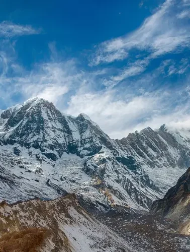
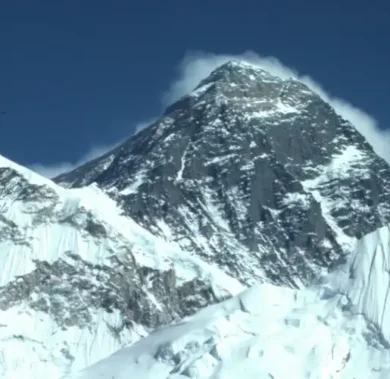
The Annapurna Mountain (the 10th highest peak in the world) is one of the most thrilling trekking routes for most trekkers. Among all the treks in the Annapurna region, Annapurna Base Camp Trek and Annapurna Circuit Map are some of the best treks.
The Annapurna Circuit Trek is a paradise for most trekkers. The Annapurna Circuit map offers breathtaking scenery of the Annapurna Mountain range, diverse landscape and vegetation, and abundant cultural experience.
The actual trekking for Annapurna Circuit Trek starts from Dharapani and ends at Muktinath. However, the Annapurna Circuit trek journey starts and ends in Kathmandu.
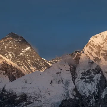
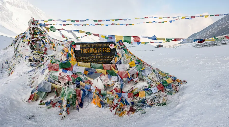
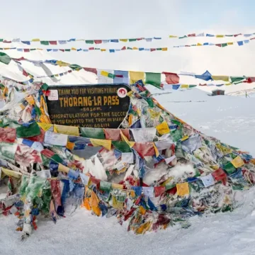
The trek lies within the Annapurna region and takes you to an elevation of 5,416 meters (17,769 feet) at Thorong La Pass. This trek is famous for its drastic climatic changes, ranging from 600 meters (2,000 feet) to 5400 meters (17,700 feet), and its diverse culture.
Annapurna Circuit Map
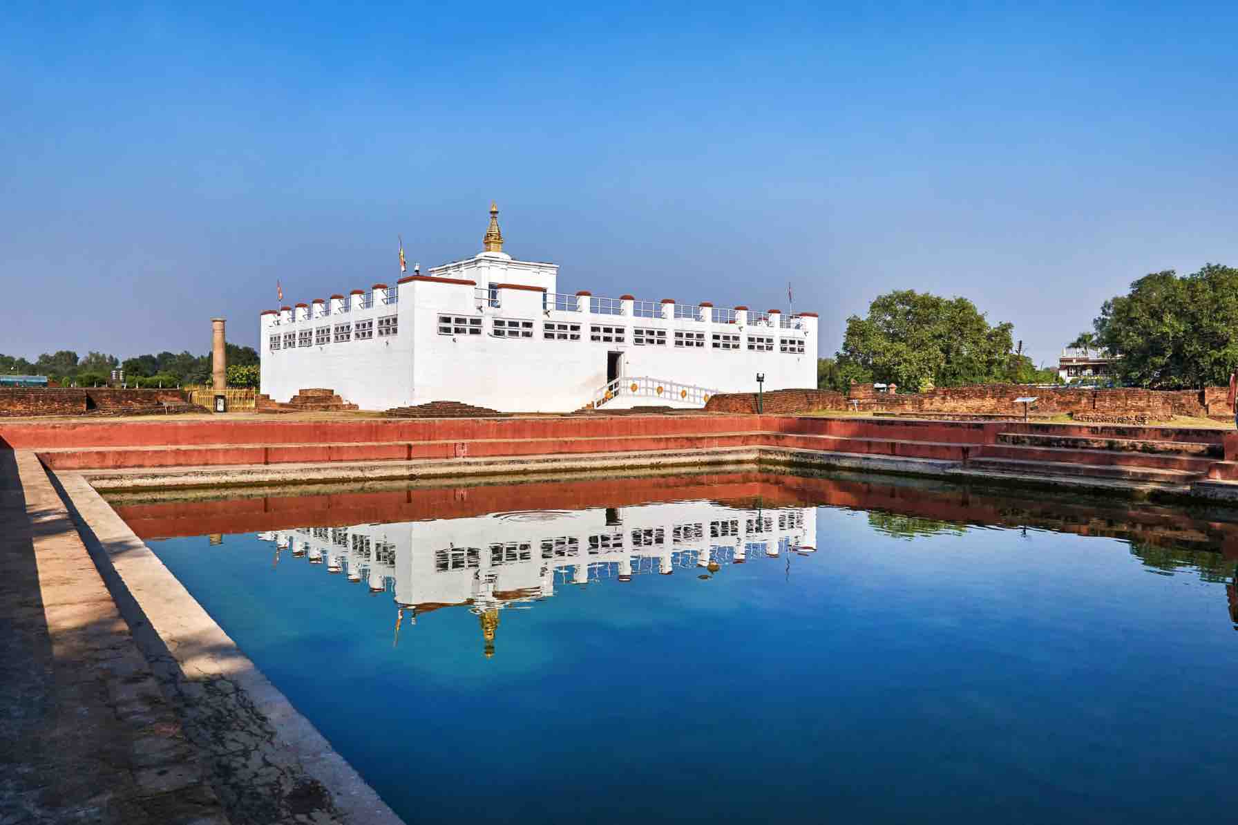
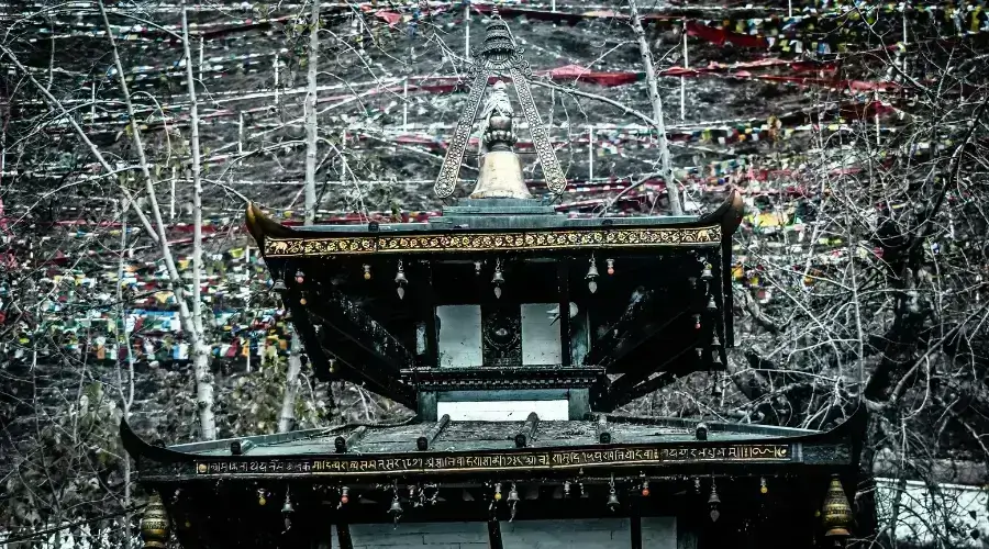
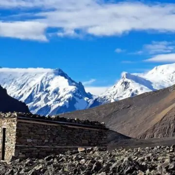
The Annapurna Circuit Map is an extraordinary journey that revolves around Annapurna massif via several traditional villages. Along with cultural and scenic views, the trek takes the trekkers to Muktinath Temple. It is a religious site for both Hindu and Buddhist pilgrims.
Annapurna Circuit Trek Itinerary
The Annapurna Circuit trek itinerary is generally 12 days long. However, it can be adjusted according to your walking capacity or how long you want to extend your trekking period.
If you are trekking with Himalayan Masters, the Annapurna Circuit Trek Map can be completed in an 11-day itinerary. You can also adjust based on your trekking experience and acclimatization.
Day 1: Drive from Kathmandu to Besisahar to Dharapani
We begin this journey by driving from Kathmandu to Besisahar and then to Dharapani.
Day 2: Trek from Dharapani to Chame
Trekking past the pine forest and Gurung village, we will now reach Chame.
Day 3: Trek from Chame to Upper Pisang
On the 3rd day, Upper Pisang is going to be our next station. We will walk through a picturesque village towards Pisang via Bhratang, which is known for its beautiful apple orchards and products.
Day 4: Trek from Pisang to Manang
We will be trekking on the Upper Pisang route to reach Manang.
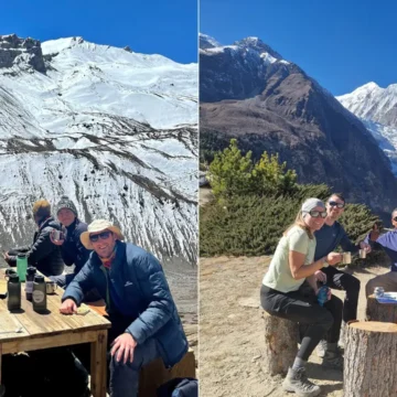
Day 5: Acclimatization day at Manang
On the 5th day, we will visit around the Manage village and acclimatize for a day.
Day 6: Trek from Manang to Yak Kharka
Trekking continues; we will be trekking to Yak Kharka from Manage.
Day 7: Trek from Yak Kharka to Thorong Phedi
Thorong Phedi will be our overnight station for day 7, where we can stay in a good lodge.
Day 8: Trek from Thorong Phedi to Muktinath via Thorong La
This is the toughest yet most exciting part of the trek. Reaching Thorong La is a little challenging; then, we will start descending to Muktinath.
Day 9: Drive from Muktinath to Tatopani
After visiting Muktinath Temple in the morning, we will take a local shared jeep to the Tatopani. On the way, we can go sightseeing at Kagbeni to see local monasteries and Jomsom village.
Day 10: Drive from Tatopani to Pokhara
Continue the trip to Pokhara. After arriving in Pokhara, you can do various exciting things in Pokhara or extend your trip by 1 or 2 days and visit a few places in Pokhara. You can enjoy boating, paragliding, ice skating, and other adventurous activities.
Day 11: Drive from Pokhara to Kathmandu
It’s the final day of the trek. Today, we will drive back to Kathmandu, or you can take a flight from Pokhara to Kathmandu too.
Note: Always carry an Annapurna Circuit Map with you for better navigation.
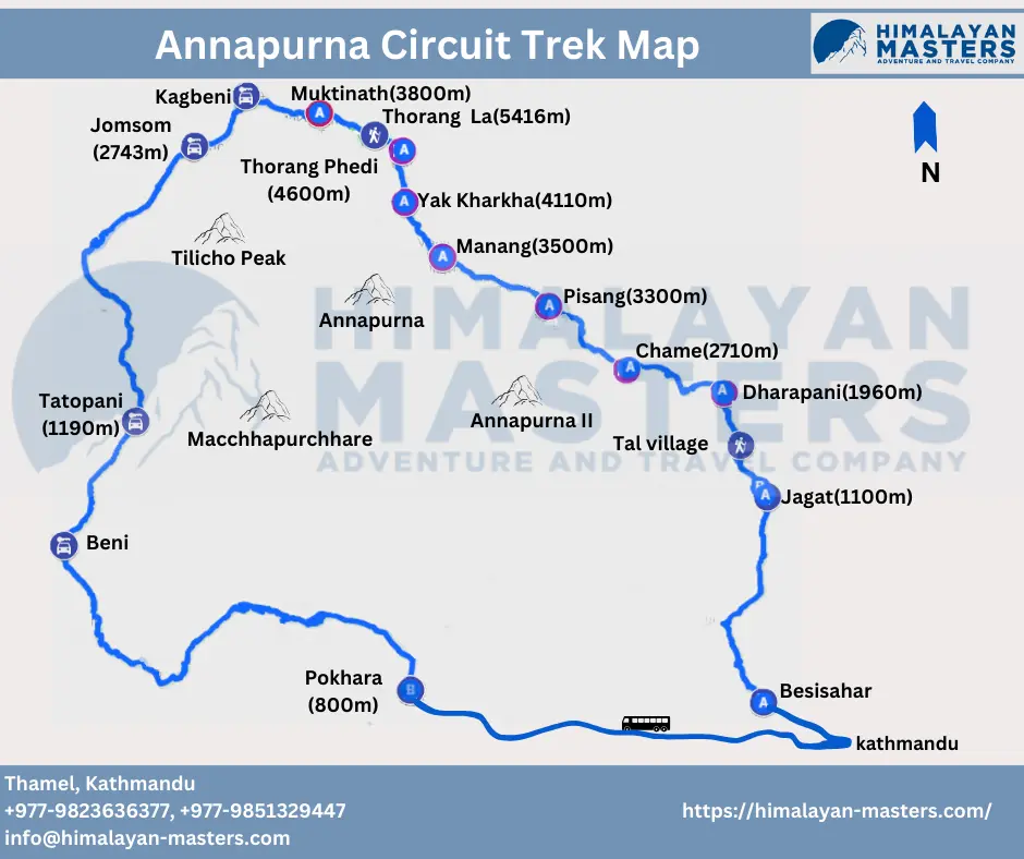
Annapurna Circuit Trek Map with Distance
The Annapurna Circuit map starts from Kathmandu. Annapurna Circuit map distance is approximately 660 km (410 miles). However, the actual trek distance is only about 80 km (50 miles), and the rest is driving distance.
We will drive from Kathmandu to Besisahar, which covers almost 175 km (109 miles), and then continue driving to Dharapani, which is about 35 km (22 miles). Then, on the 2nd day, we will trek for around 15 km before reaching Chame, followed by a 13 km trek to Pisang on the 3rd day.
On the 4th day, we will be trekking for 19 km to reach Manang, then rest and acclimatize on the 5th day. On the Annapurna Circuit trekking map, visiting and acclimatizing at management is a crucial and highlight point.
We will then walk about 10 km to Yak Kharka on the 6th day. On the 7th day, we will cover 6 km before reaching Thorong Phedi, and again on the 8th day, we will trek about 5 km to Thorong La Pass, followed by about 10 km trek to Muktinath. Here, our walking part of the trek ends.
On the 9th day, we will take a local shared jeep to Tatopani, covering around 70 km. On the 10th day, we will drive 103 km to reach Pokhara.
Finally, on the 11th day, we will take a vehicle from Pokhara to Kathmandu, which is almost 200 km away. Kathmandu is the ending point of our Annapurna Circuit trek route map.
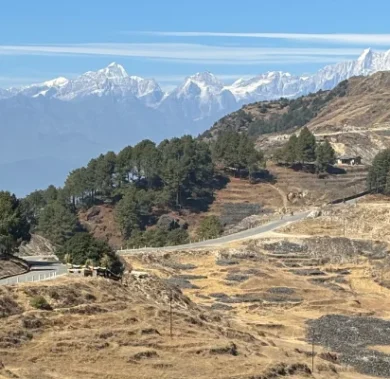
Annapurna Circuit Trek Road
The dynamics of the Annapurna Circuit trekking route map have changed drastically due to the construction of roads. The traditional trekking route used to start in Besisahar and end in Nayapul. However, due to the motorable road access, the starting and ending points have differed.
Before, trekking used to start from Besisahar, but now, many trekkers start trekking from Bhulbhule, Jagat or Dharapani to avoid roads. If you start trekking from Dharapani instead of Bhulbhule or Jagat, the trek duration decreases by a day.
Likewise, Nayapul used to be the usual ending point for several treks in the Annapurna region before the construction of roadways. But now, many trekkers’ Nepal Annapurna Circuit map ends at Jomsom and take a flight to Pokhara or Kathmandu.
Transportation Options
There are several transportation options for travelling from Kathmandu to Besisahar or Dharapani and Muktinath to Pokhara and Kathmandu. Trekkers can choose to travel in a public vehicle, reducing the overall cost of Annapurna Circuit Trek. Otherwise, travel in a comfortable private vehicle or take flights from Jomsom to Pokhara and Pokhara to Kathmandu, with some extra charge.
Public vehicle
You can take a public vehicle when travelling from Kathmandu to Besisahar. Similarly, trekkers can take a public bus directly from Jomsom to Kathmandu while returning or changing vehicles from Pokhara.
Travelling in a public vehicle can significantly reduce the overall cost. However, they are not as comfortable as private vehicles.
Private Jeep
You need to take a private shared jeep from Besisahar to Dharapani when starting your trek and Muktinath to Jomsom when returning. You can also take a jeep from Kathmandu to Besisahar and from Jomsom to Kathmandu.
Travelling in private is comparatively expensive, almost 10 times more expensive than travelling in a public bus. In contrast, a private shared jeep has more space for you to expand your legs and is cleaner.
Also, you can stop anywhere for short breaks, tea/coffee, lunch, or any sightseeing. Moreover, it can be shared among 5-7 people, eventually dividing the individual cost.
Flight
Flights are available from Jomsom to Pokhara and Pokhara to Kathmandu. For those short in time or who want to skip the tedious drive from Jomsom to Pokhara and to Kathmandu, opting for a fight could be a good idea.
Although the flight ticket price is a little expensive, this allows the trekkers to have more time to explore Pokhara.
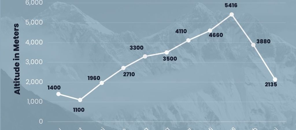
Annapurna Circuit Elevation Map
The Annapurna Circuit elevation map starts at 1,400 meters (4593 ft) at Kathmandu and reaches a maximum of 5,416 meters (12,336 ft) at Thorong La Pass.
You can find a detailed list of the villages on the Annapurna Circuit altitude map.
- Besisahar (760 m/2493.5 ft)
- Jagat (1340 m/4396 ft)
- Dharapani (1960 m/6430 ft)
- Chame (2670 m/8760 ft)
- Pisang (3300 m/10,827 ft)
- Manang (3540 m/11,614 ft)
- Yak Kharka (4020 m/13,189 ft)
- Thorong Phedi (4450 m/14,600 ft)
- Muktinath (3760 m/12,336 ft)
- Tatopani (1270 m/4167 ft)
- Pokhara (822 m/2696 ft)
- Kathmandu (1400 m/4593 ft)
FAQs
Where is Annapurna Circuit Trek’s starting point?
For the Annapurna Circuit trek map, you can consider both Kathmandu and Dharapani as starting points. Day 1 of the 11-day itinerary starts from Kathmandu, but actual trekking starts only from Dharapani on the second day.
What is the Annapurna Circuit Trek length?
The Annapurna Circuit trek length is approximately 78.8 km (49 miles) and around 582 km (361.6 miles) drive distance. So, the combined total distance is around 661.8 km (411 miles).
Is Annapurna Circuit still worth it?
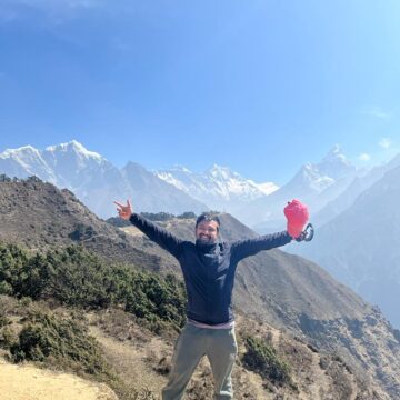
There is no doubt that the Annapurna Circuit is worth it. If you forget about the recent road constructions and a few dramatic weather changes or changes in the landscape, the Annapurna Circuit trek can be the trek for you. Cultural immersion with jaw-dropping scenery and diverse flora, fauna, and landscapes will make you want to not leave the mountains forever.
Nepal Trekking Routes
related post

Want to know more?
Speak to an Expert

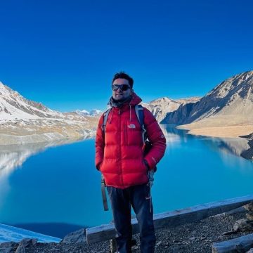

Sandip Dhungana
Nepal 🇳🇵
Whatsapp: +977-9823636377


UNSURE WHERE TO GO? WE CAN HELP
Based on your preferences, location, timeframe, and budget, our team can design your dream trek based on our extensive knowledge and experience of the Himalayas. Get in touch with us for detailed information and assistance planning your dream trek. With our 97% success rate on trekking and climbing trips in 2022 and 2023 spring season, we will answer any questions you may have and guide you for an unforgettable experience.