- TRIP DURATION
- 15 Days
- MAX. ALTITUDE
- 4870 m (15978 ft)
- TRIP GRADE
- Challenging
- LODGING
- Hotels, Teahouses, Tents
- BEST SEASON
- Spring and Autumn
- MEALS
- Breakfast, Lunch and Dinner
- COMMUNICATION
- Wi-Fi/ Local SIM Card
- PER DAY WALK
- 5-6 hours
Makalu Base Camp Trek
Makalu Base Camp Trek Overview
Makalu Base Camp Trek is one of eastern Nepal’s most adventurous trekking experiences. At the end of this trek, you arrive at the base of Makalu, the fifth-highest mountain in the world (8,485 m).
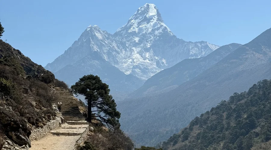
It is a remote, peaceful path with stunning scenic vistas of snowy mountains and pristine nature. The route passes through dense forests, alpine pastures, and small Sherpa villages. There is also a chance to learn about local culture and living style.
The Makalu Trek is difficult, but it gives trekkers unforgettable experiences of the country and majestic peaks. This path’s typical grade is Tumlingtar, the route along the Arun Valley. Depending on the route, the duration is between 14 and 15 days.
The Makalu Trail is located in Makalu Barun National Park, an area of outstanding biodiversity under conservation.
On the Makalu Trail, trekkers can see more wildlife than average, such as red pandas, Himalayan tahr, snow leopards, etc. The best time of year to undertake this trip is spring (March-May) and autumn (September-November) because the climate is pleasant and the landscape is quite beautiful.
About Makalu Himalaya
Mount Makalu Summit is the fifth tallest mountain on earth, at 8,485 meters. It occupies the Mahalangur Himalayan range in eastern Nepal. The mountain is known for its pyramidical-ruffed shape and steep ridge.
A ring of other stunning peaks, such as Baruntse and Chamlang, surrounds Makalu. This landscape is famous for its spectacular natural beauty and rich natural biodiversity.
The area covered by the Makalu Barun National Park, including this region, has various plants and animals represented in the flora and fauna.
Mount Makalu Location
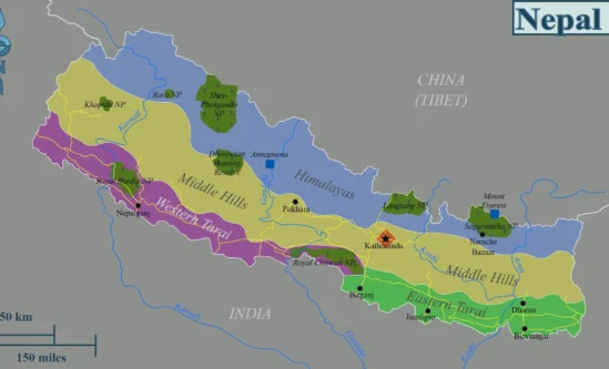
Makalu is located in the eastern region of Nepal, on the border of Nepal and Tibet. It is located in the Mahalangur Himalayan range, southeast of Mount Everest.
Mount Makalu is situated at the Makalu Barun National Park, a protected area on the interactional boundary between Nepal and Tibet.
How to reach Makalu Barun National Park? The route to Makalu is from Tumlingtar, on the eastern side of Nepal, to Arun Valley. The area is rural and less populated, ideal for adventurers to roam freely. On a map of Nepal in the eastern Himalayas, Makalu is near the world’s most famous mountain, Mount Everest, and can be readily recognized.
Mount Makalu Base Camp Trek Facts
- Trek Duration: 15 days
- Trek Distance: Around 100 km (62.1 miles)
- Beginning trek: Chichila
- Ending trek: Num
- Maximum elevation: 4870 meters (15978 feet)
- Accommodation: Teahouses/Camping
- Best Seasons to visit: Spring and Autumn
- Trek Category: Moderate
- Transportation: Flight/ Taxi/ Jeep
- Permits: Makalu Barun National park fees, TIMS
Makalu Base Camp Trek Highlights
- Stunning views of Mount Makalu, Baruntse, and Chamlang mountains.
- Trek through Makalu Barun National Park, rich in biodiversity.
- Explore remote villages like Seduwa and Tashigaon.
- Experience the local cultures of Sherpas, Rai, and Limbu people.
- It is a challenging and rewarding adventure for experienced trekkers.
- Peaceful and less crowded trekking route.
- Close-up views of Baruntse Glacier.
The Beauty of Makalu Base Camp Trek
Makalu Base Camp Trek is rich with wild nature and pristine wilderness. Walkers cross many coloured rhododendron, pine, and bamboo forests and a spring forest that is impossible to overestimate.
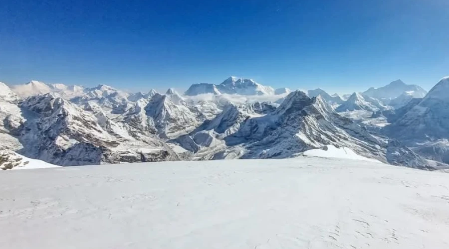
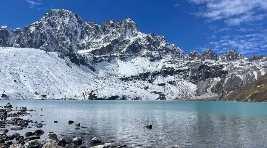
Crystal-clear streams, great waterfalls, and lovely gorges create an unforgettable sight. The hike has a beautiful view of snow-covered peaks and is, therefore, a paradise for nature lovers and climbers. In addition to the view, the trek is an opportunity to learn about the local people’s rich culture.
The tradition is preserved generation after generation among the Sherpa and Rai ethnic groups living in the region. Their warm greetings and unique lifestyle enhance the trek. Wildlife fans can observe rarities such as the red panda, Himalayan black bears, and snow leopards.
Himalayas View During Makalu Base Camp Trek
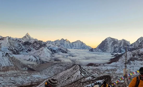
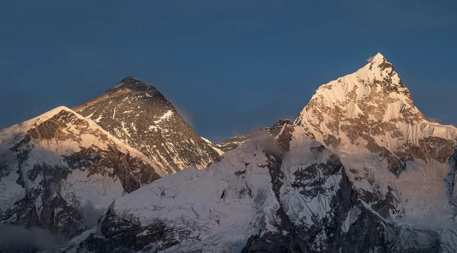
Mount Makalu is the peak of the circuit. It’s pyramid-shaped, with a blue sky and a very beautiful scene. Trekkers can also see other famous peaks like Everest, Lhotse, and Chamlang.
Whenever the trekker stands at the base camp of Mount Manaslu, breathtaking views shots and snow-covered mountains can be observed. The spectacular views from Makalu Base Camp are amazing.
Typical Day in Makalu Base Camp Trek
The Makalu Base Camp Trek starts very early in the morning. Participants get up, have breakfast, and listen to nature’s sounds before starting the trek. The day includes walking on scenic trails and experiencing forests, rivers, and villages.
You will have time to take short breaks on different tracks in the course, eat snacks, and take pictures. In the afternoon, lunch is usually provided at a teahouse or campground. After lunch, you will walk to the endpoint of the day’s stop.
Evenings are spent eating, talking, and sharing stories with other trekkers. They are also for sipping hot tea in cosy teahouses or lying in a tent under the starry sky. Each day is filled with adventure and unforgettable memories.
Important Notes for Makalu Base Camp Trek
- The trek is also a physical difficulty that requires a high degree of fitness.
- Prepare well in advance. Always have warm clothes with you, because temperatures can be very severe at great heights.
- Proper acclimatization is necessary to avoid altitude sickness. Take rest days seriously.
- The trail is remote, so bring snacks, water, and a nut-and-bolt first aid kit.
- Go with a skilled guide and porter to smooth the way and ensure the journey is safe.
- Spring and autumn are the best times to walk this route because the weather is favourable and the views are pleasant.
Benefits of Booking with Himalayan Masters
- Expert guides with years of trekking experience.
- Tailored itineraries to suit individual needs.
- Affordable pricing with no hidden costs.
- High-quality accommodation and meals.
- 24/7 customer support during the trek.
- Focus on safety and client satisfaction.
- Opportunities to explore less-crowded routes.
- Reliable transportation and permits.
Makalu Base Camp Trek 15 Days Itinerary Outline
| Day | Itinerary | Sleep Altitude | Time |
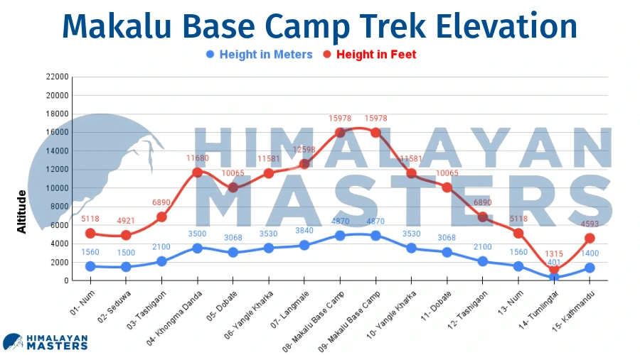
| 01 | Fly to Tumlingtar and Drive to Num | 1560 m/5118 ft | 6-7 hours |
| 02 | Trek from Num to Seduwa via the Arun River | 1500 m/4921 ft | 4-5 hours |
| 03 | Trek from Seduwa to Tashigaon | 2100 m/6890 ft | 5-6 hours |
| 04 | Trek from Tashigaon to Khongma Danda | 3500 m/11680 ft | 5-6 hours |
| 05 | Trek from Khongma Danda to Dobate via Shipton La | 3068 m/10065 ft | 7-8 hours |
| 06 | Trek from Dobate to Yangle Kharka | 3530 m/11581 ft | 6-7 hours |
| 07 | Trek from Yangle Kharka to Langmale | 3840 m/12598 ft | 4-5 hours |
| 08 | Trek from Langmale to Makalu Base Camp | 4870 m/15978 ft | 5-6 hours |
| 09 | Day walk around Makalu Base Camp | 4870 m/15978 ft | 1 hour |
| 10 | Trek back from Makalu Base Camp to Yangle Kharka | 3530 m/11581 ft | 7-8 hours |
| 11 | Trek back from Yangle Kharka to Dobate | 3068 m/10065 ft | 7-8 hours |
| 12 | Trek back from Dobate to Tashigaon | 2100 m/6890 ft | 8 hours |
| 13 | Trek back from Tashigaon to Num | 1560 m/5118 ft | 6-7 hours |
| 14 | Drive back from Num to Tumlingtar | 401 m/1315 ft | 6-7 hours |
| 15 | Fly back from Tumlingtar to Kathmandu | 1400 m/4593 ft | 35 min |
ITINERARY
Day 01: Fly From Kathmandu to Tumlingtar and Drive to Num
Drive Route: Tumlingtar → Khandbari → Chichila → Num
Beginning Point: Kathmandu (1400 m/4593 ft)
Trek Beginning Point: Num (1560 m/5118 ft)
Ending/Overnight: Num (1560 m/5118 ft)
Tumlingtar to Num Drive Distance: Approximately 45 km (28 miles)
Total Drive Time: 6–7 hours (Tumlingtar to Num)
Lunch: On the way
Meal : Breakfast, Lunch and Dinner
Accommodation : Tea House
Walking / Driving : 30 min flight and 6-7 hours drive
Day 02: Trek from Num to Seduwa via the Arun River
Trek Route: Num → Arun River → Seduwa
Beginning Point: Num (1560 m/5118 ft)
Ending/Overnight: Seduwa (1500 m/4921 ft)
Num to Seduwa Trek Distance: Approximately 6.5 km (4 miles)
Total Descent: 620 m (2034 ft) Num to Arun River
Total Ascent: 560 m (1837 ft) Arun River to Seduwa
Lunch: Seduwa
The day starts with a downhill walk of about 2 hours. After crossing the suspension bridge over the river, we walk to the Rhododendron forest.
The hike begins with a gradual descent through lush forests and farmlands, providing a refreshing start to your adventure.
You’ll pass through a small Rai village, where you can observe their traditional farming practices and experience their warm hospitality.
The villagers are known for their skills in cultivating paddy, millet, corn, and potatoes, and they are always ready to share a smile and a friendly greeting with visitors.
About Seduwa:
Seduwa is a small village in Makalu region. Your Makalu Barun Permits will be checked here as there is a permit checking centre.
Meal : Breakfast, Lunch and Dinner
Accommodation : Tea House
Walking / Driving : 4-5 hours walk
Day 03: Trek from Seduwa to Tashigaon
Trek Route: Seduwa → Tashigaon
Beginning Point: Seduwa (1500 m/4921 ft)
Ending/Overnight: Tashigaon (2100 m/6890 ft)
Seduwa to Tashigaon Trek Distance: Approximately 9 km (5.6 miles)
Total Ascent: 600 m (1968 ft)
Lunch: Tashigaon
The trek to Tashigaon from Seduwa begins with a relatively flat and easy trail, which allows you to enjoy stunning views of the Arun River valley and the surrounding mountains. As you walk, you’ll also find rhododendron forests and wildflowers.
The trail leads you to Tashigaon, a charming Tibetan Buddhist village between the hills. As you arrive, you’ll be greeted by a peaceful atmosphere, with prayer flags fluttering in the wind and Chortens. The villagers are known for their warm hospitality and deep connection to their traditions.
About Tashigaon:
Tashigaon is a small village with 25-35 local people. There are rhododendron forests in the region. You will also see a Buddhist monastery, chortens, a primary-level school, and a health post. Most of the people are engaged in cardamom raising.
Meal : Breakfast, Lunch, and Dinner
Accommodation : Tea House
Walking / Driving : 5-6 hours
Day 04: Trek from Tashigaon to Khongma Danda
Trek Route: Tashigaon → Khongma Danda
Beginning Point: Tashigaon (2100 m/6890 ft)
Ending/Overnight: Khongma Danda (3500 m/11680 ft)
Tashigaon to Khongma Danda Trek Distance: Approximately 8.5 km (5.3 miles)
Total Ascent: 1400 m (4790 ft)
Lunch: Khongma Danda
The trek towards Khongma Danda starts with an easy incline through the thick subtropical forest, which must be quite a relief from the heat.
There are opportunities to observe various species of plants and animals in the forest, which can be described as lively. With the increase in altitude, the size of the mountains around grows larger, and one can see the great Himalayan ranges.
During the trek, one comes across small villages home to the Sherpas, people of Nepalese origin who are very skilled at mountain climbing and very close to nature.
Usually constructed from stone and wood, the houses are integrated into the environment to perfectly illustrate the area’s ecological ideals.
Meal : Breakfast, Lunch and Dinner
Accommodation : Tea House
Walking / Driving : 5- 6 hours walk
Day 05: Trek from Khongma Danda to Dobate via Shipton La
Trek Route: Khongma Danda → Shipton La Pass → Dobate
Beginning Point: Khongma Danda (3500 m/11680 ft)
Ending/Overnight: Dobate (3068 m/10065 ft)
Khongma Danda to Dobate Trek Distance: Approximately 10 km (6.2 miles)
Total Ascent: 670 m (2200 ft) Khongma Danda to Shipton La
Total Descent: 830 m (2723 ft) Shipton La to Dobate
Lunch: Shipton La (maybe packed one)
Today, there is an ascending towards Shipton La, another high-altitude pass. The trail is normally rocky, especially steep, and one has to exert a lot of energy to cover the distance.
As the altitude increases, the atmospheric pressure gradually reduces, and the climate and geographical features of the area become mountainous, with snow and glaciation.
The views from the top of Shipton La are wonderful. After you have enjoyed the views, you will start descending towards Dobate.
They are not as steep, and some can be quite challenging as you navigate through more sharp rocks and sometimes loose gravel. It is a tiny village situated in the mountains with basic homestays.
Meal : Breakfast, Lunch and Dinner
Accommodation : Tea House
Walking / Driving : 7- 8 hours walk
Day 06: Trek from Dobate to Yangle Kharka
Trek Route: Dobate → Yangle Kharka
Beginning Point: Dobate (3068 m/10065 ft)
Ending/Overnight: Yangle Kharka (3530 m/11581 ft)
Dobate to Yangle Kharka Trek Distance: Approximately 6.5 km (4 miles)
Total Ascent: 130 m (426 ft)
Lunch: Yangle Kharka
The trail to Yangle Kharka begins along the Barun River, passing through beautiful forests and streams. The air is fresh and cool, and the sound of the water gushing over the rocks creates a serene environment.
One significant factor is that the trail is not so steep, and you can view the surrounding mountains well.
Along the way are small settlements of indigenous Sherpa and Rai people. Their houses are almost camouflaged. The inhabitants are always friendly and have a strong bond with the mountain.
The day ends with a fulfilling arrival at Yangle Kharka, a valley with gorgeous hills. Here, you will find simple accommodations where guests can take a break and spend the night.
Meal : Breakfast, Lunch and Dinner
Accommodation : Tea House
Walking / Driving : 6-7 hours walk
Day 07: Trek from Yangle Kharka to Langmale
Trek Route: Yangle Kharka → Langmale
Beginning Point: Yangle Kharka (3530 m/11581 ft)
Ending/Overnight: Langmale (3840 m/12598 ft)
Yangle Kharka to Langmale Trek Distance: Approximately 7 km (4.3 miles)
Total Ascent: 310 m (1017 ft)
Lunch: Langmale
Yak Kharka is reached through a path that changes the landscape into an alpine meadow. The scenery may be rarefied, but it is spectacular.
The trail is rather flat and easy, so you can focus on the stunning views. You can expect to see yaks wandering in the pastures, giving the scenery a natural look of authenticity.
You will arrive at Yak Kharka, a small village in the alpine region. The surrounding mountains are beautiful, and you will feel like you are arriving at Makalu Base Camp. Yak Kharka has simple lodges where tourists can rest and relax after trekking.
Meal : Breakfast, Lunch and Dinner
Accommodation : Tea House
Walking / Driving : 4-5 hours walk
Day 08: Trek from Langmale to Makalu Base Camp
Trek Route: Langmale → Makalu Base Camp
Beginning Point: Langmale (3840 m/12598 ft)
Ending/Overnight: Makalu Base Camp (4870 m/15978 ft)
Langmale to Makalu Base Camp Trek Distance: Approximately 8.5 km (5.3 miles)
Total Ascent: 1030 m (3380 ft)
Lunch: Makalu Base Camp
The final push to Makalu Base Camp is relatively flat and easy, taking you through beautiful alpine meadows. The air is thin, and the scenery is breathtaking. As you walk, the towering Makalu massif looms ahead.
The trail offers spectacular views of the surrounding mountains and glaciers. The sense of accomplishment is amazing as you reach Makalu Base Camp.
You can either stay at the tea house or you’ll set up camp at the base camp, enjoying the serenity of the high altitude and the breathtaking views.
Meal : Breakfast, Lunch and Dinner
Accommodation : Tea House
Walking / Driving : 5-6 hours walk
Day 09: Day walk around Makalu Base Camp
Meal : Breakfast, Lunch and Dinner
Accommodation : Tea House
Walking / Driving : 1 hour walk
Day 10: Trek back from Makalu Base Camp to Yangle Kharka
Trek Route: Makalu Base Camp → Langmale → Yangle Kharka
Beginning Point: Makalu Base Camp (4870 m/15978 ft)
Ending/Overnight: Yangle Kharka (3530 m/11581 ft)
Makalu Base Camp to Yangle Kharka Trek Distance: Approximately 15 km (9.3 miles)
Total Descent: 1340 m (4389 ft)
Lunch: Langmale
The descent back to Yangle Kharka allows you to enjoy the familiar scenery. The trail is relatively easy, allowing you to see the breathtaking views.
As you walk, you’ll see the same small settlements and the friendly villagers you met on the way up. The air feels heavier as you descend, but the scenery is just as breathtaking.
The day trek ends with the arrival at Yangle Kharka, where you can settle into a guesthouse and rest.
Meal : Breakfast, Lunch and Dinner
Accommodation : Tea House
Walking / Driving : 7-8 hours walk
Day 11: Trek back from Yangle Kharka to Dobate
Trek Route: Yangle Kharka → Dobate
Beginning Point: Yangle Kharka (3530 m/11581 ft)
Ending/Overnight: Dobate (3068 m/10065 ft)
Yangle Kharka to Dobate Trek Distance: Approximately 10 km (6.2 miles)
Total Descent: 130 m (426 ft)
Lunch: Dobate
The trek back to Dobate is a gradual descent through beautiful landscapes, offering a chance to enjoy the familiar trails and the breathtaking scenery. The air is thicker, but the views are just as stunning.
You’ll pass through the same settlements, but the sense of accomplishment makes the journey feel even more rewarding. As you reach Dobate, you’ll find a welcoming guesthouse offering a comfortable respite after the day’s trek.
Meal : Breakfast, Lunch and Dinner
Accommodation : Tea House
Walking / Driving : 7-8 hours walk
Day 12: Trek back from Dobate to Tashigaon
Trek Route: Dobate → Khongma Danda → Tashigaon
Beginning Point: Dobate (3068 m/10065 ft)
Ending/Overnight: Tashigaon (2100 m/6890 ft)
Dobate to Tashigaon Trek Distance: Approximately 10 km (6.2 miles)
Total Ascent: 130 m (426 ft) From Dobate to Khongma Danda
Total Descent: 1100 m (3609 ft) From Khongma Danda to Tashigaon
Lunch: Khongma Danda
The trek back to Tashigaon Danda takes you through a thick subtropical forest, offering a welcome change in scenery after the alpine meadows. The air is warmer, and birdsong fills the air.
As you ascend, the trail becomes a bit steeper, but the beauty of the forest will keep you captivated. You’ll pass through the same small settlements.
Meal : Breakfast, Lunch and Dinner
Accommodation : Tea House
Walking / Driving : 8 hours walk
Day 13: Trek back from Tashigaon to Num
Trek Route: Tashigaon → Seduwa → Num
Beginning Point: Tashigaon (2100 m/6890 ft)
Ending/Overnight: Num (1560 m/5118 ft)
Tashigaon to Num Trek Distance: Approximately 9 km (5.6 miles)
Total Descent: 540 m (1772 ft)
Lunch: Seduwa
The trek to Tashigaon is a gradual descent. It takes you through beautiful landscapes, offering stunning views of the surrounding mountains. The air is a bit warmer.
As you descend, you’ll pass through vibrant rhododendron forests. The trail is moderately easy, allowing you to enjoy the stunning scenery.
You’ll arrive in Tashigaon, a charming Tibetan Buddhist village in the hills. The village is adorned with prayer flags, creating a serene atmosphere. The villagers are known for their hospitality and deep connection to their traditions.
Meal : Breakfast, Lunch and Dinner
Accommodation : Tea House
Walking / Driving : 6-7 hours walk
Day 14: Drive from Num to Tumlingtar
Drive Route: Num → Tumlingtar
Beginning Point: Num (1560 m/5118 ft)
Ending/Overnight: Tumlingtar (800 m/2625 ft)
Num to Tumlingtar Drive Distance: Approximately 45 km (28 miles)
Total Descent: 760 m (2493 ft)
Lunch: On the way
The drive to Tumlingtar is relatively easy. You must drive through dusty, bumpy roads for 6-7 hours. As no bus operates on the route, only four-wheeler jeeps can carry the passengers in the area.
Meal : Breakfast, Lunch and Dinner
Accommodation : Tea House
Walking / Driving : 6-7 hours drive
Day 15: Fly from Tumlingtar to Kathmandu
Fly Route: Tumlingtar → Kathmandu
Beginning Point: Tumlingtar (401 m/1315 ft)
Ending Point: Kathmandu (1400 m/4593 ft)
Flight Duration: Approximately 35–40 minutes
Tumlingtar to Kathmandu Fly Distance: 218 km (135 miles)
Total Ascent: 600 m (1969 ft) Tumlingtar to Kathmandu
As you stay in the luxurious seat of the domestic aeroplane, you will be excited to be flying above the mountains. Soon, you will be driving to your hotel in Thamel from Kathmandu.
A private car drop you in a hotel room, and you will have some time for souvenir shopping.
Meal : Breakfast
Accommodation : Not Inclu
Walking / Driving : 30 min flight
include / exclude
Trip Cost Includes
- Airport pick up & drop off service in a private vehicle
- 3-star accommodation in Kathmandu with breakfast
- The best available clean and comfortable tea house accommodation during the trek
- All meals (breakfast, lunch and dinner) with tea/coffee during the trek
- Staff insurance and necessary ground transport for support staff
- Guide for 15 days
- Trekking permits – Makalu Barun Conservation Area Permit, Makalu Rural Municipality Permit and TIMS Card.
- All Local and Government taxes, administrative charges
Trip Cost Excludes
- International flight ticket and Nepal entry visa
- Personal travel insurance (Which should include coverage for trekking)
- Lunches and dinners in Kathmandu, except the farewell dinner
- Personal gear for trekking (Including any you may wish to hire in Kathmandu), any personal expenses (i.e. soft and alcoholic drinks, snacks etc.)
- Tip For filed staff
useful info
Elevation Gain During Makalu Base Camp Trek
How Difficult Is the Makalu Base Camp Trek?
Well, it isn’t easy. The Makalu Base Camp trek is among the most challenging treks in Nepal, and it is more than 100 km in distance. Compared to other base camp treks like Everest and Annapurna, this particular trek needs a lot of preparation and a muscular physique.
However, climbing gear and mountaineering skills are not needed. Our guide will teach any climbing skills required for the dangerous part before the trek.
The Makalu trek also has an elevation of 4800 meters, and the chances of altitude sickness are severe at such a height. You need to add acclimatization days to your Itinerary and walk very slowly.
Other than altitude and distance, the hardest part of the Makalu Base Camp trek is its remoteness. Once you reach the higher altitude, you barely see any villages and meet people.
Trip Grade: Fitness level, Medical, and health
The Makalu Base Camp trek is a challenging adventure that demands good physical fitness and endurance. Trekkers can expect difficulty walking moderately for around six to eight hours daily, often on rugged terrain.
The trekkers should be prepared for more strenuous activity and have a good endurance level. Trekkers must be in good health and physical condition before starting this journey.
Those with pre-existing conditions such as asthma, high blood pressure, or cardiovascular disease are advised against attempting this trek without consulting a doctor first.
Altitude Sickness in Makalu Trek
Altitude sickness is a big worry when trekking to Makalu Base Camp trek. Before going to higher places, ensure you’re used to the altitude. It’s wise to climb slowly and take breaks to get used to the height.
If you start feeling sick, like a headache or dizziness, it’s crucial to go down to a lower place and see a doctor. The highest elevation during the trek is 4,800 meters, so ensure that you acclimate properly and drink enough water to avoid altitude sickness.
Trekking Experience for Makalu Circuit Trek
Having some climbing experience can be helpful when climbing the Makalu Base Camp trek. The Makalu Circuit Trek is challenging, and having some hiking experience and basic climbing skills can make it easier. It’s good to be comfortable walking for long hours each day and be prepared for rugged terrain.
If you’ve climbed other mountains before or done challenging hikes, you’ll feel more confident on this trek.
However, even if you’re new to climbing, as long as you’re in good physical shape and ready to take on the challenge, you can still enjoy the adventure of reaching the Makalu Base Camp trek. Take it slow, listen to your guide, and enjoy the breathtaking views.
Emergency and Evacuation at Makalu Base Camp Trek
Helicopter rescue is the primary means of evacuation. Helicopter rescue can be costly in favourable weather conditions. In an emergency, contact local authorities or your trekking agency promptly. Your trekking agency will arrange an evacuation helicopter, but you are responsible for the costs.
The trekking agency does not provide travel insurance. You must purchase your policy from your home country. Expect to pay around $250 – $400 for comprehensive travel insurance.
Kit and Equipment for Makalu Trek
When getting ready for the Makalu Base Camp Trek, it’s crucial to pack the right gear since you’ll be in a remote area with limited supply access. Here’s a simple list of things to bring:
Clothing:
- Base Layers (synthetic base layers (2 sets) for warmth and moisture-wicking)
- Fleece jackets
- Down jackets for varying temperatures
- Waterproof and breathable shell jacket and pants
- Trekking Pants
- Hiking Shorts
- Warm Hat
- Gloves
- Socks
- Headscarf/Buff
- Sunglasses (Polarized sunglasses with UV protection)
- Sun Hat
Footwear:
- Hiking Boots (Waterproof, sturdy, and well-broken-in boots with ankle support)
- Hiking Shoes
Backpack:
- Trekking Backpack (Durable, with a comfortable fit, 60-70L capacity)
- Daypack
- Waterproof Backpack Liner
Sleeping Gear:
- Sleeping Bag (Rated for -20°C/-4°F or colder, down or synthetic)
- Sleeping Pad
Other Gear:
- Water Bottles (2-3L capacity, with purification tablets)
- Trekking Poles
- First Aid Kit
- Toiletries
- Toilet Paper
- Portable Hand Sanitizer
- Personal Documents (Passport, visa, insurance information, emergency contact details)
- Cash
- Credit Card
- Camera
- Binoculars
- Waterproof Bags
Special Training
Special training for the Makalu trek should focus on building physical fitness and endurance. You can start with regular aerobic exercises like walking, jogging, or cycling to improve your stamina.
Strength training exercises for your legs, core, and upper body will help you cope with the demands of the Makalu Circuit Trek.
It’s important to gradually increase the intensity and duration of your workouts to prepare your body for the long trekking days.
Practising hiking with a backpack is also beneficial, as it will help you get used to carrying a load during the Makalu Barun National Park trek.
Best Time for Makalu Base Camp Trek
The Makalu Base Camp Trek can be enjoyed at different times of the year, depending on your preference and situation. Here’s a more detailed look at the two best times to trek to Makalu Base Camp trek:
Spring (March to May)
Pros:
- Clear skies and warm weather.
- Stunning rhododendron forests in bloom.
- Sunny and mild days, making trekking comfortable.
- Ideal conditions for completing the trek with ease.
Cons:
- It can be crowded with other trekkers, and you may not get teahouses if you don’t make a booking.
- Potential for late snowfalls.
Autumn (September to November)
Pros:
- Clear skies and dry weather after monsoon season.
- Moderate temperatures with cool nights, aiding acclimatization.
- Uninterrupted views of surrounding peaks, perfect for photography.
Cons:
- Early snowfall is possible in higher altitudes.
- Temperatures can drop significantly at night.
Weather Information of Makalu Barun Trek
Spring (March to May)
- Temperature: Mild, with daytime highs around 15-20 degrees Celsius and nighttime lows dropping to near freezing (around 0 degrees Celsius).
- Precipitation: Moderate rainfall, especially in April. Occasional snowfall can occur at higher altitudes.
Summer (June to August)
- Temperature: Warm with daytime highs around 20-25 degrees Celsius and nighttime lows around 10-15 degrees Celsius.
- Precipitation: Heavy monsoon rains with increased cloud cover and reduced visibility.
Autumn (September to November):
- Temperature: Mild, with daytime highs around 15-20 degrees Celsius and nighttime lows dropping to near freezing (around 0 degrees Celsius).
- Precipitation: Less rainfall than spring, occasional snow flurries at higher altitudes.
Winter (December – February):
- Temperature: Cold with daytime highs around 0-5 degrees Celsius and nighttime lows dropping below freezing (-10 degrees Celsius or lower).
- Precipitation: Heavy snowfall, especially in January and February, with blizzard conditions possible.
Makalu Base Camp Trek Permit
Two required permits:
- Makalu Barun Conservation Area Permit: Essential for accessing the base camp.
- Makalu Rural Municipality Permit: Required for entry into the area.
Permit Costs:
- Nepalese citizens: NPR 100 per person.
- SAARC citizens: NPR 1500 per person.
- Other nationalities: NPR 3000 per person.
- Makalu Rural Municipality Permit: NPR 2000 per person.
Food During the Makalu Base Camp Trek
Due to the high altitudes of the Makalu Base Camp Trek, it’s essential to fuel your body with enough nutrition and carbohydrates to support your walking. Here’s a rundown of the typical food options you can expect along the way:
Breakfast:
- Pancakes, oatmeal, muesli.
- Eggs (omelettes, poached, boiled)
- Tibetan bread, buckwheat bread, chapatis.
- Honey, jam, apples.
Lunch:
- Dal Bhat (rice and lentil soup).
- Soups, spaghetti, dumplings, pizza, spring rolls.
- Sandwiches, macaroni, tendu (noodle soup), spaghetti noodles, thukpa (Tibetan noodle soup), pasta, and pizza with various toppings.
Dinner:
- Dal bhat and tarkari (vegetable curry).
- Tibetan bread, soups, Sherpa stew.
- Sandwiches, dumplings, macaroni, tenduk, noodles, thukpa, pasta, vegetable curry, and salad.
Accommodation during the Makalu Base Camp Trek
Staying in Makalu Base Camp Trek is easy and enough for trekking. In the lower zones, teahouses have rooms, which are usually common but may be single rooms on a request basis.
Overnight stays in regions with limited facilities at high altitudes may require trekkers to sleep in tents.
Attached bathrooms are rare, and shared bathrooms are the norm along the trek. Hot baths are provided in some teahouses; however, they are available at an extra charge, particularly as you climb.
Otherwise, warm water buckets can be provided in rural areas, and blankets are provided in tea shops. However, the sleeping bag must always be warm to be effective when it is cold at night.
Trekking Costs for Makalu Circuit Trek
Himalayan Masters offers a comprehensive Makalu Base Camp trek cost package, including permits, guides, porters, food, accommodation, gear rental, insurance, and transportation.
This package provides a suitable and cost-effective way to experience the trek without managing individual expenses, typically costing around $2800 per person.
Insurance for Makalu Base Camp Trek
Travel insurance is essential for the remote Makalu Base Camp trek. It covers medical expenses, including emergency helicopter evacuation, which may be necessary due to limited medical facilities.
You must purchase your travel insurance from your home country, as trekking agencies in Nepal do not provide it. Expect to pay around $250 to $400 for comprehensive coverage.
Your insurance should cover the full cost of a helicopter evacuation if needed. Ensure your policy covers trip cancellations, lost or stolen gear, and adventure sports activities.
Choose a policy offering 24/7 assistance for medical advice or emergency support. During the trek, always carry a copy of your insurance policy and contact information.
Additional Expenses for Trip
Other expenses to consider when planning a trip to Makalu Base Camp include gear rental or purchase, which is essential for the challenging terrain and high altitude.
You’ll also need to budget for food and accommodation along the trekking route and any permits or fees for entering the national park. It’s also wise to budget for souvenirs or additional activities you might want to do along the way.
ATMs in Makalu Circuit Trek
Withdraw cash in Kathmandu before starting your Makalu trek, as ATMs are unavailable along the route. While there is an ATM in Tumlingtar, it is not directly on the Makalu Base Camp trail. Carry enough cash to cover expenses, as some lodgings may accept credit cards, but it’s best to have cash as a backup. Inform your bank of your travel plans to ensure your cards work abroad.
Communication
Communication can be challenging in the Makalu region. Mobile networks are only available in parts of the world and can have poor signal quality. Satellite phones are a good option for emergencies.
Though Wi-Fi services are unavailable in the Makalu Base Camp area, you must use local SIMs like Ncell and NTC. These SIMs will work up to the Tashigaon area.
Electricity, Charging, and Water
Electricity is available in most teahouses at low altitudes, enabling trekkers to charge their devices only up to Tashigaon. Above the Tashigaon area, there is no electricity, and sometimes the solar power also doesn’t work properly enough to charge.
It is wise to carry a power bank. Drinking water can be found in nature but has to be decontaminated from germs and bacteria before drinking. Bring water purification tablets or a filter.
Bottled water is served at teahouses, and the price increases as you go up.
Porter vs. Solo Trekking
Hiring a porter for the Makalu Base Camp Trek is highly recommended. Porters carry your bags so that you can focus completely on the scenery and enjoy the walk without effort.
Solo trekking is an option, but you must carry your gear and be better equipped for difficulties.
The Makalu Trail is authentic and off the beaten track, and for the sake of individual safety and convenience, engaging a familiar guide (e.g., a guide porter) is possible.
Tipping Culture
Tipping is a common practice in Nepal’s trekking industry. It is a chance to express gratitude for the work of a guide and a porter. The amount may differ; however, it will typically be 10-15% of the trek cost.
After the trek, you may voluntarily chide tips or collectively discuss them with your group. It is better to tip in Nepali rupees, and please do not forget that even a small tip is welcome.
Makalu Death Rate
Makalu is a remote and challenging trek, but mortality among trekkers is relatively low compared to climbing the summit. In particular, altitude illness, extreme weather, and rugged terrain are the major challenges.
Proper acclimatization and preparation reduce these risks. Trekking with experienced guides and porters adds to safety. Minding your borders and paying attention to your body are some of the greatest preventatives for accidents.
Alternative Routes
One popular alternative is the Makalu Circuit Trek, which includes high passes like Sherpani Col. Another option is Hiking to the Arun Valley, known for its scenic and religious significance. You can also hike the Everest Three Passes Trek, which includes crossing three high passes.
Extend:
You can extend your adventure by exploring nearby destinations. The Nagarkot to Changunarayan trail, just south of Kathmandu, is also a good option. It has a majestic view of the Himalayas and a heritage heritage experience of the historic Changunarayan Temple.
You can even trek to popular trekking destinations in Nepal, like ABC, EBC, or Langtang Valley Trek.
Booking Procedure
Booking the Makalu Base Camp Trek is simple. Start by choosing an established trekking operator (e.g., Himalayan Masters). Contact them to tell them about your preferred itinerary, the number of travellers, and proposed travel dates.
Himalayan Masters will handle permits, guides, porters, and logistics. To guarantee space, remember to book beforehand, especially during peak season.
Reviews
I did my Makalu Base Camp Trek with Himalayan Masters on October. From the logistics to the planned itinerary everything was very well planned. Sandip did a great job throughout the trek. The trip will remain forever in my memories. Thank you Himalayan Masters for such an amazing experience.
Stacy HarrisUnited States
FAQs
What is the best time to trek to Makalu Base Camp?
The best time to trek to Makalu Base Camp trek is during the spring (March to May) and autumn (September to November) seasons.
How long does it take to complete the Makalu Base Camp trek?
What is the altitude of Makalu Base Camp?
Is prior trekking experience required for the Makalu Base Camp trek?
Are there any age restrictions for the Makalu Base Camp trek?
What type of accommodation is available along the Makalu Base Camp trek?
Is it safe to drink water from streams along the Makalu Base Camp trek?
What kind of wildlife can be spotted during the Makalu Base Camp trek?
Are there any emergency evacuation services available along the Makalu Base Camp trek?
What should I pack for the Makalu Base Camp trek?
Are there any communication facilities available along the Makalu Base Camp trek?
What are the main challenges of the Makalu Base Camp trek?
Can I hire a guide or porter for the Makalu Base Camp trek?
Is it possible to do the Makalu Base Camp trek independently?
What is the food like along the Makalu Base Camp trek?
How do I prepare for altitude sickness during the Makalu Base Camp trek?
Are there any cultural attractions along the Makalu Base Camp trek route?
What should I do in case of an emergency during the Makalu Base Camp trek?
What are the main highlights of the Makalu Base Camp trek?
How to reach to Makalu Barun National Park?
How high do you get during the trek to the Makalu Base Camp?
Where is Makalu Situated?
How long is the Makalu Base Camp Trek in Total?
Can I have vegetarian or vegan food?
Can I Rent Trekking Gear in Nepal?
Can Helicopter Be Used For Rescuing In Emergencies?
What Should I do if I am Injured while on the Trail?
What Ethnic Groups Live in the Makalu Region?
How Can I Support the Local Communities During My Trek?
Speak to an Expert


Sandip Dhungana
Nepal 🇳🇵
Whatsapp: +977-9823636377
Speak to an Expert


Sandip Dhungana
Nepal 🇳🇵
Whatsapp: +977-9823636377


