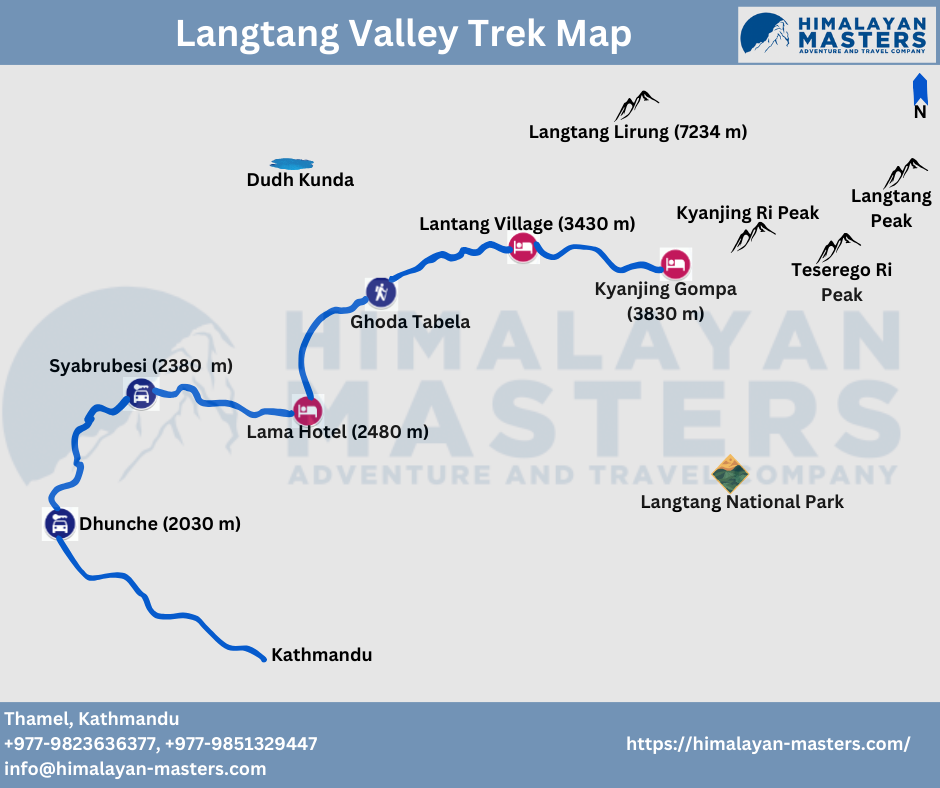
Langtang trek map
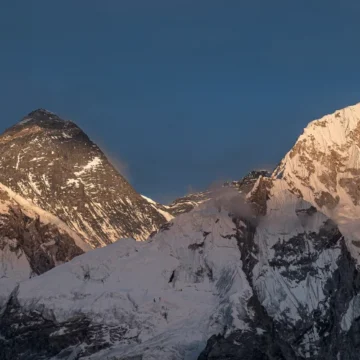
The Langtang Valley trek is a beautiful and not-too-difficult trekking adventure in Nepal. It’s a short trek that many foreign and Nepalese tourists enjoy. Situated north of Kathmandu and bordering Tibet, the Langtang region combines nature and culture. This trek is perfect for those who want to connect with nature and explore independently and it is better to carry Langtang valley trek map.
The Langtang Valley trek includes the Tamang Heritage and Langtang Valley, making it an excellent family trek. You’ll experience the warm hospitality of the Tamang people, their unique culture, and the charm of old Buddhist monasteries.
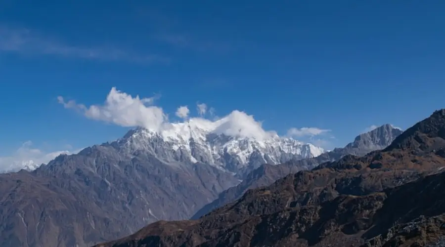
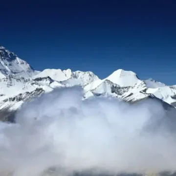
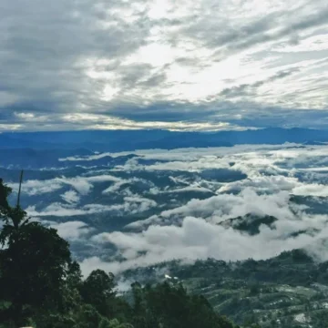
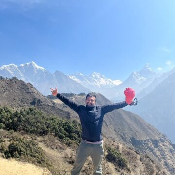
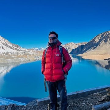
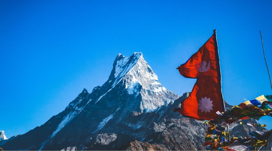
It combines exploring the untouched Tamang culture with the beauty of the Langtang Region. The trek offers stunning views of snow-capped mountains like Ganesh Himal, Langtang Lirung, and more. With beautiful landscapes, alpine meadows, and opportunities to see wildlife, the Langtang Valley trek is enjoyable throughout the year, especially in spring and autumn. Therefore, it’s an easy trek suitable for trekkers with good physical fitness, offering a glimpse into authentic Nepalese life.
Langtang Valley Trek map
The Langtang Valley trek in Nepal is a beautiful adventure, and having a Langtang Valley Trek Map is crucial for navigating its challenging trails. Hence, Trekkers should carry a Langtang Valley Trek Map to enhance their overall trekking experience, providing valuable information about the terrain and key locations.
Day 01: Kathmandu to Syabru Besi
- Altitude Kathmandu: 1300 meters
- Altitude Syabru Besi: 2000 meters
- Drive Duration: 10 hours on public bus
- Distance: 122 kilometers
Day 02: Syabru Besi to Lama Hotel
- Altitude Lama Hotel: 2748 meters
- Trek Duration: 5 hours 30 minutes
- Distance: 11.3 kilometers
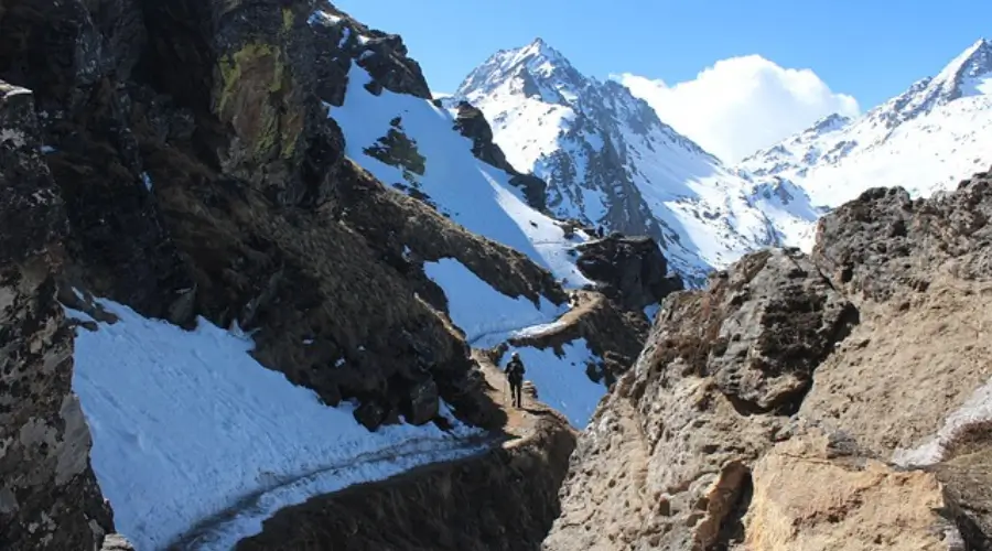
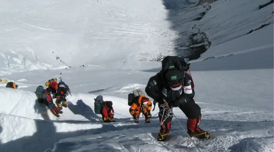
- Begin trekking from Syabru Besi, the entrance of Langtang National Park. The trail takes you over a suspension bridge across Bhote Koshi – Mundu – Ghode Tabela – Gumna Chowk. Reach Lama Hotel for an overnight stay.
Day 03: Lama Hotel to Langtang Valley
- Altitude Langtang Valley: 3500 meters
- Trek Duration: 5 hours
- Distance: 14.8 kilometers
- Trek to the beautiful Langtang Valley, witnessing a mix of terrain from steep ascents to lush jungles. Enjoy views of Mount Langtang Lirung and encounter Tamang villages along the way. Arrive in Langtang Valley for an overnight stay.
Day 04: Langtang Valley to Kyanjin Gompa
- Altitude Kyanjin Gompa: 3870 meters
- Trek Duration: 5 hours 30 minutes
- Distance: 6.8 kilometers
- Experience one of the most beautiful days on the Langtang Gosaikunda trek. Pass through flats, ascents, and descents, and come across Mani walls, prayer flags, and chortens. Reach Kyanjin Gompa, offering stunning views of Mt. Langtang Lirung, Manaslu, and Kimshung.
Day 05: Kyanjin Gompa to Lama Hotel
- Altitude Lama Hotel: 2784 meters
- Trek Duration: 4 to 5 hours
- Distance: 21.6 kilometers
- As you trek from Kyanjin Gompa to Lama Hotel, retracing your steps along the Langtang Khola, the Langtang Gosaikunda trek map ensures you stay on the right path.
Day 06: Lama Hotel to Thulo Syabru
- Altitude Thulo Syabru: 2000 meters
- Trek Duration: 5 hours
- Go downhill to Pairo, cross a river, and climb towards Thulo Syabru. Walk through pine and Juniper forests, witnessing the unique lifestyle of Tamang villages. Enjoy Langtang Himalayan range views and stay overnight in Thulo Syabru.
Day 07: Thulo Syabru to Shin Gompa
- Altitude Shin Gompa: 3330 meters
- Trek Duration: 4 to 5 hours
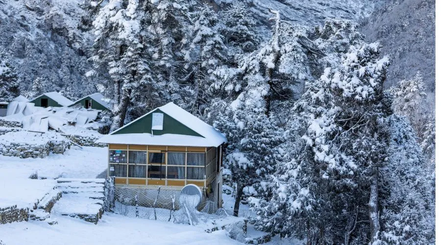
- Climb Dimsa village, pass through Durdagang and Foprang Danda, and experience lush rhododendrons, hemlocks, and oak trees. Reach Shin Gompa, visit a local cheese factory, and explore the Buddhist Monastery. Overnight stay.
Day 08: Shin Gompa to Lauribina Yak
- Altitude Lauribina Yak: 3920 meters
- Trek Duration: 4 to 5 hours
- Begin the day by climbing to Chalang Pati, which offers beautiful views of Mt. Langtang Lirung and the Tibetan mountains. Walk through serene forests, encountering diverse wildlife. Reach Lauribina Yak for an overnight stay.
Day 09: Lauribina Yak to Gosaikunda Lake
- Altitude Gosaikunda Lake: 4460 meters
- Trek Duration: 4 hours
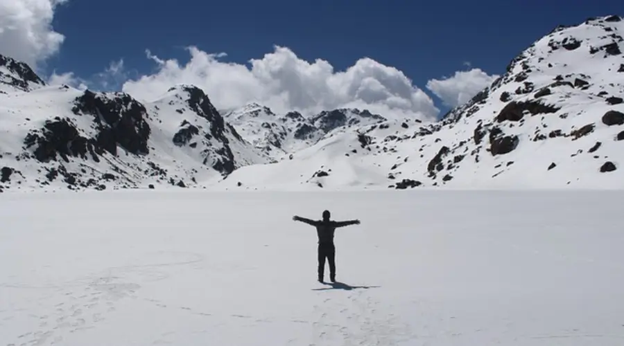
- Walk across a temple with a statue of Sakyamuni, enjoy views of Saraswati Kunda and Bhairav Kunda, and climb gently to Gosaikunda Lake. Experience the magic of the majestic lake and stay overnight.
Day 10: Gosaikunda to Gopte
- Altitude Gopte: 3440 meters
- Trek Duration: 6 to 7 hours
- Walk around Gosaikunda Lake, cross Lauri Bina Pass, and descend to Phedi—Traverse rocky hills and pine forests, reaching Gopte for an overnight stay.
Day 11: Gopte to Tharepati
- Altitude Tharepati: 3640 meters
- Trek Duration: 5 to 6 hours
- Descend from Ghopte, navigating several ascends and descends. Reach Tharepati, experiencing challenging trail sections. Stay overnight in a lodge.
Day 12: Tharepati to Gul Bhanjayang
- Altitude Gul Bhanjyang: 2140 meters
- Trek Duration: 5 hours
- Walk through forested trails in Shivapuri National Park, spotting animals and birds. Pass through Magen Goth, Panghu, and Khutumsang, reaching Gul Bhanjyang for an overnight stay.
Day 13: Gul Bhanjayang to Chisopani
- Altitude Chisopani: 2134 meters
- Trek Duration: 5 to 6 hours
- Walk through lush greenery, ascending to Thodang Betini and Pati Bhanjyang. Reach Chisopani, known for its sunrise view, and stay overnight.
Day 14: Chisopani to Sundarijal. Drive to Kathmandu
- Altitude Sundarijal: 1300 meters
- Trek Duration: 4 to 5 hours
- Drive Duration: 1 hour 30 minutes
- The Langtang trek route map is an essential tool as trekkers walk through dense forests in Shivapuri National Park on their way from Chisopani to Sundarijal.
Internet and charging facilities in Langtang Trek
In the Langtang Helambu Trek, especially in the lower areas, there needs to be more internet and charging available. At the start, in places like Syabrubeshi and Lama Hotel, a few teahouses might offer essential internet, but it might not be very fast or reliable, and sometimes you might have to pay for it. As you go higher up into more remote areas, it gets harder to find internet access. The connection might need improvement in Langtang Village, and the internet could be slow.
There are places to charge your electronic stuff in the lower parts of the trek. Teahouses usually have spots where you can plug in your devices. But finding places to charge might be tricky as you go higher. Some teahouses might have few charging options. It’s a good idea to bring a portable power bank to ensure you have extra power.
Permits in Langtang Valley Trek
You need two permits for the Langtang Valley Trek in Nepal: a TIMS card, like a trekking ID, and a Langtang National Park Entry Permit. Get the TIMS card (Green for individuals, Blue with a guide) from the Nepal Tourism Board and the Park permit at the entrance. Bring your passport, a copy, and two photos for each permit. It’s wise to use a licensed trekking guide for safety.
Conclusion
The Langtang Valley trek in Nepal is popular for nature and culture enthusiasts. A Langtang Valley Trek Map is crucial for navigating challenging trails, calculating distances, and ensuring a safe journey. So, Langtang Gosaikunda Helambu trek map plays a crucial role as trekkers ascend towards Langtang Valley, witnessing steep ascents, lush jungles, and the charm of Tamang villages. So, get your map and start a breathtaking adventure in this beautiful Himalayan region.
FAQs
Do I need to carry a Langtang Valley Trek Map?
Yes, carrying a Langtang Valley Trek Map is advisable. The map is a valuable navigation tool, providing essential information about the terrain, trails, and key locations. It enhances your overall trekking experience and can be crucial for route planning and safety.
How to navigate using a map during the Langtang Valley Trek?
Langtang Gosaikunda Helambu trek map plays a crucial role as trekkers ascend towards Langtang Valley, witnessing steep ascents, lush jungles, and the charm of Tamang villages. Begin by understanding the map’s symbols and legend. So orient the map according to your surroundings and use compass directions. Regularly cross-reference the map with your actual location during the trek.
What are the major attractions of the Langtang Trek?
a. Kyanjin Gompa: A picturesque village with a stunning monastery and views of Langtang Lirung.
b. Langtang Village: Surrounded by stone walls, it offers a glimpse into the local Tamang culture.
c. Tserko Ri: A vantage point providing breathtaking views of the Langtang peaks.
d. Ghora Tabela: A scenic pasture with views of snow-capped peaks and a key resting point.
e. Cheese Factory: Located in Kyanjin Gompa, it offers insight into traditional cheese-making.
f. Birendra Lake and Manaslu Base Camp: Scenic spots for relaxation and exploration.
What is the best time to undertake the Langtang Valley Trek?
The optimal time for the Langtang Valley Trek is spring (March to May) and autumn (September to November). The weather is generally stable during these periods, with clear skies and moderate temperatures, providing ideal trekking conditions. You can opt for Langtang Helicopter tour.
Are permits required for the Langtang Valley Trek?
Yes, trekkers need permits to enter the Langtang National Park. The required permits include the Langtang National Park Entry Permit and the TIMS (Trekkers’ Information Management System) card. These permits can be obtained in Kathmandu before starting the trek.
Is acclimatization necessary during the Langtang Trek?
Yes, acclimatization is crucial to prevent altitude-related issues. The Langtang trek map itinerary includes rest days at higher elevations, allowing trekkers to acclimatize gradually. Adequate hydration, proper rest, and awareness of symptoms related to altitude sickness are essential for a safe and enjoyable trek.
Nepal Trekking Routes
related post
Want to know more?
Speak to an Expert
Sandip Dhungana
Nepal 🇳🇵
Whatsapp: +977-9823636377
Leave Your Comment
Author
Swostika is a content writer at Himalayan Masters as well as a travel enthusiast. She loves to travel and learn about different cultures and people. With a love for writing, traveling, and embracing diverse cultures, she is on a journey to explore and inspire through words.

COMMENT(1)