Langtang Trek Map- Helambu Valley and Gosaikunda
Table of Contents
The Langtang Valley trek is a beautiful and not-too-difficult trekking adventure in Nepal. It’s a short trek that many foreign and Nepalese tourists enjoy. Situated north of Kathmandu and bordering Tibet, the Langtang region combines nature and culture.
Langtang Trek is perfect for those who want to connect with nature and explore independently. The Langtang trek map includes the Tamang Heritage and Langtang Valley, making it an excellent family trek. You’ll experience the warm hospitality of the Tamang people, their unique culture, and the charm of old Buddhist monasteries.
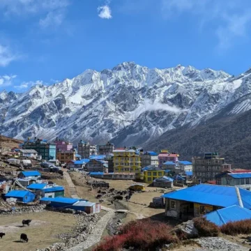
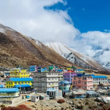
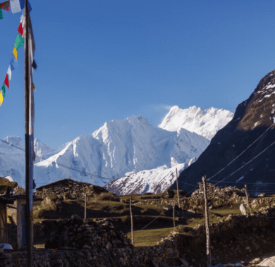
It combines exploring the untouched Tamang culture with the beauty of the Langtang Region. The trek has stunning views of snow-capped mountains like Ganesh Himal, Langtang Lirung, and more. With beautiful landscapes, alpine meadows, and opportunities to see wildlife, the Langtang Valley trek is enjoyable throughout the year, especially in spring and autumn.
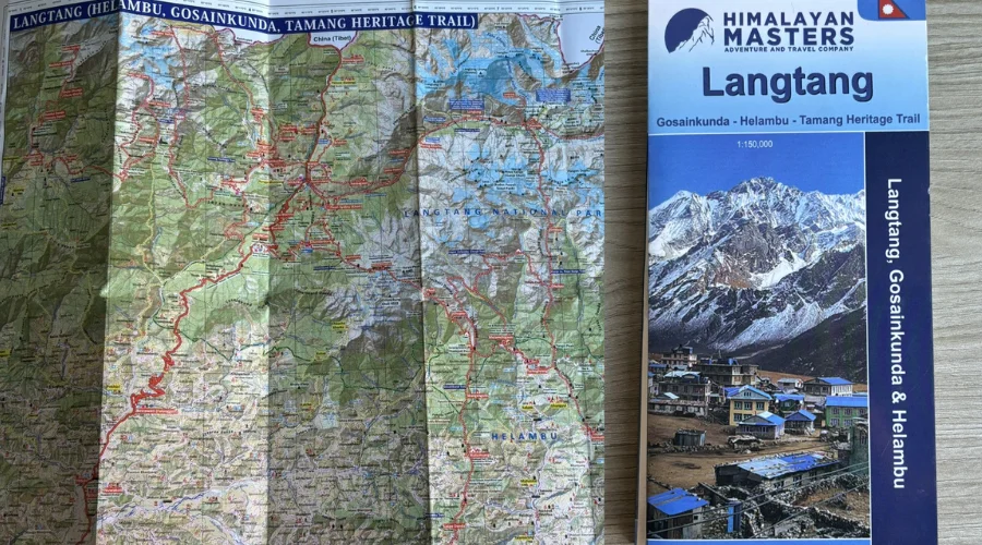
Langtang Valley Trek Map
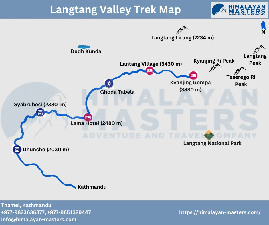
The Langtang Valley trek in Nepal is a beautiful adventure, and having a Langtang Valley Trek Map is crucial for navigating its challenging trails. Trekkers should carry a Langtang Valley Trek Map to enhance their overall trekking experience, providing valuable information about the terrain and key locations. The trek of Langtang Valley starts from Syabrubesi of Rasuwa and ends at Dhunche. Between these places, you will trek through the Langtang National Park area.
Helambu Valley Trek Map
The Helambu Valley Trek lies in a remote area, yet only just north of Kathmandu. It is renowned for its landscapes, rich Tamang and Sherpa culture, and moderate trekking routes. The Helambu trek map shows trails that wind through lush green hills, terraced fields, and villages like Sermathang, Melamchi Gaon, and Tarkegyang.
However, this trek is very helpful in planning stops using a map, understanding elevation changes, and ensuring you are on the right path. It gives an apparent overview of the route, marking tea houses and significant landmarks, which makes navigation seamless for trekkers.
Langtang Gosaikunda Trek Map
The Langtang Gosaikunda trek is unique in that it combines alpine lands, high-altitude sacred lakes, and Himalayan views. Unlike other treks, the trail combines cultural exploration with natural beauty.
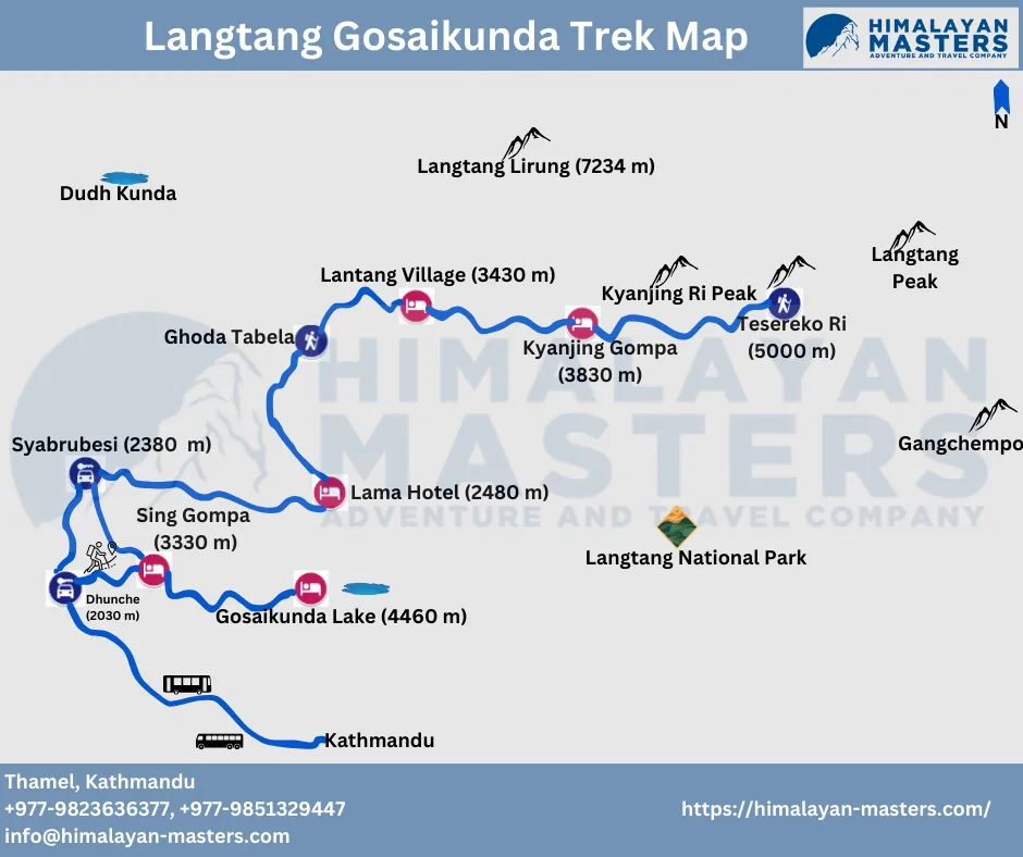
The Gosaikunda map focuses on Langtang and Kyanjin Gompa villages in the Langtang Valley and extends to holy lakes named Gosaikunda. It also includes variations in altitude and connecting trails so that trekkers can prepare themselves for the challenges of the trek while enjoying its beauty.
Tamang Heritage Trail Map
The Tamanag Heritage Trail map is also similar to the maps of Langtang in other regions. The only difference is the starting and ending point of the trek. You will pass through charming and cultural Tamang villages and houses. The Tamanag Heritage map includes Tamang Villages like Gatlang, Nagthali, Briddhim, and others. You will also cross some suspension bridges, rivers and monasteries.
How do you use a map for navigation during the Langtang Trek?
A map will be your best friend for the Langtang Valley Trek. Find Syabrubesi, the start of this trek, and then trace the contours and trails to reach villages such as Lama Hotel, Langtang Village, and Kyanjin Gompa.
The map also shows the river crossings, suspension bridges, and forested areas to guide your journey. Landmarks such as monasteries and view towers are marked on the map. Check it at every stop to ensure you’re on the right track, and estimate how much farther your next destination will be.
Conclusion
The Langtang trek map in Nepal is popular with nature and culture enthusiasts. A Langtang Valley Trek Map is crucial for navigating challenging trails, calculating distances, and ensuring a safe journey.
Langtang Gosaikunda Helambu trek map plays a vital role as trekkers ascend towards Langtang Valley, witnessing steep ascents, lush jungles, and the charm of Tamang villages. So, get your map and start a breathtaking adventure in this beautiful Himalayan region.
Some FAQs Related to Langtang Valley Map
Do I need to carry a Langtang Valley Trek Map?
Yes, carrying a Langtang Valley Trek Map is advisable. The map is a valuable navigation tool, providing essential information about the terrain, trails, and key locations.
Do you get a free map for Langtang Trek?
If you trek with us, Himalayan Masters, you will get a free Langtang Trek Map.
What are the major attractions of the Langtang Valley Trek Map?
Kyanjin Gompa, Langtang Village, Tserko Ri, Ghoda Tabela, and Cheese Factory are the significant attractions of Langtang Valley Trek.
Can I use Google Maps for the Langtang Valley Trek?
Yes, indeed, you can use Google Maps for the Langtang Valley Trek. The paths and routes are determined in the app.
How do I use a map for the Langtang Valley Trek?
You can look for the places you want to reach or find on the map, making it easy to locate the area.
Want to know more?
Speak to an Expert


Sandip Dhungana
Nepal 🇳🇵
Whatsapp: +977-9823636377

