All you need to know about Langtang Lirung Expedition
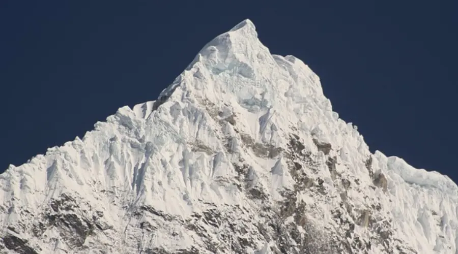
Table of Contents
Langtang Lirung, also known as Nandanli, is a majestic mountain peak situated in the Langtang region of Nepal. Langtang Lirung height is at an elevation of 7234 meters, which is approximately 23711 feet above sea level. The peak is identified by the code LANG and is officially open for climbers and adventurers to explore.
Langtang Lirung is at a latitude of approximately 28º 15′ 22 and a longitude of 85º 31′ 10. Langtang Lirung offers breathtaking views and is a popular destination for mountaineers and trekkers seeking thrilling experiences amidst stunning natural landscapes.
Where is Langtang Lirung?
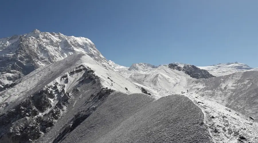
Langtang Lirung is a big mountain that sits right on the line between Tibet and Nepal in a group of mountains called the Langtang Himal sub-range. It is like a giant in the family of Himalayan peaks, standing proud southwest of another famous mountain called Shishapangma.
There are 14 main peaks in this region, and Langtang Lirung is one of the tallest, reaching up to a staggering 7,227 meters. Langtang Lirung height is that high. Most of the other peaks here are also super tall, with only one being shorter than 6,000 meters and 11 others falling between 6,000 and 6,999 meters. So, the Langtang Lirung expedition is among the highest of the highest in this majestic mountain family.
Langtang Lirung Expedition difficult, dangerous mountain
The Langtang Lirung elevation of 7234 meters offers breathtaking views of the surrounding Himalayan landscape. Trekkers can experience dramatic changes in scenery as they ascend to higher Langtang Lirung elevations. Langtang Lirung Expedition is a tough and risky mountain to climb. Only a few climbers dare to tackle its steep slopes.
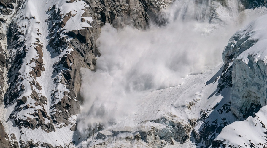
Out of 51 groups that tried to reach the top, only 14 made it. That’s not a lot. And sadly, 16 climbers lost their lives trying. Most of them were caught in avalanches, big masses of snow sliding down the mountain and due to Langtang Lirung altitude. Others were hit by falling rocks or ice. One climber fell and couldn’t survive. Even skilled climbers like Tomaz Humar, famous in the climbing world, faced tragedy on this mountain in 2009. The Langtang Lirung expedition offers an exciting opportunity to explore this majestic peak up close.
Because it’s so challenging and dangerous, companies don’t take groups up there for fun. Interestingly, none of the climbers who tried it used extra oxygen, which is sometimes used to help climbers breathe better at high altitudes at Langtang Lirung Expedition.
Climbing History and Difficulty
Since 1949, many people tried to climb Langtang Lirung. Bill Tilman and Peter Lloyd went first but found it too tough from the south. Summiting Langtang Lirung’s height requires careful planning and physical endurance. They tried again from the north but ended up in Tibet by mistake.
Then, in 1959, Japanese climbers aimed for it but found another peak instead. In 1961, a Japanese team got hit by an avalanche, and in 1963, Italians faced avalanches too. In 1964, a Japanese team couldn’t go past 6,000 meters because of dangerous ridges and avalanches.
Another attempt in 1964 by a British-Australian team also failed due to tough routes. Finally, in 1978, a Japanese team succeeded in climbing it.
In the winter of 1988, Polish climbers did it for the first winter. Since then, others have done it in winter, too. Most climbers go via the southeast or southwest ridges.
Trying the south face has been tough. British-Canadian and Canadian teams tried in 1980 and 1984, but bad weather and snow stopped them. In 2009, Tomaz Humar died trying. In 2010, an Iranian team made it.
Attempts were made in 1984 and 1985 from the north, but they only went a little. In the east face, it’s super dangerous. Japanese tried in 2010, but only reached 4,150m. In 2017, French climbers couldn’t do it either. Last year, Ecuadorians gave up at 5,800m due to falling rocks. Conquering Langtang Lirung’s height is a remarkable achievement for mountaineers and adventurers alike.
Langtang Lirung NorthWest Face
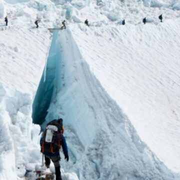
The Northwest Face is the most common route, and it’s tough. It has steep slopes of snow and ice, dangerous cracks called crevasses, and big walls of ice you have to climb over. But if you’re up for a different challenge, there are also the North Ridge and the West Ridge routes. These give climbers other options to explore, with their obstacles and fun moments. Whether you’re tackling the Northwest Face or trying out the North or West Ridge, Langtang Lirung climbing is all about adventure and pushing yourself to reach the top.
Langtang Lirung South Face
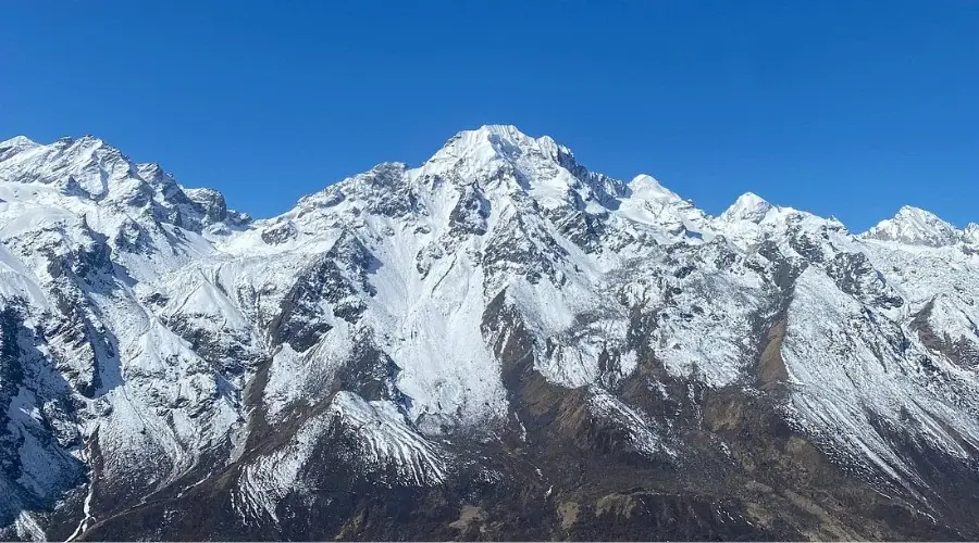
The south face of Langtang Lirung is still one of the most difficult line in climbing on this mountain. The Langtang Lirung south face begins at an approximate altitude of 4,200m (13,780 ft) at the base camp. From here, climbers get to cables and ropes and tough walk as they progress towards the summit which is at 7,227 meters or 23,711 feet. The Langtang Lirung South Face is full of challenges but do give mountaineers a thrilling and enthralling climb to the top of this beautiful mountain in the Langtang Himal of Nepal.
How to get there Langtang Lirung altitude?
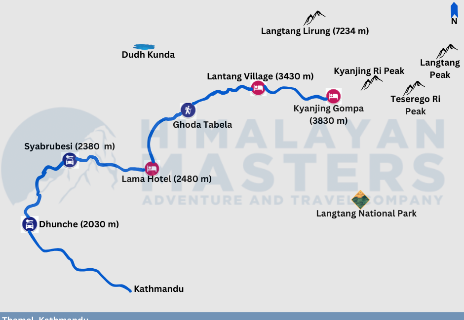
Many people ask how far is Langtang Lirung? To get from Kathmandu to Syabrubesi, you can travel in a local bus or a private vehicle. the private vehicle will help you arrive faster like 2-2.5 hours before the public one. The distance you need to travel by vehicle is around 122 kilometers. Once you’re in Syabrubesi, you’ll start your journey towards the base camp. Before reaching the base camp, the caravan route goes through places like Lama Hotel and Kyanjin. This Lantang Lirung distance route is about 42.9 kilometers long and passes through Dhunche.
The Lantang Lirung distance, the climbing route from Syabrubesi to the base camp is shorter, about 10.1 kilometers. However, this journey will take longer, around 35 days. During these 35 days, you’ll be trekking through various terrains and altitudes, gradually making your way toward the base camp. Planning your journey carefully is important, considering factors like weather conditions, rest stops, and acclimatization to high altitudes.
Langtang Lirung Permit Cost
In Nepal, if you’re a Nepalese citizen the Langtang Lirung Cost, you pay a certain amount in Nepalese Rupees (NRs) to access certain areas during different seasons. In spring, it’s 6000 NRs; in autumn, it’s 3000 NRs; and in winter or summer, it’s 1500 NRs.
For foreigners, the Langtang Lirung Cost for a permit is in US Dollars (USD). In spring, it’s 500 USD; in autumn, it’s 250 USD; and in winter or summer, it’s 125 USD.
Choosing a reputable trekking company can help travelers manage the Langtang Lirung cost-efficiently. Group discounts may be available for Langtang Lirung treks permit, reducing overall costs for participants.
These fees help maintain and protect these areas so everyone can enjoy them safely. Whether you’re a local or a visitor from abroad, following these rules and paying the required fees is important.
Langtang Gosaikunda Helambu Trekking route
Langtang Lirung has different ways to climb it, each with difficulties and excitement. Langtang Gosaikunda Helambu trekking is a popular route among trekkers seeking diverse landscapes. Trekkers should be prepared for various weather conditions during Langtang Gosaikunda Helambu trekking. Trekkers rely on the Langtang Lirung trek map to identify landmarks and plan their route.
Langtang Lirung Expedition Base Camp and Acclimatization
The base camp for Langtang Lirung is like a starting point for climbers, and it’s situated around 4,100 meters (13,450 feet) above sea level. Here, climbers take a break to get used to the high altitude and to get ready for the tough climb ahead.
It’s a place to rest, organize their climbing gear, and get advice from experienced climbers. Think of it as a kind of safe spot where climbers can recharge their batteries and learn important stuff before tackling the big mountain. It’s from here that climbers begin their adventure, step by step, getting ready to take on the challenge of Langtang valley trek. Acclimatization days are essential for adjusting to the Langtang Lirung altitude and avoiding altitude-related illnesses. Trekkers should stay hydrated and maintain a steady pace to minimize the effects of Langtang Lirung altitude.
Langtang Lirung Food and water
Local cuisine adds flavor to the Langtang Lirung food experience, with dishes like dal bhat and momos. Dietary restrictions can be accommodated with advance notice when arranging Langtang Lirung food. Hydration is crucial during the Langtang Lirung peak climb, so travelers should drink plenty of water and fluids.
Fresh vegetable sourced from nearby villages adds flavor and nutrition to meals, ensuring trekkers stay nourished during their adventures. Hydration is equally important, with travelers encouraged to drink plenty of water and fluids to prevent dehydration, especially at higher elevations where the air is thinner. Langtang Lirung climb people should also be mindful of water sources, opting for purified or boiled water to avoid waterborne illnesses.
Langtang Lirung hotel/camps
Along the Langtang Lirung peak climb, travellers find cozy lodges and campsites offering basic accommodation. Resting in Langtang Lirung hotels or camps allows trekkers to recharge after a day of exploration. Langtang Lirung hotels and camps provide warm blankets and comfortable beds for a good night’s sleep. Travellers can socialize with fellow trekkers and share stories at Langtang Lirung hotels and camps. But after reaching the Langtang Lirung Base Camp you have to stay in a tent like everyone does while summitting Everest.
Langtang Lirung Views and Surroundings
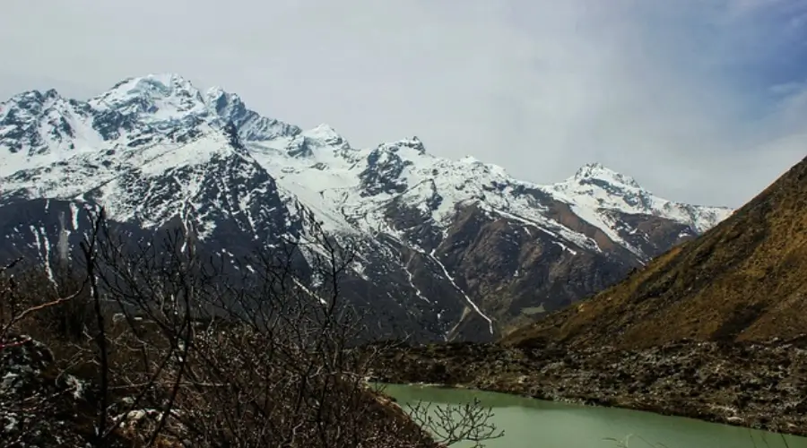
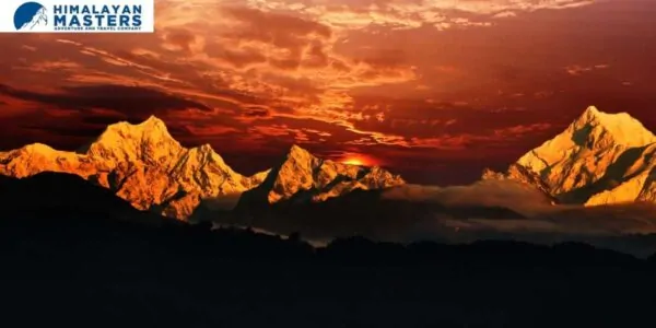
Standing on top of Langtang Lirung climb feels like being on the roof of the world, with breathtaking views all around. You can see towering Himalayan peaks like Langshisa Ri, Ganesh Himal, and Dorje Lakpa standing proudly against the sky. The Langtang Valley spreads out below, a picture-perfect scene of mountains, valleys, and lush greenery. It’s like stepping into a painting of nature’s most stunning sights, where every view takes your breath away and fills you with wonder. Langtang Lirung is a gateway to a world of beauty that’s hard to put into words—it’s simply unforgettable. You can opt for Langtang valley helicopter tour.
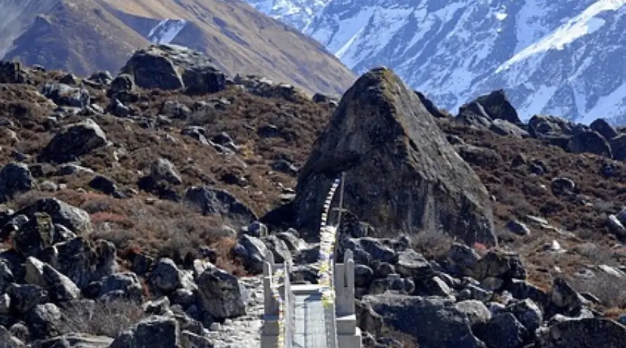
Bagmati Pradesh is a province in Nepal, and the Langtang mountain range is within it. Specifically, in the Rasuwa district of Bagmati Pradesh, there’s a municipality, GosaiKunda.
Stunning landscapes, lush greenery, and breathtaking mountain views characterize this area, which is renowned for its natural beauty. Hindus consider Gosai Kunda famous for its pristine lakes, which hold sacred significance. Many people visit this area for trekking and experiencing the calmness of nature. It’s a place where you can escape the hustle and bustle of city life and immerse yourself in the serenity of the mountains.
Langtang Trekking and Photography
Even if you’re not into climbing, you can still have an amazing time exploring the Langtang area. Trekking routes like the Langtang Valley trek show you stunning views of Langtang Lirung from different spots. This means you can take awesome photos of Langtang Lirung, the icy glaciers, green meadows, and the cool landscapes around.
As you walk, Langtang Lirung’s beauty keeps getting closer, standing tall and impressive. Each step reveals new scenes—sparkling glaciers, peaceful meadows, and rocky paths that tell stories of long ago. For those who love taking pictures or simply enjoying nature, every moment on the trek is a chance to capture Langtang Lirung’s breathtaking charm.
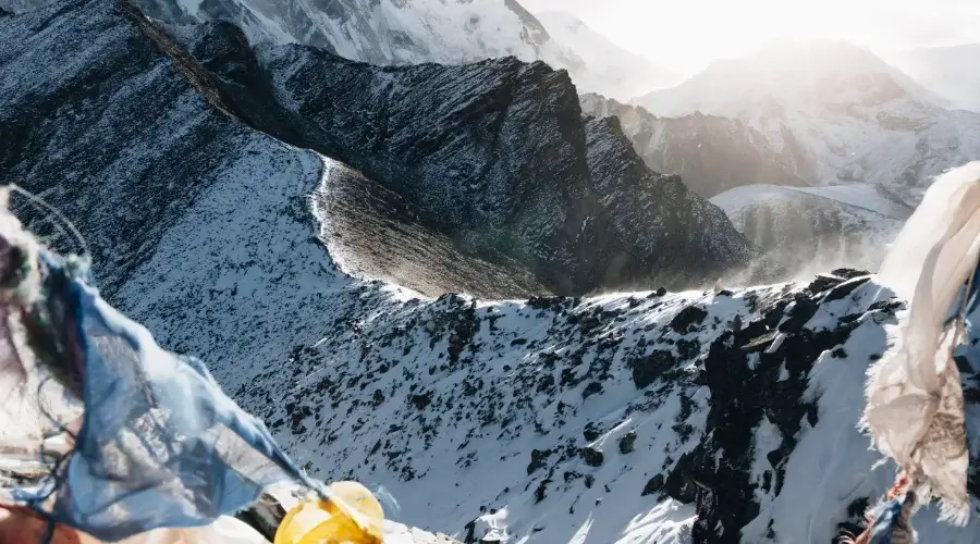
Whether you’re a pro trekker or an adventure seeker, the Langtang region beckons with its beauty and wonder, inviting exploration and lasting memories. It’s advisable to carry a waterproof Langtang Lirung trek map to protect it from the elements.
Conservation and Tourism in Langtang Lirung Expedition
Langtang Lirung, as part of the Langtang region, falls within the boundaries of the Langtang National Park, which is dedicated to conserving the area’s natural environment and biodiversity. Tourism is vital in supporting conservation efforts while contributing to the local economy. Visitors to the region, whether climbers or trekkers, are responsible for respecting the natural surroundings and the local culture.
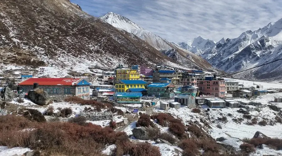
By following responsible practices, such as properly disposing of waste, staying on trails, and supporting local communities, tourists can help preserve the pure beauty of Langtang Lirung and its surroundings for future generations to enjoy. Conservation and tourism go hand in hand, ensuring that places like Langtang Lirung remain accessible while safeguarding their ecological integrity.
Want to know more?
Speak to an Expert


Sandip Dhungana
Nepal 🇳🇵
Whatsapp: +977-9823636377





COMMENT(1)