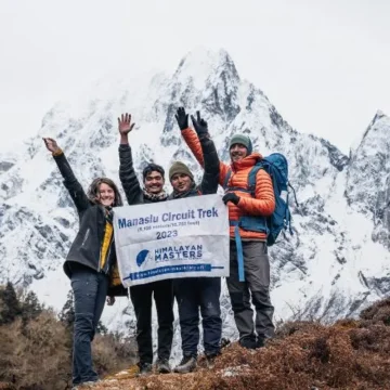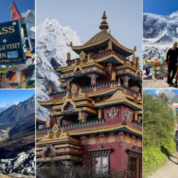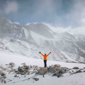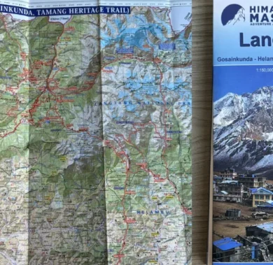
Manaslu Circuit Trek map; Base Camp, TSUM valley Route
Table of Contents
Mount Manaslu, a wonder of Nepal, is nestled in Nepal and proudly stands as the eighth tallest mountain in the world. The elevation of Manaslu is 8,163 meters (26,781 feet). It is also known as the “Mountain of the Spirit.” As Mount Manaslu is not overcrowded, it offers something special for those who seek a quieter path. It is like a hidden gem in the Himalayas.
Manaslu is not just a tall pile of rocks covered with snow. It is an adventure that awaits. When we talk about Manaslu, we don’t talk about the mountain; we talk about the incredible trekking routes and the localities around it.
The challenging trekking routes of the Manaslu base camp maps and TSUM Valley map make the trekking more wonderful. Trekkers can discover the remote villages, local people, and authentic Himalayan experience. A map of the Manaslu circuit trek is essential.
Manaslu Circuit Trek Map
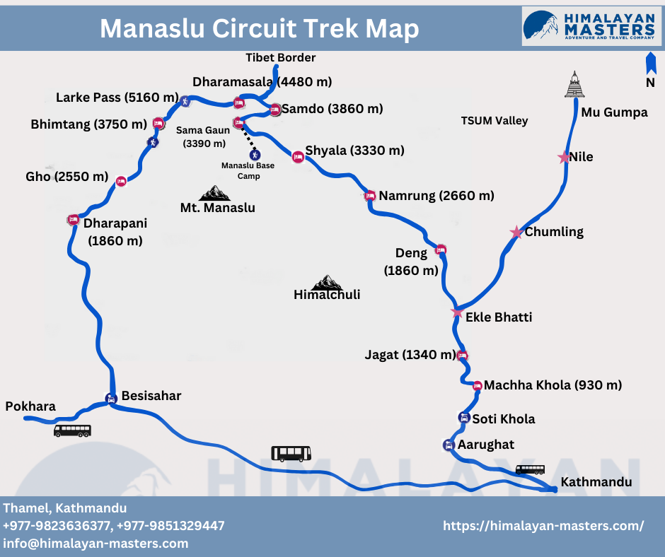
Day 01: Drive from Kathmandu to Machha Khola via Soti Khola (730 m)
The route takes us through scenic landscapes alongside the Trishuli River on the northward from Aarughat- Soti Khola- Machha Khola.
- Distance: 160 km (100 miles)
- Duration: 7 to 8 hours
Day 02: Trek from Machha Khola to Jagat (1340 m)
Walk along the Budhi Gandaki River to Khorlabesi- Dovan- Thulo Dunga- Jagat
- Distance: 20 km (12.43 miles)
- Duration: 6 to 7 hours
Day 03: Trek from Jagat to Deng (Dyang) (1860 m)
Mostly farmlands, bamboo forests, and wildlife-rich areas
- Distance: 22 km (13.6 miles)
- Duration: 7 to 8 hours
Day 04: Trek from Deng to Namrung (2660 m)
Walk on Terrance farm to Ghap- Rana- Namrung
- Distance: 19 km (11.8 miles)
- Duration: 6 to 7 hours
Day 05: Trek from Namrung to Shyala Village (3420 m)
Pass Tibetain villages such as Lihi- Lho- Shyala Village
- Distance: 16.5 km (10.25 miles)
- Duration: 4-5 hours
Day 06: Trek to Samagaon (3540 meters) via Pungen Monastery
Tibetan-influenced villages such as terraced fields- Pungen Monastery- Samagaon
- Distance: 17 km (10.6 miles)
- Duration: 4-5 hours
Day 07: Rest at Samagaon/ Trip to Manaslu Base Camp
Birendra Lake- Manaslu Base Camp
Day 08: Trek from Samagaon to Samdo (3860 m)
Crossing the Budhi Gandaki River- Samdo
- Distance: 5.1 km (3.16 miles)
- Duration: 2-3 hours
Day 09: Rest Day at Samdo (3860 m) (Acclimatization Hike to Tibet Border)
Close to the Tibetan Border
Day 10: Trek from Samdo to Dharamasala (4480 m)
Walk along Budhi Gandaki River to Dharmasala.
- Distance: 6.1 km (3.8 miles)
- Duration: 3-4 hours
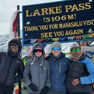
Day 11: Trek from Dharamasala to Bhimtang (3750 m) via Larke Pass (5160 m)
25 km journey via Larke Phedi- Larke Pass- Bhimtang
- Distance: 16 km (9.9 miles)
- Duration: 8 hours
Day 12: Trek from Bhimtang to Tilje Village (2550 m)
Walk downhill via a lush green forest
- Distance: 20 km (12.4 miles)
- Duration: 5-6 hours
Day 13: Drive from Tilje Village to Kathmandu or Pokhara
7-hour local jeep drive from Tilje to Beshisahar precedes an 8-hour bus journey to Kathmandu.
- Distance: 200 km (124.3 miles)
- Duration: 10 hours
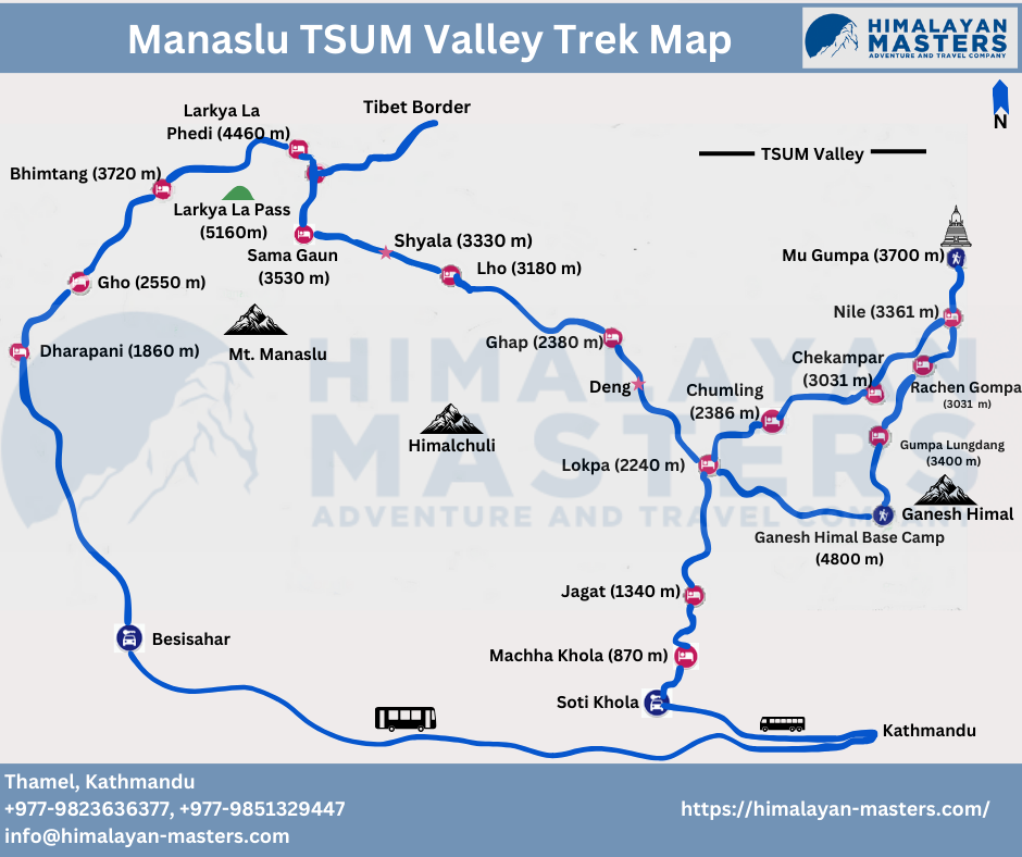
Manaslu TSUM Valley Trek Map
The TSUM Valley lies to the east of the Manalsu Circuit trek, and the diversion occurs between Jagat and Deng at the place called Lokpa.
Manaslu Tsum Valley Trek Map
Day 01: Drive from Kathmandu to Machha Khola (869 m/2851 ft) via Soti Khola
The drive route follows a scenic view of the Trishuli River, local villages, and lush forest to Machha Khola vi Arughat Bazaar and Soti Khola.
- Distance: 160 km (100 miles)
- Duration: 7-8 hours
Day 02: Trek from Machha Khola to Jagat (1340 m/4396 ft)
Our trekking journey begins. We will walk along a beautiful view of the Budi Gandaki River to Jagat.
- Distance: 20 km (12.4 miles)
- Duration: 6-7 hours
Day 03: Trek from Jagat to Lokpa (2240 m/7349 ft)
We will continue trekking to Lokpa via lush landscapes and views of mountains.
- Distance: 10-12 km (6-7.5 miles)
- Duration: 5-6 hours
Day 04: Trek from Lokpa to Chumling (2386 m7828 ft)
Today is a beautiful day; trekkers will be trekking through the forest trails and crossing rivers to reach Chumling.
- Distance: 8 km (5 miles)
- Duration: 4 hours
Day 05: Trek from Chumling to Chhekampar (3031 m/9944 ft)
Now, we are in a high-altitude region, so trekkers can enjoy a beautiful panoramic mountain view.
- Distance: 9 km (5.6 miles)
- Duration: 4-5 hours
Day 06: Trek from Chhekampar to Nile (3361 m/11,026 ft)
We will be trekking to the Nile today, exploring the remote terrains of Tsum Valley.
- Distance: 7 km (4.3 miles)
- Duration: 3.5-4 hours
Day 07: Trek from Nile to Mu Gompa (3700 m/12,139 ft) and back to Nile
Trekking from the Nile to Mu Gompa is a beautiful experience, as trekkers can explore the culture of monks living in the monastery.
- Distance: 10 km (6.2 miles)
- Duration: 5-6 hours
Day 08: Trek from Nile to Rachen Gompa (3240 m/10,629 ft)
This is another significant day of the trek; trekkers can visit another historic monastery school, Rachen Gompa.
- Distance: 3-4 km (2.4 miles)
- Duration: 1.5 hour
Day 09: Trek from Rachen Gompa to Gompa Lungdang (3200 m/10,498 ft)
On the way to Gompa Lungdang from Rachen Gompa, trekkers can get an awe-inspiring view of Ganesh Himal.
- Distance: 14-15 km
- Duration: 7-8 hours
Day 10: Trek to Ganesh Himal Base Camp (4800 m/15,748 ft) and Back to Gompa Lungdang
The 10th day of the Manaslu Tsum Valley Trek is a little challenging day. Today, you will need to hike up to a significant height to the Ganesh Himal Base Camp.
- Distance: Around 7 km (4.3 miles)
Duration: 7-8 hours
Day 11: Trek from Gompa Lungdang to Lokpa (2240 m/7349 ft)
It’s an easier day, and you will descend to Lokpa, where you will see serene nature.
- Distance: 10-12 km (9.3 miles)
- Duration: 5-6 hours
Day 12: Trek from Lokpa to Ghap (2397 m/7864 ft)
Trekkers will trek to Ghap from Lokpa through dense forests and rivers and might even spot some wild birds and animals.
- Distance: 12.5 km (7.7 miles)
- Duration: 9-10 hours
Day 13: Trek from Ghap to Lho (3280 m/10,433 ft)
Trekking from Ghap to Lho could be a little challenging, as you will need to ascend on a steep trail, but the stunning views of mountains from Lho are worth it.
- Distance: 16.3 km (10.1 miles)
- Duration: 7-8 hours
Day 14: Trek from Lho to Samagaon (3520 m/11,548 ft)
Samagaon is a significant village in the Manaslu region, offering pristine cultural immersion.
- Distance: 17.2 km (10.6 miles)
- Duration: 4-5 hours
Day 15: Rest in Samagaon
You have been trekking for 2 weeks, and now your body needs rest and also needs to acclimatize to the increasing altitude. Trekkers can also visit a historic monastery nearby, Pungen Monastery.
Day 16: Trek from Samagaon to Samdo (3875 m/12,713 ft)
For some trekkers, this part of the trek could be challenging as they will need to walk on rugged high-altitude terrain.
- Distance: 9.1 km (5.1 miles)
- Duration: 3-4 hours
Day 17: Trek from Samdo to Dharmashala (4460 m/14,633 ft)
During the trek, you will be awarded with the views of Larkya Peak and Naike Peak.
- Distance: 6.1 km (3.8 miles)
- Duration: 3-4 hours
Day 18: Trek from Dharmashala to Bhimthang (3590 m/11,778 ft) via Larkya La Pass (5106 m)
The 18th day of the trek is quite challenging; trekkers need to hike on a steep route to Larkya La Pass.
- Distance: 16 km (10 miles)
- Duration: 7-8 hours
Day 19: Trek from Bhimthang to Tilje (2300 m/7546 ft)
Although it’s a long walk day, the route is quite easier since it’s a downhill trek.
- Distance: 20 km (12.4 miles)
- Duration: 5-6 hours
Day 20: Drive from Tilje to Kathmandu (1400 m/4593 ft)
Now your trekking journey is over, you will waive your goodbyes to the mountains and drive back to Kathmandu from Tilje.
- Distance: 200 km (124.3 miles)
- Duration: 10 hours
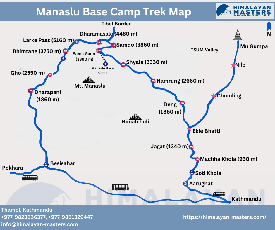
Manaslu Base Camp map
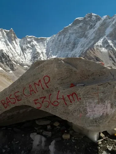
You follow the same trail up to Samagaon for the Manaslu base camp map. For the rest of the day at Samagaon, you can hike beyond Birendra Lake and then walk to the Manaslu Base Camp.
Conclusion
The Manaslu Circuit Trek Map in Nepal is an incredible adventure filled with stunning nature and rich culture. From high mountain passes to hidden valleys, it’s a journey full of thrilling experiences. By planning well, using a Manaslu Circuit Trekking Map, and getting the right permits, trekkers can enjoy this special trek and create beautiful memories.
Some FAQs Related to Manaslu Trekking
What Makes the Manaslu TSUM Valley Trek stand out among other trekking destinations in Nepal?
The Manaslu TSUM Valley Trek stands out because of its unspoiled landscapes, rich Tibetan-influenced culture, beautiful mountains, and the opportunity to explore hidden gems less frequented by tourists. This trek offers a more authentic Himalayan experience compared to other popular routes.
How challenging is the Manaslu TSUM Valley Trek Map?
This trek requires physically and mentally prepared and determined individuals as the trek presents a moderate to challenging level of difficulty. The trek consists of diverse terrains, steep ascents, descents, and high-altitude sections.
Why is the Manaslu Circuit Trek Map considered an essential tool for trekkers?
The Manaslu circuit trekking map is important for trekkers as it provides detailed information about maximum altitudes, trek durations, distances, and side trip options, facilitating efficient planning and implementation.
What permits are required for the Manaslu TSUM Valley Trek Map?
For the Manaslu TSUM Valley Trek, trekkers must secure the Manaslu Conservation Area permit (MCAP), the Restricted Area Permit (RAP), and the TSUM Valley Permit. These permits support environmental preservation, provide access to the trekking route, and ensure controlled region exploration.
What are the key attractions along the Manaslu Circuit Trek map?
Trekkers along the Manaslu TSUM Valley Trek encounter Sherpa Villages, Gurung Villages, Tibetan Buddhist Monasteries like the Pema Choyling Lhakhang, and breathtaking panoramic views of Manaslu, Annapurna, and Larke La pass.
Want to know more?
Speak to an Expert


Sandip Dhungana
Nepal 🇳🇵
Whatsapp: +977-9823636377

