- TRIP DURATION
- 15 Days
- MAX. ALTITUDE
- 6119 m (20,070 ft.)
- TRIP GRADE
- Difficult
- LODGING
- Tea House and Camping
- BEST SEASON
- Autumn and Spring
- MEALS
- Breakfast, Lunch and Dinner
- COMMUNICATION
- Wi-Fi/ Local SIM Card
- PER DAY WALK
- 5 to 7 hours
Lobuche Peak Climbing with EBC & Kala Patthar
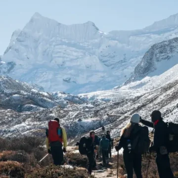
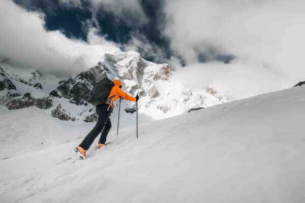
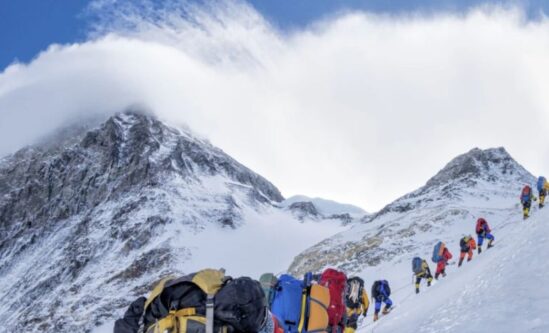
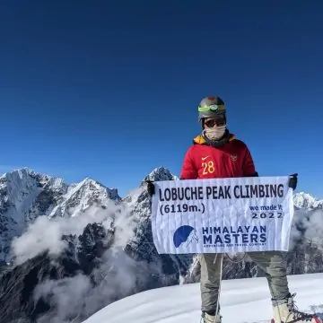
Lobuche East Peak Climbing is one of the major trekking peaks in Nepal’s Khumbu region, towering at 6,119 meters. The mountain combines adventure and spectacular views, hence becoming a favourite among climbers when it comes to adding charm to the Everest Base Camp trek. The Lobuche climb is somewhat technical. A climber should have prior experience with rock and ice climbing.
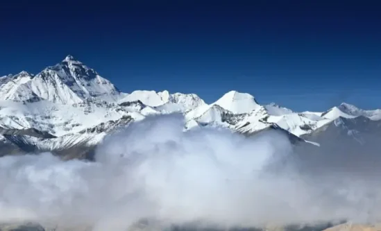
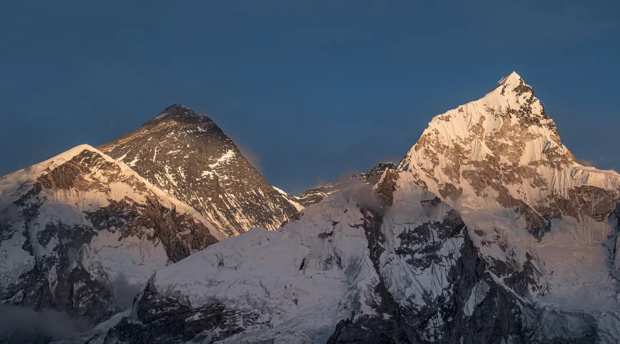
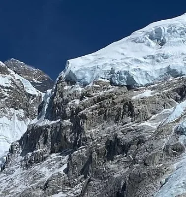
While Island Peak is slightly above 6,119 meters, Lobuche East requires more technical skills. It provides panoramic views of iconic mountains such as Mount Everest, Ama Dablam, Lhotse, and Nuptse from its summit. The Lobuche Peak has been categorized as a group “B” trekking peak by the Nepal Mountaineering Association; climbers must be proficient in using ice climbing gear to safely navigate its rough terrain.
The round trip to Lobuche East generally begins with flight arrival in Lukla, then several days of trekking across the beautiful landscape, including lush forests and rocky moraine trails. Typically, climbers acclimate at critical points like Namche Bazaar and Dingboche before reaching the base camp.
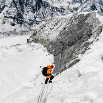
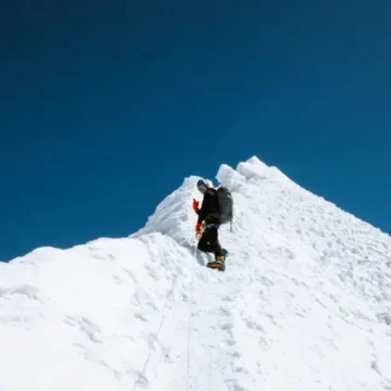
This involves an ascent by steep snow slopes and rocky ridges, often with fixed ropes for safety. Most climbers prefer to begin early in the morning so that the climb is finished when the weather is at its best, and they can also enjoy an unforgettable sunrise over the Himalayas. Climbing to the top of Lobuche East is quite an achievement, with breathtaking views of surrounding peaks and glaciers.
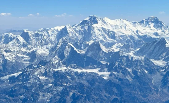
Mountains seen from Lobuche East Peak
- Mount Everest: 8,848.86 meters (29,029 feet)
- Lhotse: 8,516 meters (27,940 feet)
- Nuptse: 7,861 meters (25,791 feet)
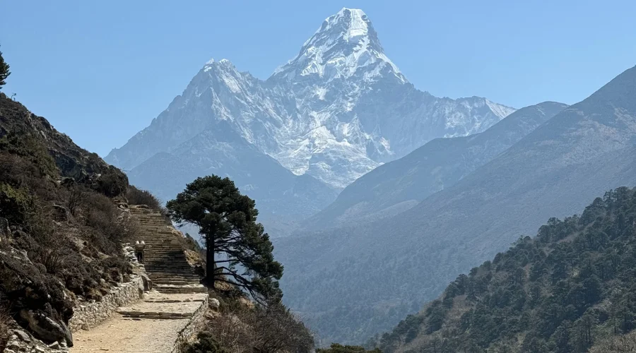
- Ama Dablam: 6,812 meters (22,349 feet)
- Pumori: 7,161 meters (23,494 feet)
- Tawoche: 6,542 meters (21,463 feet)
- Cholatse: 6,440 meters (21,126 feet)
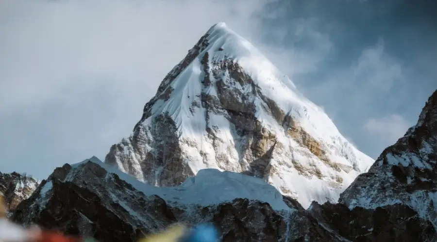
Facts About Lobuche East Peak Climbing
- Height: 6,119 meters (20,070 feet)
- Location: Khumbu region, Nepal
- Best Season: Spring (March to May) and Autumn (September to November)
- Trekking Duration: Typically 12 to 15 days
- Difficulty Level: Moderate; requires good fitness and some climbing experience
- Climbing Permit Cost: $250 in spring, $125 in autumn, and $70 in summer.
Top Highlights of Lobuche East Peak Climbing
- Panoramic vistas of major peaks such as Mount Everest, Lhotse, Nuptse, and Ama Dablam.
- Interact with local Sherpa communities and explore traditional villages.
- Lobuche East Peak stands at 6,119 meters (20,075 feet) in the Khumbu region of Nepal.
- It is considered a trekking/climbing peak, making it suitable for climbers with moderate mountaineering skills.
- The ascent involves a mix of trekking and technical climbing, including sections requiring fixed ropes.
- The climb includes visits to Sherpa villages and ancient monasteries, enriching the climbing experience.
- Climbers establish a base camp around 4,950 meters and a high camp at approximately 5,400 meters for acclimatization.
- The peak was first summited on April 25, 1984, by Laurence Nielsson and Ang Gyalzen Sherpa.
Culture and Wildlife on Lobuche Climb
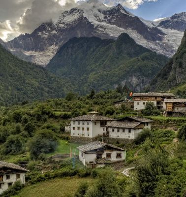
The Lobuche East trek goes through some Sherpa villages where one may witness the rich culture, including many traditional festivals, customs, and food. The area is also home to various wildlife, such as Himalayan tahr, pheasants, and various bird species. The trekkers may find yaks that the locals help with transportation.
A Typical Day on Lobuche East Peak Climbing
On Lobuche East Peak route climbing treks, the day usually starts well before dawn. A normal wake-up time for the climbers is around 2 to 3 AM when getting ready for the climb. After having a very quick breakfast, they put on the essential climbing kits: crampons, ice axes, harnesses, and so on and so forth.
The gentle start of the ascent will take one through rocky and snowy landscapes. It may take 5-10 hours to climb up, depending upon the pace of the individual and climatic conditions. Steep snow walls will be attempted near the top, using fixed ropes for safety.
The view from the top is just unforgettable as climbers will get to see the surrounding peaks in their prime beauty, including Mount Everest, Lhotse, and Ama Dablam. After a bit of time at the top to capture these stunning views and click pictures, the descent is usually carried back to high camp or base camp for rest and recovery.
Points to Remember for Lobuche Climbing
Following are the notes to be taken during preparation for the Lobuche East Peak climbing trek:
- Physical fitness is the main priority; regular training is important for developing stamina and strength for climbing.
- Acclimatization is also critical to avoid altitude sickness; proper time at lower altitudes should be strictly required before going to higher altitudes.
- One should pack well, considering the temperature can drop significantly in higher altitudes.
- One should be familiar with their equipment and use them around a bit before the climb. For the safety of the trek, one should follow guides who are experienced in the trek.
- Finally, food and water are very important to the climbers to help them build enough energy levels.
Benefits of Booking the Expedition with Himalayan Masters
- Experienced guides lead the expedition, which makes the trip better.
- The well-structured itinerary balances trekking and climbing, allowing for proper acclimatization.
- We also provide necessary gear and training in essential mountaineering skills.
- Engage with local Sherpa culture and communities with a guide.
- Tailored booking options accommodate individual preferences regarding time, budget, and goals.
- Receive extra gear at no additional cost, such as trekking poles and sleeping bags, adding value to your trip.
- Supporting local economies through local resources contributes positively to the communities involved in tourism.
- Get complimentary Water purification tablets, a Himalayan Masters Cap, a Duffle bag t-shirt and water bottles.
Itinerary Outline for 15-day Lobuche Peak Climbing with EBC & Kala Patthar
| Day | Itinerary | Sleep Altitude | Time |
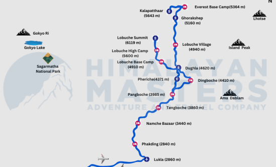
| 01 | Fly to Lukla and then trek to Phakding | 2,610 m/ 8,562 ft. | 4-5 hrs |
| 02 | Trek to Namche Bazaar | 3,440 m/11,286 ft. | 6-7 hrs |
| 03 | Acclimatization Day (Day hike to Everest View Hotel) | 3,440 m/11,286 ft. | 3-4 hrs |
| 04 | Trek to Tengboche | 3,867 m/12,687 ft. | 5-6 hrs |
| 05 | Trek to Dingboche | 4,410 m/14,468 ft. | 7 hrs |
| 06 | Acclimatization Day (Day hike to Nagarjuna View Point) | 4,410 m/14,468 ft. | 4-5 hrs |
| 07 | Trek to to Lobuche | 4,940 m/16,207 ft. | 6-7 hrs |
| 08 | Trek to Gorakshep (Day hike to Everest Base Camp) | 5,164 m/16,942 ft. | 7-8 hrs |
| 09 | Trek to Kala Patthar and back to Lobuche Base Camp | 4,950 m/16,240 ft. | 6-7 hrs |
| 10 | Trek to Lobuche High Camp (Summit Prepare) | 5,400 m/17,717 ft. | 4-5 hrs |
| 11 | Climbing Lobuche Peak & back to High Camp | 5,400 m/17,717 ft. | 9 hrs |
| 12 | Trek to Pangboche | 3,900 m/12,795 ft. | 6-7 hrs |
| 13 | Trek to Namche | 3,440 m/11,286 ft. | 5-6 hrs |
| 14 | Trek to Lukla | 2,840 m/9,318 ft. | 6-7 hrs |
| 15 | Fly back to Kathmandu | 1,400 m/4,593 ft. | 25 min |
ITINERARY
Day 01: Fly from Kathmandu to Lukla and then trek to Phakding
Trek Route: Kathmandu → Lukla → Phakding
Fly Distance: Approx. 138 km
Trek Distance from Lukla: 8 km/5 miles
Starting Point: Kathmandu (1,400 m/4,593 ft.)
Lunch: En-route or at Phakding
Ending Point/ Overnight: Phakding (2,610 m/8,562 ft.)
Maximum Elevation: 2,840 m/9,317 ft. (Lukla)
Total Ascent: 240 m/ 787 ft.
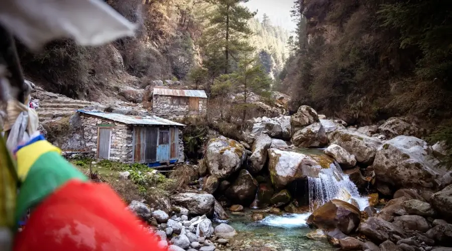
On the first day, we start early in the morning by flying from Kathmandu to Lukla, considered to be the gateway to Everest. The flight is a sight to see while flying over the Himalayas and gives you an even bigger taste of what’s in store. After landing at Lukla Airport, so-termed “one of the most thrilling airstrips in the world,” we will start a trek to Phakding.
The trek from Lukla to Phakding is a relatively smooth descent, moving down through a number of tiny villages and greenery. You will cross some suspension bridges over the Dudh Koshi River, which will bring some excitement on the first trekking day.
About Phakding:
Once we reach Phakding, teahouse check-in will be done for our overnight stay there. Phakding is a nice village surrounded by forests and rivers. The quiet town allows us to relax and prepare for the hard trek ahead.
Tea Houses in Phakding:
– There are around 15-20 teahouses in the area.
– The teahouses in Phakding offer good food and comfortable stays.
– Wi-Fi and hot showers are available.
– You do not need to pay for the extra services.
Meal : Breakfast, Lunch and Dinner
Accommodation : Tea House
Walking / Driving : 30 mins flight and 4 hours walk
Day 02: Trek from Phakding to Namche Bazaar
Trek Route: Phakding → Monjo → Jorsalle → Namche Bazaar
Distance: 12 km / 7.5 miles
Starting Point: Phakding (2,610 m/ 8,562 ft.)
Lunch: Jorsalle
Ending Point/ Overnight: Namche Bazaar (3,440 m/11,286 ft.)
Total Ascent: 830 m/2,723 ft.
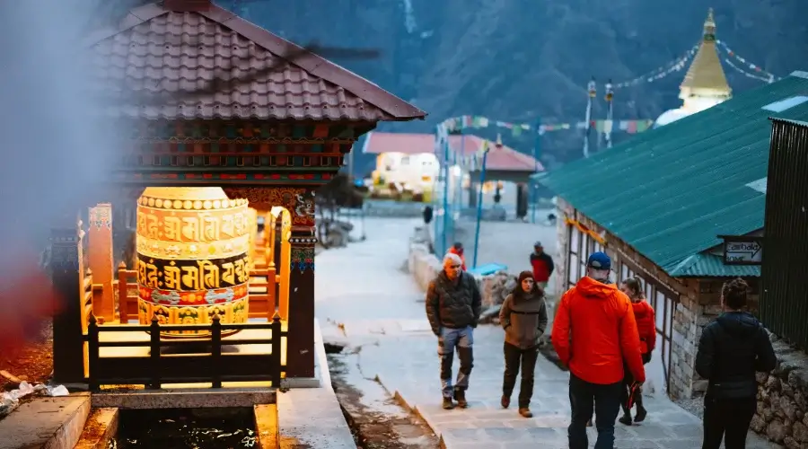
After a healthy breakfast in Phakding, the iconic trek starts toward Namche Bazaar, one of the major towns in the Everest region. The trail follows the Dudh Koshi River, with several crossings over exciting suspension bridges adorned with coloured prayer flags.
We pass through some of the most beautiful pine forests and small Sherpa settlements on the way. Further on, we reach Monjo, where our trekking permits will be checked to enter Sagarmatha National Park. The trail ahead from here is quite steep and steeply scenic, affording breathtaking views of Thamserku and surrounding peaks.
From here, the last stretch of the trek is quite uphill and steep as we get closer to Namche. This stretch is rather steep and rewarding, especially when you catch your first glimpse of Mount Everest from the viewpoint halfway up. We then reach the village of Namche Bazaar, which is the biggest village in the Khumbu region.
About Namche Bazar:
Namche Bazaar falls in the lap of the mountains, bustling with mountain life. It is a common stoppage point among trekkers. Around 70-80 houses of local people are in Namche, which belongs to the Sherpa community.
Facilities include cafes, bakeries, shops, and even internet cafes. You could also visit the Sherpa Museum, which would give you an understanding of the region’s local culture and history of mountaineering.
Teahouses in Namche Bazar:
– There are around 40-50 teahouses in Namche.
– You will find basic to standard hotels in Namche Bazar.
– There are all the services, such as WIFI, hot shower, electricity, and charging, and you do not need to pay for them.
Meal : Breakfast, Lunch and Dinner
Accommodation : Tea House
Walking / Driving : 7 hours
Day 03 : Acclimatization Day at Namche Bazaar
Trek Route: Namche Bazaar → Hotel Everest View → Khumjung Village → Namche Bazaar
Distance: 4-5 km (3-4 hours)
Beginning & Ending Point/ Overnight: Namche Bazaar (3,440 m/11,286 ft.)
Lunch: Hotel Everest View or Khumjung Village
Total Ascent: 440 m/1,443 ft.
Acclimatization is the most important factor in going on a successful Everest Base Camp trek. On Day 3, all day at Namche Bazaar, rest will be given for acclimatization to high altitude and its effects on the body.
However, this does not mean that we will be spending our time being lazy; we will take a short hike to a higher altitude and sleep back at Namche at a lower altitude, which is an effective strategy for acclimatization.
We will begin our day by hiking to the Hotel Everest View, one of the world’s highest-altitude hotels. This trail offers a stunning panorama of Everest, Lhotse, Ama Dablam, and other beautiful peaks. Once we reach the hotel, we can have a leisurely tea time bathed in the views of the Himalayas.
We then make a descent to Khumjung Village, one of the major villages of Sherpas. Here, we can take part in visiting the Khumjung Monastery, which is said to house a legendary relic- a Yeti’s scalp. The village also has a school that Sir Edmund Hillary built.
After exploring Khumjung, we will be back down at Namche Bazaar, where you could rest the day exploring the town. You could visit the local market, get some bakery treats, or relax in your teahouse.
Meal : Breakfast, Lunch and Dinner
Accommodation : Tea House
Walking / Driving : 3-4 hours
Day 04: Trek from Namche Bazaar to Tengboche
Trek Route: Namche Bazaar → Kyangjuma → Phunki Tenga → Tengboche
Distance: 6 km / 3.7 miles
Beginning Point: Namche Bazaar (3,440 m/11,286 ft.)
Lunch: Phunki Tenga
Ending Point/ Overnight: Tengboche (3,867 m/12,687 ft.)
Total Ascent: 427 m/1,401 ft.
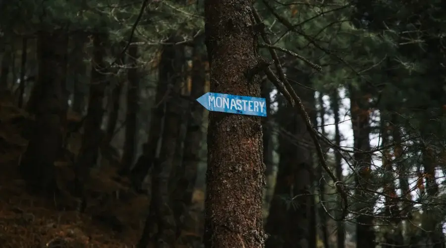
From Namche Bazaar, after having breakfast, we start our trek to Tengboche, a place that is home to the famous Tengboche Monastery, which is the biggest of all in the Khumbu region.
The trail initially starts with a relatively easy, flat walk from Namche, following a well-marked path that offers beautiful views of Ama Dablam, Everest, Lhotse, and Nuptse. We will pass by Kyangjuma, a small settlement before we descend to the Dudh Koshi River at Phunki Tenga.
After lunch, the trail climbs steeply through a lovely rhododendron forest. The steep gradient makes this section quite exhausting, but the surrounding peaks’ rewarding views are worth it. As the altitude gains, one can begin to feel the thin air.
About Tengboche:
Tengboche is a teahouse area where you will find one of the ancient monasteries in the region, which is believed to be 500-600 years old. Most of the people there belong to the Sherpa community. During the spring season, you will find rhododendron forests all along the way.
Teahouses in Tengboche:
– Around 5-6 teahouses in the area.
– Accommodations in Tengboche teahouses are simple and neat.
– Hot shower facilities are available, as well as Wi-Fi and charging.
– There are no attached bathrooms.
Meal : Breakfast, Lunch and Dinner
Accommodation : Tea House
Walking / Driving : 6 hours
Day 05: Trek from Tengboche to Dingboche
Trek Route: Tengboche → Deboche → Pangboche → Dingboche
Distance: 8 km / 5 miles
Beginning Point: Tengboche (12,687 ft./3, 867 m.)
Lunch: Pangboche
Ending Point/ Overnight: Dingboche (14,468 ft./4,410 m.)
Total Ascent: 543 m/1,781 ft.
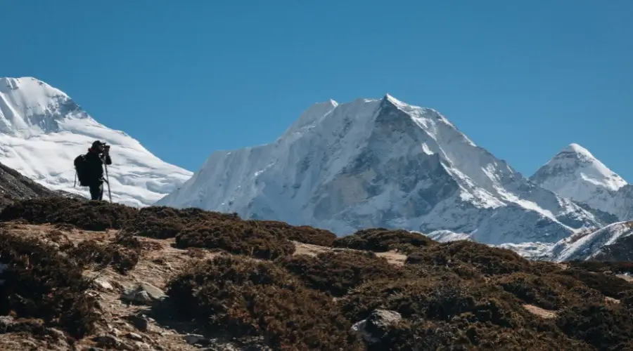
A gentle descent through rhododendrons and pine forests starts the day as we descend to Deboche – a tiny village with an atmospheric nunnery. Beyond Deboche, the route crosses a suspension bridge over the Imja Khola River and then climbs steadily up to the village of Pangboche.
Pangboche is also the highest year-round settlement in the region. It also has some relics believed to come from the Yeti. Lunch will be at Pangboche, allowing a little time to rest, look around and enjoy beautiful views of Ama Dablam, Thamserku, and Kangtega.
After lunch, the trail rises very gradually as we bid goodbye to the tree line. The landscape is desolate with fields of stone walls for crops like potatoes and barley that would keep wind away. The views open up to spectacular sights of Mount Lhotse, Ama Dablam, and Island Peak.
About Dingboche:
We arrive in Dingboche, a big village with breathtaking mountain views and terracing. Unlike other villages, stone-walled enclosures here protect the crops from harsh winds, making for a unique patchwork across the valley differently. This is also a business teahouse area only. We can find various small stupas and Gumba all over the place.
Teahouses in Dingboche:
– There are around 25-30 teahouses in Dingboche.
– You must pay extra for Wi-Fi, electricity, and a hot shower.
– The food is essential, yet you can still get Western foods.
Meal : Breakfast, Lunch and Dinner
Accommodation : Tea House
Walking / Driving : 7 hours
Day 06: Acclimatization Day at Dingboche
Trek Route: Dingboche → Nagarjuna View Point → Dingboche
Starting and Ending Point: Dingboche (4,410 m/14,468 ft.)
Lunch: Dingboche (Post Nagarjun hike)
Distance: 4-5 km/2.5-3 miles
Maximum Altitude: 5,083 m/16,676 ft. Nagarjun Peak
Total Ascent Gain: 673 m/2,208 ft.
Overnight: Teahouse in Dingboche
Today is an important rest day to prevent AMS (altitude sickness) and make sure that we can ascend well over the next few days. Nevertheless, today is a partial rest day; we will do a small acclimatization hike today.
Now, let that body rest before the real adventure begins. As we are gaining altitude quickly, it’s ideal to take a rest day here at Dingboche and see the nearby areas. You can hike unto Nagarjun Hill at 5100 mt in the morning if you wish.
While you stop, you can also explore the Chhukung and Imja valleys.
Meal : Breakfast, Lunch and Dinner
Accommodation : Tea House
Walking / Driving : 4-5 hours round trip
Day 07: Trek from Dingboche to Lobuche
Trek Route: Dingboche → Thukla → Lobuche
Distance: 8 km/5 miles
Starting Point: Dingboche (4,410 m/14,468 ft.)
Ending Point/ Overnight: Lobuche (4,940 m/16,207 ft.)
Lunch: Thukla
Total Climb: 530 m/1,739 ft.
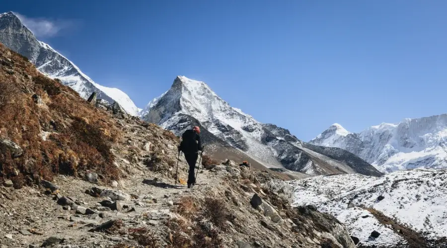
After breakfast, we leave Dingboche and begin with a gentle ascent along a broad valley following the glacial moraines of the Khumbu Glacier. As the elevation increases, the terrain becomes increasingly barren and rocky, and spectacular peaks surround us, including Pumori, Nuptse, and Lobuche East.
Today’s trek is relatively short but very demanding due to the altitude. We start the day trekking on the valley floor, cross a small wooden bridge over the glacial streams, and then gently rise up past yak pastures and alpine meadows.
About Thukla:
Thukla is a small settlement at the foot of the steep climb that leads to the Thukla Pass. Immediately after lunch, we begin ascending along a steep ridge. Although short, this ascent can be very tiring at high altitudes, so we will go leisurely. At the top of the hill, we’ll find the Thukla Memorial, a hauntingly beautiful sight with memorials to several Sherpas and other climbers who lost their lives on Everest.
About Lobuche:
We will reach Lobuche’s small, cold village in the late afternoon. Lobuche is based in a bleak, high-altitude area that boasts icy peaks on all sides. The tea houses are basic but warm and comfortable venues for the night. After checking in, you have time to rest up and then enjoy a sunset view of the Himalayan giants.
Teahouses in Lobuche:
– You will find around 7 teahouses in Lobuche.
– There are no attached bathrooms; you will need to share.
Meal : Breakfast, Lunch and Dinner
Accommodation : Tea House
Walking / Driving : 6-7 hours
Day 08: Trek to Gorakshep, Hike to Everest Base Camp, and Return to Gorakshep
Trek Route: Lobuche → Gorakshep → Everest Base Camp → Gorakshep
Distance: 15 km/9.3 miles (7-8 hours)
Starting Point: Lobuche (4,940 m/16,207 ft.)
Lunch: Gorakshep
Ending Point/ Overnight: Gorakshep (5,164 m/16,942 ft.)
Maximum Elevation: 5,364 m/17,598 ft. (Everest Base Camp)
Total Ascent: 424 m/1,391 ft. (up to Everest Base Camp)
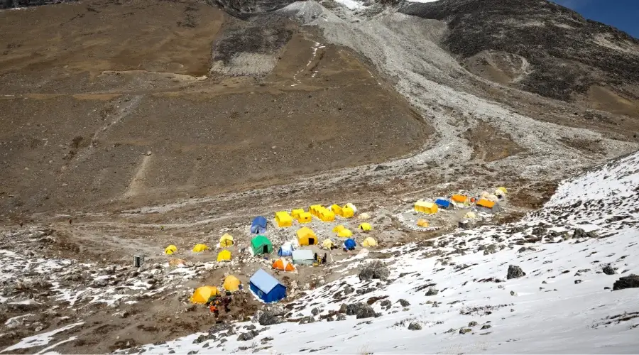
This is one of the most awaited days of the trek since you will finally arrive at the iconic Everest Base Camp! We start our early trek from Lobuche after having a hearty breakfast following the rocky and rugged trail towards Gorakshep.
The walk is demanding as it goes uphill with an uneven path, but the view of the surrounding peaks -Everest, Pumori, and Nuptse- is breathtaking.
After three hours of walking, we finally reach the small settlement of Gorakshep, which stands on the flat field of the Khumbu Glacier. It is also the last village teahouses are located in and serves as the last stop before Everest Base Camp.
The trail from Gorakshep to Everest Base Camp passes on rocky, hilly moraines and ridges. Even though the walk is not steep, the altitude makes it quite exhausting; hence, the speed of the movements should be very slow. The last approach to Everest Base Camp is very surreal as it surrounds the Khumbu Icefall, huge glaciers, and peaks on all sides.
After a few hours of hiking, we finally reached Everest Base Camp. Standing at the foot of the world’s highest mountain is an overwhelming feeling. During the climbing season, the base camp is a colourful and lively place, as many tents are fully set up, and the camp serves as a starting point for the mountaineers who try to climb Everest.
You will not be able to see the summit of Everest from the base camp itself, but it is a very impressive close-up view of the Khumbu Icefall and mountains looking down.
It takes around 2 hours to return trek to Gorakshep, where, upon arrival, we will check into our teahouse for overnight rest.
Teahouses in Gorakshep:
– There are 5 teahouses in Gorakshep.
– There is Wi-Fi, electricity, and mobile network services.
– You need to pay a high cost for drinking water.
– You will find a bucket hot shower, but one can avoid it since the temperature is freezing cold.
– You will get electric blankets for heating.
Meal : Breakfast, Lunch and Dinner
Accommodation : Tea House
Walking / Driving : 7-8 hours
Day 09: Trek to Kala Patthar and Descent to Lobuche
Trek Route: Gorakshep → Kala Patthar → Gorakshep → Lobuche Base Camp
Distance: 11 km/6.8 miles (6-7 hours)
Starting Point: Gorakshep (5,164 m/16,942 ft.)
Lunch: Gorakshep
Ending Point/ Overnight: Lobuche Base Camp (4,950 m/16,240 ft.)
Maximum Elevation: 5,545 m/18,192 ft. at Kala Patthar
Total Ascent: 381 m/1,250 ft. – to Kala Patthar
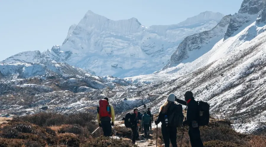
Early morning trekking provides great views of the breathtaking sunrise over Mount Everest and other peaks. This short trek involves steep and strenuous climbing, but the rewards at the top are absolutely worth the effort.
We start our day with a steep climb from Gorakshep onto the rocky face uphill trek to Kala Patthar at 5,555 meters, 18,192 feet, followed by spectacular views of Everest, Nuptse, and Lhotse, which will slowly unfold in the morning light. It will take about 1.5 to 2 hours to make the climb, depending on the pace.
From the top of Kala Patthar, we have panoramic views of the Everest massif, which includes the famous southwest face of Mt. Everest. The surrounding peaks- Pumori, Ama Dablam, and the Khumbu Icefall- absorb the sun’s golden rays in an awe-inspiring setting. In addition, Kala Patthar offers good views of Pumori and is the best place to take iconic photos of Everest and the Himalayas.
After viewing and snapping some pictures, we head back down to Gorakshep. Upwards, it takes roughly an hour to make our way back, and when we do, upon arrival, we will have some breakfast and get ready to continue on with the trek.
From Gorakshep, we descend towards Lobuche and further down to the Lobuche Base Camp. The trail follows the side of the Khumbu Glacier, and we descend very slowly through the same rocky terrain and glacial valleys. We reach Lobuche Village after approximately 3-4 hours of trekking.
Meal : Breakfast, Lunch and Dinner
Accommodation : Tea House
Walking / Driving : 6 to 7 hours
Day 10: Trek to Lobuche High Camp and Preparation for the Summit
Trek Route: Lobuche Base Camp → Lobuche High Camp
Distance: 7 km/4.3 miles
Starting Point: Lobuche Base Camp (4,950 m/16,240 ft.)
Ending Point: Lobuche High Camp (5,400 m/17,717 ft.)
Lunch: Lobuche High Camp
Total Ascent: 450 m/1,476 ft.
Overnight: Tent at Lobuche High Camp
We get up early in the morning, have breakfast, and make some final preparations to head to high camp at 5,400 meters (17,717 feet) elevation.
The trail from Lobuche Base Camp to Lobuche High Camp goes uphill, passing through rocky terrain with stunning landscapes. Gaining altitude makes the air thinner and thereby makes the trek quite difficult. Hence, it is very important to pace your climb and keep your body hydrated in order to acclimatize to the heightened altitude.
The route includes gains and traversing on steep and rocky slopes. After about 4 to 5 hours of trekking, we reach Lobuche High Camp. This camp is the base for climbers who intend to go to the summit of Lobuche Peak, and it’s a pretty established site with tents awaiting trekkers. The view from the high camp is a superb opportunity to take in the beauty of the Himalayas.
Once we arrive, lunch will be taken at the high camp, accompanied by time to rest and acclimatize.
The afternoon can be spent enjoying the scenery or preparing gear for the summit attempt on the following day. Then, we will start our training to climb the Lobuche Peak. We’ll be trained on how to use crampons and harnesses, climb, and use the rope in climbing.
Meal : Breakfast, Lunch and Dinner
Accommodation : Camping
Walking / Driving : 4-5 hours
Day 11: Climb Lobuche Summit and Return to Lobuche High Camp
It’s going to be hard but a very interesting day. We wake up at around 4 o’clock in the morning and pack our breakfast. With the help of a flashlight, we start to climb a big rocky peak that lies before us. This black rock is named Lobuche.
Trek Route: Lobuche High Camp → Lobuche Summit → Lobuche High Camp
Distance: 10 km/6.2 miles
Starting/Ending Point: Lobuche High Camp (5,400 m/17,717 ft.)
Lunch: Lobuche High Camp
Maximum Elevation: 6,119 m/20,075 ft. (Lobuche Summit)
Total Ascent: 719 m/2,362 ft.
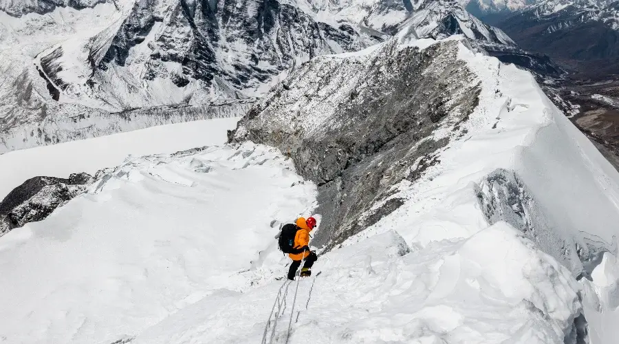
Starting very early in the morning-usually at 2:00 AM or 3:00 AM-we try to do our best in the coolest temperature and make sure that we make it to the summit before any weather deterioration.
Morning Climb to the Summit
After a light breakfast, we depart with all the necessary climbing equipment, including harnesses, ropes, and crampons.
The initial part of the climb consists of lower rocky slopes and snowfields. As altitude is gained, the landscape becomes rugged, and the views start to open up to some of the most spectacular peaks in the Himalayas. You may be faced with steep sections where you will have to use fixed ropes, so keep your focus clear and mind your guide’s instructions.
Closer to the summit, the air is skinny, and taking breaks, drinking water, and knowing the signs of altitude sickness becomes essential.
From the Lobuche High Camp, we reach Crampon Point, where we use normal trekking boots. However, from Crampon Point onwards, proper crampons and harnesses are needed for climbing. From Crampon Point, we start using ropes and climbing side by side with the rope.
Lobuche Summit will take around 4-5 hours from the Crampon point. It is steep upwards, going up to the summit point.
Reaching the Summit
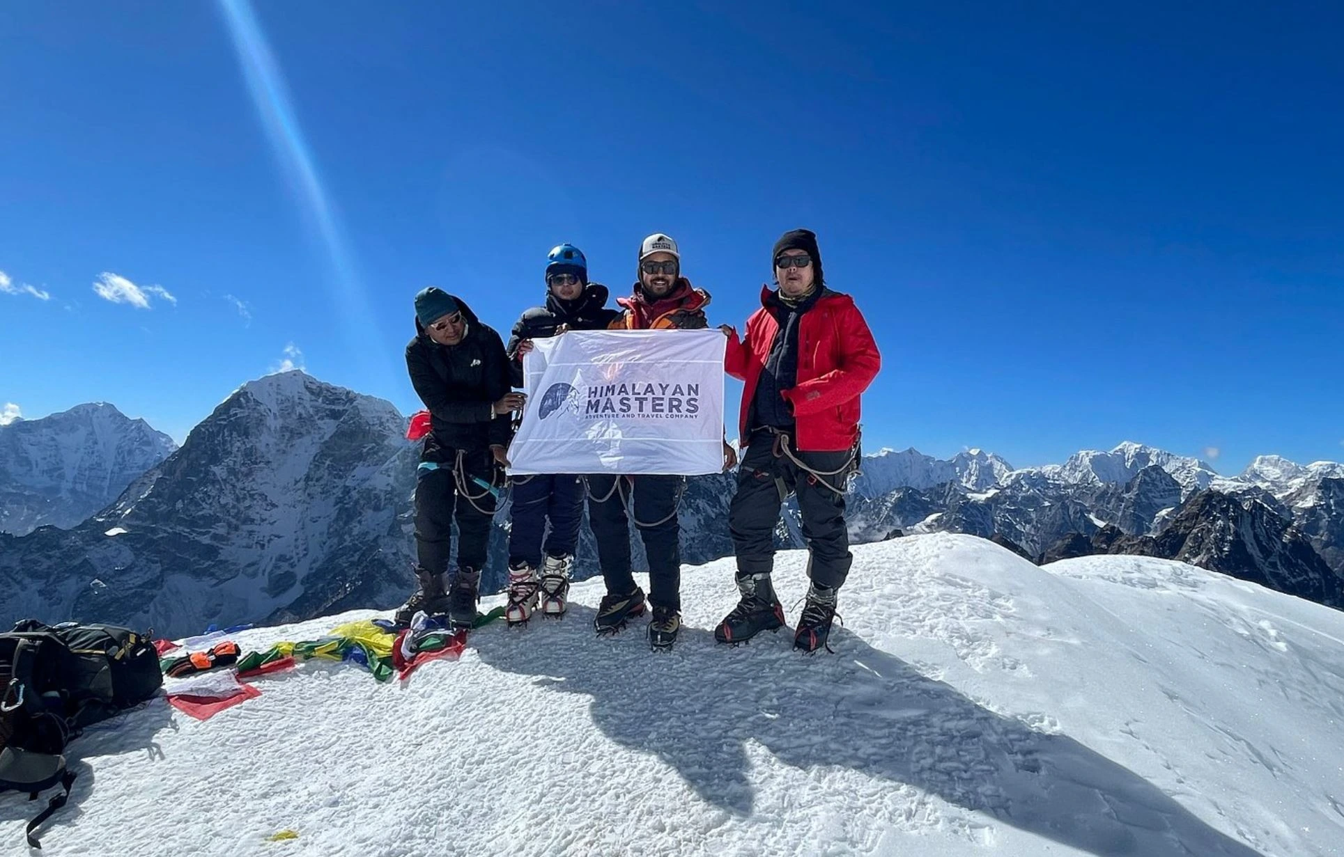
From Lobuche Peak, at 6,119 meters (20,075 feet), one can see breathtaking panoramic views of surrounding mountains, including Mount Everest, Lhotse, and Nuptse. This is a moment of triumph, and we take time to soak in the scenery, celebrate our achievements, and capture stunning photographs at the top.
Descent Back to High Camp
After some time at the summit, we then start our descent from the top towards Lobuche High Camp. It takes about 4-5 hours to reach the Crampon point. The downhill climb needs good care taken, especially in the steeper sections.
Later in the evening, dinner will be held together, and we will share experiences of today’s summit. We will have another night at Lobuche High Camp, preparing for the next stage of our journey.
Meal : Breakfast, Lunch and Dinner
Accommodation : Camping
Walking / Driving : 7-9 hours
Day 12: Lobuche High Camp to Pangboche
Trek Route: Lobuche High Camp → Lobuche → Pangboche
Distance: 12 km/7.5 miles
Starting Point: Lobuche High Camp (5,400 m/17,717 ft.)
Ending Point: Pangboche (3,900 m/12,795 ft.)
Lunch: Pangboche
Total Descent: 1,500 m/4,921 ft.
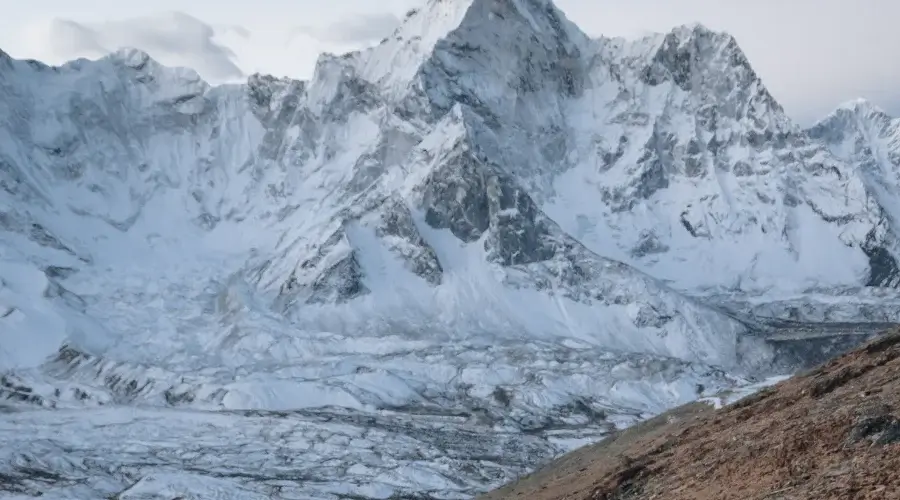
Having breakfast at the high camp, we pack our belongings and head off to make our way back down. The initial part of the trek traces back to Lobuche for a short break to rest and refresh ourselves.
From Lobuche onwards, we continue our descent down to Pangboche. The trail winds down through outstanding alpine meadows, rocky terrain, and glacial rivers.
Pangboche has ancient monasteries and a rich cultural heritage. It is home to welcoming locals, and terraced fields surround traditional houses.
Once we arrive in Pangboche, we check into a teahouse that night. The teahouses in Pangboche are comfortable, with facilities that make it a perfect place to rest after a tiring day of trekking.
Upon arrival, lunch will be done at the teahouse. In the afternoon, you will see the village and be taken to the famous Pangboche Monastery, one of the oldest monasteries. The monastery is a tranquil place where, if lucky, you get to see monks performing their routine activities and feel the spiritual environment.
Meal : Breakfast, Lunch and Dinner
Accommodation : Tea House
Walking / Driving : 6-7 hours
Day 13: Trek from Pangboche to Namche Bazar
Trek Route: Pangboche → Tengboche → Namche Bazar
Distance: 10 km/6.2 miles (5-6 hrs)
Starting Point: Pangboche (3,900 m/12,795 ft.)
Lunch: Tengboche
Ending Point/ Overnight: Namche Bazar (3,440 m/11,286 ft.)
Total Descent: 460 m/1,509 feet
We’ll have breakfast at Pangboche as we take in the serenity of the village. Then, after packing our gear, we’ll head out and begin our trek toward Tengboche.
The trail starts with a gentle drop into the thick rhododendron and pine forests. We walk down in a subjugating view of the Ama Dablam Mountain and surrounding peaks.
Upon arrival at Tengboche, lunch will be served at a teahouse, and then, spend the afternoon visiting the famous Tengboche Monastery, which is majestically set amidst this backdrop of substantial spiritual importance.
It is the largest in the Khumbu region of Nepal and affords an exclusive view of the Buddhist culture prevailing here in this part of the world. We might get to observe a prayer ceremony or monks doing their daily chores.
As we get closer to Namche Bazar, the trail starts getting steeper and rougher; however, our spirits are always high, knowing that soon we shall be back at this bustling Sherpa centre.
Once arriving, we’ll check into our teahouse, freshen up, and have some time to relax.
Meal : Breakfast, Lunch and Dinner
Accommodation : Tea House
Walking / Driving : 5-6 hrs
Day 14: Trek from Namche Bazar to Lukla
Trek Route: Namche Bazar → Monjo → Lukla
Distance: 18 km/11.2 miles
Starting Point: Namche Bazar (3,440 m/11,286 ft.)
Lunch: Monjo
Ending Point: Lukla (2,840 m/9,318 ft.)
Total Descent: 600 m/1,968 ft.
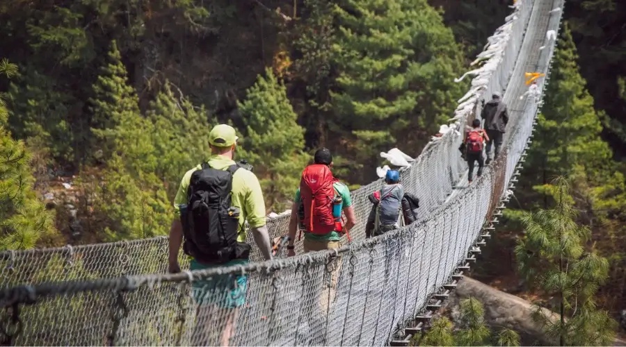
Having our delicious and filling breakfast in Namche Bazar, we pack our stuff to prepare for the day’s trek. A steep descent through the forest begins this beautiful day’s trek with spectacular views of surrounding peaks and valleys all around. The colours of the landscape will be a treat to watch, mainly the colours of the rhododendron flowers.
From here, a few hours of trekking will take us to Monjo, where lunch will be provided in a warm teahouse. Monjo is considered the entrance to Sagarmatha National Park, and this is a good place to rest and recharge energy. Have delicious food while enjoying the serenity in the environment.
As we descend even more, the landscape slowly changes, opening up and giving fantastic views of the surrounding mountains.
The walk back to Lukla is enjoyable and filled with excitement, knowing we are nearing the end of our trek. We will pass through several suspension bridges, offering fantastic views of the river below and the towering peaks above.
Meal : Breakfast, Lunch and Dinner
Accommodation : Tea House
Walking / Driving : 6-7 hours
Day 15: Fly Back to Kathmandu from Lukla
Fly Route: Lukla → Kathmandu
Distance: 138 km/85.7 miles
Starting Point: Lukla (2,840 m/9,318 ft.)
Ending Point: Kathmandu (1,400 m/4,593 ft.)
After an early breakfast at our teahouse in Lukla, we check our baggage and other preparations to be made for Kathmandu.
Flight duration is approximately 30-40 minutes. As we fly from Lukla, stunning panorama displays of surrounding peaks, valleys, and rivers will be seen on the backdrop. You get a bird’s view to catch a last glimpse of the majestic mountains you have been trekking around.
Our team can arrange for transportation to the airport if someone has already booked a flight.
Meal : Breakfast
Accommodation : Hotel
Walking / Driving : 35 minutes flight
include / exclude
Trip Cost Includes
- Pick up and drop off at the airport.
- Hotels in Kathmandu with breakfast.
- All costs for permits and tickets.
- Flight to Lukla and Lukla to Kathmandu.
- Three meals during the trek (breakfast, lunch, and dinner) and accommodation at tea house.
- All expenses of guides.
- The guide’s insurance, food, and accommodation will be pre-paid.
- A one-night or two-night tent stay at the Lobuche Base Camp and two-night tent accommodation at Lobuche High Camp.
- All food and drinks in the camps are unlimited.
- One climbing sherpa per solo traveller or two sherpas for three clients (Private guide).
The Complimentary service from The Himalayan Masters
- A -25-degree sleeping bag during the trip.
- Down jacket during the trip.
- Water bottles and purification tablets.
- First aid kit box.
- Himalayan Masters Brand Duffle Bag for the Trip.
- Himalayan Masters Brand Trekking T-Shirt and Cap.
- Farewell dinner in Kathmandu by the Himalayan Masters Team.
Trip Cost Excludes
- International flight to Kathmandu, Nepal.
- Nepal Visa cost.
- All kinds of tips for staff and restaurants.
- Wi-Fi, hot showers, and charging costs at the tea houses in the mountains.
- Any personal expenses and food other than the three meals we provide.
useful info
Lobuche Peak Altitude Chart
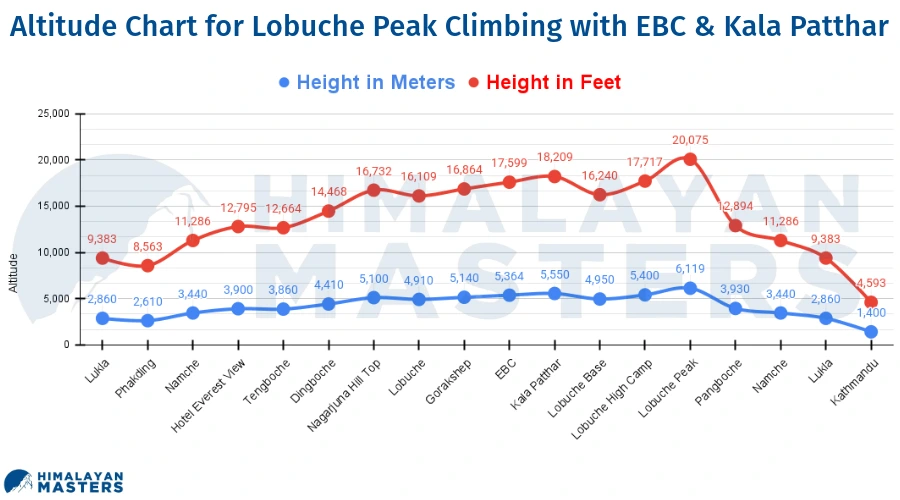
Best Time to do Lobuche East Peak Climbing
The best time to climb Lobuche East Peak Climbing is the season of Autumn and Spring.
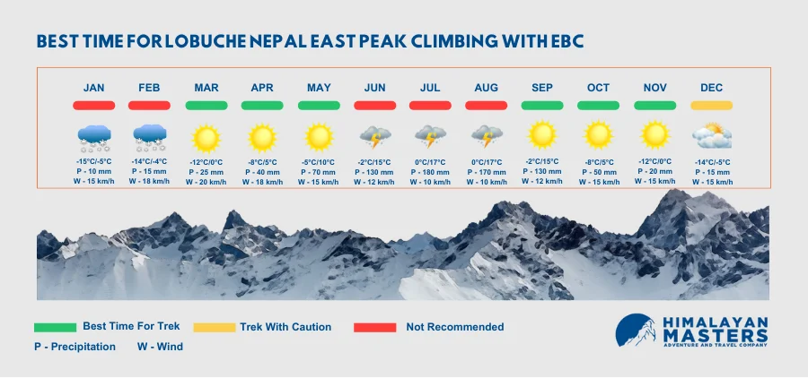
Autumn Season
One of the best times to climb Lobuche East Peak is during the autumn season, starting from September to November. Normally, the weather is stable, with clear skies and mild temperatures during this period, providing excellent visibility conditions. The trails are less crowded than in spring. Hence, one can enjoy quiet time in the mountains during these seasons.
Spring Season
Spring is also a favourite season for climbing Lobuche East Peak, from March to May. The season is featured by flowers of rhododendrons and generally warmer temperatures. Sometimes, the winds may be occasional, but the landscapes are vibrant, with stunningly clear views of the peaks. Many trekkers also take this season up to Everest Base Camp.
Winter Season
From December to February, the month is winter, with cold and heavy snowfall. The trek up during this season will be difficult, whereas, in other months, more people climb it. During this time, the mountains are solitary, with beautiful winter scenery. But the preparation and gear should be proper as the weather will be harsh.
Summer/Monsoon Season
Generally, the summer or monsoon season takes place from June to August, and this is the worst period for climbing Lobuche East Peak. In this season, heavy rainfall can make the trails slippery and increase the risks of landslides. Besides, poor visibility due to clouds and fog will cause climbers to have bad visibility and not be able to see well enough for safe trekking.
Experience in Lobuche East Peak Climbing
Lobuche East Peak Climbing is a highly adventurous and thrilling experience. During your trek on this route, you will get to walk through some of the most beautiful landscapes with alpine forests and glacial rivers.
The climb is a source of satisfaction as climbers overcome different challenges on the route using their physical fitness and teamwork skills. The moment of standing on its summit is unforgettable. Standing 6,119 meters above sea level offers complete uniqueness in its views of some of the world’s highest peaks.
Lobuche Nepal Weather
The weather conditions on Lobuche Peak, Nepal, vary with the seasons. In the spring, from March to May, it is generally mild in the daytime, with temperatures around 10-15°C, though at night, it can go below freezing at higher altitudes. Autumn, spanning from September to November, is generally quite similar, though a bit drier, with much clearer skies.
On to that, winters-from December to February-are icy, with temperatures way below zero both during daytime and nighttime; one has to be duly prepared for such weather.
At the same time, summer is dominated by the monsoon season, starting from June through August, when heavy rain makes climbing conditions difficult with slippery, muddy trails and less visibility.
The Difficulty of Lobuche Peak Climbing
Yes, Lobuche peak climbing is difficult because it is peak climbing in Nepal. It falls under a moderate peak in Nepal. Because it involves climbing at a high altitude above 6000 meters. You must be extra careful while climbing the peak in Nepal.
Roads on the Lobuche Trek & How to Avoid
Lobuche trek follows the remote mountain trails of the Khumbu region, starting with a flight to Lukla. No vehicular roads are beyond Lukla, and all travel is on foot. Some stretches can be steep, rocky, and uneven, so the use of trekking poles and proper footwear is recommended. To avoid the harshest sections, stick to most travellers’ main trekking routes and follow your guide’s advice on the safest paths.
Trip Grade: Fitness Level, Medical, & Health
The Lobuche trek is demanding; any trekker must maintain a decent fitness level. Trekkers need experience with long-distance hiking at high altitudes. It is fundamentally needed to have cardiovascular fitness with leg strength. One must be in good health as the high altitude dares the body.
Consultation with the doctor before the trip starts, especially for those having asthma problems, issues with the heart, or hypertension. Trekkers must also be mentally strong due to the cold, fatigue, and uneven ground.
Special Training for Lobuche East Peak Climbing
Lobuche East Peak climbing requires special training. It includes high-altitude trekking experience and mountaineering training, such as using crampons, ice axes, and harnesses. You should be acquainted with rope techniques for glacier travel.
Practising on local hills or peaks is beneficial. The training shall focus on endurance, core strength, and leg muscles. Attending mountaineering courses or guided practice climbs will also prepare you better for Lobuche East.
Altitude Sickness During Lobuche Climbing
Trekkers can experience AMS or high-altitude ailment, ranging from mild AMS to severe diseases like HAPE or HACE. Headache, nausea, vertigo, and tiredness are some of the symptoms. Acclimatization days can be provided to avoid altitude sickness. Trekkers should be able to drink plenty of water, avoid alcohol, and ascend slowly.
Medicines like Diamox help prevent the symptoms, but it is more important to recognize the signs and symptoms early. If the symptoms persist and worsen, descent to lower altitudes becomes mandatory.
Emergency and Evacuation at Lobuche Peak
In emergencies, such as severe altitude sickness or injury, helicopters are the fastest means of evacuation. However, this is only sometimes possible since the weather may delay helicopters.
Prevention is the better approach, therefore. All trekkers must possess comprehensive travel insurance that covers emergency evacuation at high altitudes. Guides are trained in the management of emergencies and will facilitate contacting and coordinating evacuations if needed.
Lobuche Peak Nepal Insurance
The right insurance is important for any trek that is above 5,000 meters. For travel insurance, ensure your trekking and climbing are covered up to 6,000 meters, including helicopter rescue, medical treatment, and trip cancellation. Most of the standard policies will cover something other than mountaineering activities.
Hence, checking and confirming that your policy includes the same is essential. In fact, please check with your insurance company to ensure all risks associated with high-altitude trekking and climbing are included.
Lobuche Peak Climb Costs
The Lobuche Peak climb costs $2305 per person. The cost fluctuates depending on the season, length of stay, and services offered. Normally, this should cover the guide fees, permits, accommodations and meals, climbing gear, porters, and insurance for the staff.
For most flights to and from Lukla, additional rentals, tips for guides and porters, and personal expenses are excluded. Some may also want to pay for better accommodations or add more acclimatization days, which increases the price.
Extra Costs
Additional costs include food and drinks in Kathmandu, rental gear you might not possess, souvenirs, tips for your guides and porters, extra acclimatization days, and personal snacks or drinks during the trek.
Other costs to prepare for include unexpected delays due to weather or flight cancellations. Trekkers will need some extra cash to pay for these needs.
ATM on the Lobuche Trek Route
After crossing Namche Bazaar, access to ATMs along the Lobuche trek route must be accessible. One should draw enough cash from Kathmandu or Namche Bazaar to suffice all expenses on the trail, including accommodations, food, and tips. Namche has a few ATMs, but they are unreliable because of power outages, so it’s always best to carry cash from Kathmandu.
Money Exchange
Changing your money in Kathmandu is better because you can get a better exchange rate. Main currencies such as the USD, EUR, and GBP are acceptable for exchange. The facilities to exchange money are available at Namche Bazaar, but the exchange rates may be better than in Kathmandu. You can bring small denomination notes to help you purchase small things along the trek.
Packing list for Lobuche East Peak Climbing
Clothing:
- Thermal base layers (tops and bottoms)
- Long-sleeve shirts and T-shirts
- Fleece jacket
- Waterproof shell jacket
- Down jacket
- Trekking pants (lightweight and breathable)
- Insulated pants
- Warm hat and gloves
Footwear:
- Lightweight shoes or sandals for camp
- Medium-weight waterproof hiking boots (broken-in)
- Climbing boots
Accessories:
- Backpack (50-70L)
- Trekking poles
- Sunglasses with UV protection
- Water bottles or hydration system
Climbing Gear
- Safety Equipment:
- Climbing harness
- Ascender (Jumar)
- Carabiners (minimum of two locking carabiners)
- Descender (Figure 8 or ATC)
Climbing Tools:
- Ice axe
- Crampons (12-point recommended)
- Ropes and Slings
- Climbing rope (appropriate length for your group)
- Tape slings
Sleeping Equipment:
- Sleeping bag rated to at least -20°C (-4°F)
- Sleeping pad (Thermarest or similar)
- Portable stove and fuel
- Cooking set and utensils
- Headlamp with extra batteries
Additional Considerations:
- Personal Snacks
- First Aid Kit
- Water Purification
- Adapters and Chargers
Permits for Loubche Peak Climbing in Nepal
You should have the following permits for Lobuche East Peak climbing:
Sagarmatha National Park Entry Permit
Cost for Foreign Nationals: NPR 3,000 (approximately USD 24)
Cost for SAARC Nationals: NPR 1,500 (approximately USD 12)
Cost for Nepali Citizens: NPR 100
Khumbu Pasang Lhamu Rural Municipality Permit
Cost: NPR 2,000 (approximately USD 16) per person
This permit replaced the old TIMS card and is required to enter the Khumbu region.
Lobuche Peak Climbing Permit
Varies based on the season, generally around NPR 25,000 to NPR 40,000 (approximately USD 200 to USD 320) for foreign climbers.
Accommodation
Teahouses are the primary type of accommodation on the Lobuche Peak climbing route. The teahouses are simple lodges offering basic amenities for trekkers.
Teahouse bedrooms are very basic. Most bedrooms have shared twin beds; Mattresses, pillows, and blankets are provided. It is common to share. Rooms are not heated, and space is limited; bring your warm sleeping bag when the altitude gains.
Hot showers are available on the Lobuche trek, but it is a luxury, especially at higher altitudes. Some teahouses have hot water; often, there will be an extra charge, which could be $3-5 dollars per shower, depending on the place or altitude.
The water is usually heated with solar power or gas, but in cold areas, it is not available at all. Teahouses commonly have shared washrooms, which can best be described as basic. In lower altitudes, some operate with flush toilets. Higher up, trekkers will see squat toilets where water may be a problem.
Foods
Food items teahouses are simple but nutritious enough to keep you going throughout the trek. The higher you go, the fewer choices you will have because of the difficulty transporting the supply uphill.
Breakfast
Breakfast in teahouses typically includes many heavy carbohydrate meals to furnish energy for the day. The popular options include porridge, Tibetan bread, boiled, scrambled, or fried, in any style to put protein in your meal, and tea/coffee.
Lunch
Lunch is normally taken up at teahouses en route and generally consists of the following items. Dal Bhat: Traditional Nepalese food made of rice, lentil soup, and vegetables. It is considered the trekkers’ power food because it is rich in energy and nutrients. Noodles /Soups, Fried Rice.
Dinner
Dinner options are often the same as lunch but with more carb-rich meals to regain energy reserves: Dal Bhat, Momo, and Pasta.
Electricity & Battery Recharge En Route
Most of the teahouses along the route to Lobuche have electricity, although this might be available to a very limited extent at the higher altitude parts. The teahouses will need to charge for this electricity, generally $2 to $5 per hour, which can be used to recharge devices like phones, cameras, or power banks.
Since most of the power supply in most remote areas is through solar systems, the availability could depend on weather conditions. A power bank or solar charger is highly recommended to charge your devices during the trek.
Water on Trek
Staying hydrated during the trek is very important, but bottled water can get pretty costly as you go higher up. A bottle of water may be $1 in the lower regions but can get as high as $4 or more in the villages at high altitudes.
Most trekkers prefer to carry either water purification tablets or a water filter to treat tap or stream water, readily available at all points. It’s also eco-friendly and avoids using plastic bottles. Teahouses provide boiled water for a small fee. That is another safe option.
Communication
While cellular network coverage in most parts of the Everest region is decent, as you climb higher toward Lobuche, it becomes a bit weaker. Major Nepali carriers- both Ncell and NTC- offer coverage up to a certain point but quite unreliably at higher altitudes.
SIM Card: The Ncell and NTC SIM cards work perfectly till Namche Bazaar. You will quickly get them in Kathmandu or Namche. After that, the connectivity is intermittent.
Landlines: In the larger villages, teahouses may offer landlines that can be used in emergencies. They are rather expensive and only sometimes present.
Postal Services: There are no postal services along the trek; only some manage to send postcards or letters. Any such requirements must be fulfilled from Kathmandu.
Walkie-Talkie: Guides and porters use Walkie-talkies for short-distance communications among team members. It helps coordinate during trekking or in an emergency when a mobile phone network has low coverage.
Wi-Fi/Internet
Wi-Fi is available in many teahouses along the trek, but it is mostly slow, unreliable, and not free. It may be US$5 to 10 per hour or per day. So you can buy Everest Link Wi-Fi data packs, which work smoothly in the Everest region.
The higher you go up, the worse it becomes, and not all teahouses have Wi-Fi. It is better to let your loved ones know of your progress whenever you have access, which places like Namche Bazaar can afford, for at the far end of this trek, you may lose your internet connection.
Safety and Security for Climbing
Safety during any trekking- much more so the high-altitude climb that Lobuche Peak is- requires that you be adequately prepared with equipment and have muscular physical fitness.
Emergency services, like helicopter evacuations, are available but very expensive if you don’t need proper insurance. It is best to keep valuables safe with yourself or reputed teahouses.
Guide vs. Solo Trekking
Therefore, on the Lobuche Expedition, hiring a guide is merited for safety, followed by convenience. Guides understand the terrain and risks, how to mitigate altitude problems, and sometimes help navigate and communicate with locals.
One can solo-trek, but that’s highly adventurous; the risk is much greater, especially about getting lost or some kind of emergency sans immediate help. If you are an experienced trekker and have experience under high-altitude conditions, solo trekking can be done, but it is invariably more secure to have an expert on board.
Porters vs. No Porter
Porters offer support on high-altitude treks such as Lobuche by taking the heavy luggage off you as you are left to climb. It can assist in saving energy for trekking and make it considerably above average.
Without a porter, you will carry everything yourself, which might be highly exhausting in difficult conditions. Also, hiring a porter will cost you more than hiring one without. So it will cost you around $320 extra.
Tips for Hiring a Porter
While hiring a porter, it’s better to use the services of a responsible agency such as Himalayan Masters: this way, you will be sure they are experienced enough, have insurance, and that you pay them a good wage.
Establish the weight of his load beforehand, ideally between 15 and 20 kg. It is also important to be open with your porter, be on good terms with him, and tell him about his daily plan and pace.
Tipping Culture for Guides and Porters
Tipping in the Nepalese trekking industry is a custom, especially for guides and porters, who work hard to make the trek both safe and enjoyable. The amount varies with the duration and difficulty of the trek, but generally, trekkers tip $10-$20 per day for guides and $5-$10 per day for porters.
Tips are always given directly to the guides and porters at the end of a trek and are considered a token of appreciation for their service.
Alternative Lobuche Expedition Routes
Those who would like to extend their route further or take a different route to Lobuche could embrace the following alternative routes: One could trek towards the nearby Gokyo Lakes and experience views of turquoise glacial lakes or add an iconic trip to the Everest Base Camp.
Other options include combining the Lobuche trek with the Three Passes Trek, which takes one deeper into remote and even more difficult landscapes.
Extending the Lobuche Expedition
Many trekkers prefer to extend their journey after climbing Lobuche Peak. Some were interested in exploring the surrounding villages, including the famous Namche Bazaar or the Tengboche Monastery.
Some might like to take a cultural tour in Kathmandu or Pokhara after their climb. To make a longer mountaineering expedition, Lobuche Peak can be combined with other trekking peaks, such as Island Peak or Mera Peak.
How do you book Lobuche Expedition with Himalayan Masters?
Booking the Lobuche Peak Expedition is quite easy with the help of trekking agencies, such as Himalayan Masters. You can conveniently make an online reservation on their official websites, which are recorded with the details in the itinerary, trip cost, and availability dates.
Once you’ve identified the dates you prefer, you can have them help you with permits, equipment, and trip customization. If you prefer spring or autumn trekking, you should make a booking at least 2-3 months in advance.
Documents for Booking
To book a Lobuche East Peak climbing trek, you typically need:
- A valid passport
- Passport Size Photos
- Travel insurance covering high-altitude climbing
- Medical clearance, if necessary
How Do I Make a Last-Minute Lobuche Expedition Booking?
Lobuche Peak expeditions allow last-minute bookings subject to availability. For any sudden trek, it is better to contact the Himalayan Masters directly. They can quickly manage all the necessary permits, accommodations, and guides and make late bookings.
You will likely have to pay a little higher for hurried logistics and limited availability during peak season. Having your documents and insurance ready will help in expediting such a process.
Why choose the Himalayan Masters?
Himalayan Masters is a reputed agency arrangement of trekking expeditions to Lobuche Peak and other parts of the Himalayas. The agency ensures a safe and memorable trek with professional guides and reliable porters. They would handle all the logistics, including your permits, accommodation, meals, and transportation.
Trip Cancellations
In the case of trip cancellations, the amount you have will not be refunded. But from the amount, you can trek or have a trip with us for a lifetime. If you cannot trek with us, you can even refer your friends, family or relatives for the same amount also.
Feedback/Reviews
We, Himalayan Masters, always seek feedback and reviews from the clients who trek with us. We prioritize the client’s reviews and focus on what we should improve. So we need to get the client’s reviews.
Reviews
Amazing Journey – Nov 2023
Sandeep from himalayan masters is the best. His team (Subas, Bage, and the others) was really helpful. They really care with us (7 people) and did excellent service. My team got altitude sickness and they were really responsive. We had expendables journey with himalayan masters. Thankyou sandeep and team, because of you i did it, reached the top pf lobuche peak 🤩🤩🤩🤩. cheersss
Hugo Ivan KIndonesia
FAQs
What will happen to me if I am sick or cannot complete the trek?
There is a high chance that you might have to be evacuated from the mountain. This is why every traveler must get travel insurance from their home country before they book the trip. You must ensure that it covers all kinds of rescue and evacuations at higher altitudes.
Is Lobuche East a technical peak to climb?
What gear do you need?
Who can do Lobuche Peak Climbing?
What grade is the peak of Lobuche?
How high is Lobuche Base Camp?
How do you train for Lobuche East?
What is the easiest 20000 feet peak?
How long does it take to climb Lobuche?
How much is the permit for Lobuche Peak?
How much does the Lobuche East Peak Trek Cost?
Is Lobuche a trekking peak?
Can you see Everest from Lobuche?
How high is the Lobuche High camp?
How High Is Lobuche Peak?
How hard is Lobuche Peak?
Can the trek be customized?
Is Lobuche Peak Climbing Safe for Solo Female Trekkers?
Do teahouses have laundry services available?
Should I join a group if I’m traveling alone?
Can I extend my trek if I want to explore more areas?
What should I look for when booking a trek?
Can I change my trekking route once I’ve started?
Speak to an Expert


Sandip Dhungana
Nepal 🇳🇵
Whatsapp: +977-9823636377
Speak to an Expert


Sandip Dhungana
Nepal 🇳🇵
Whatsapp: +977-9823636377


