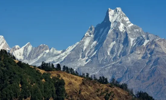
Mount Kanchenjunga is 8,586 meters above sea level, making this summit the world’s third-highest mountain. Also popular as “The Five Treasures of Snow,” it features five main peaks, each symbolizing gold, silver, gems, grain, and sacred treasures.
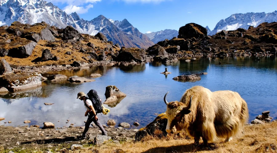
Among Nepal’s many popular trekking routes, the Kanchenjunga Circuit trek is the remotest and most challenging. The true form of nature has been preserved in its remote form within the eastern highlands of Nepal. The Kanchenjunga Circuit Trek itinerary takes you to the far eastern region of Nepal, encircling Kanchenjunga Mountain.
Along with Kanchenjunga, there are other high peaks likeEverest, Makalu, Cho Oyo, etc., that you can see on the Kanchenjunga map. However, these mountain peaks are not the only perks of the Kanchenjunga Circuit Trek. The pristine set of five glacial systems flows towards Sikkim, including Zumu, Talung, and Rathong.
The Yalung glaciers flow right into the Tamor River. The Kanchenjunga Conservation Area protects this alpine highland and its wonders, so a special Kanchenjunga trek permit is required. Inside the Kanchenjunga National Park, you can witness an unbelievable array of unique flora and fauna in pristine condition.
There are also relic mammals like the Red Panda and the Snow Leopard. The Kanchenjunga trek was opened for tourists only in 1980. Recently, the Kanchenjunga base camp has been upgraded to teahouse trekking. This means you can comfortably walk while living in a cosy room and enjoying warm food.
History of Mount Kanchenjunga
Mount Kanchenjunga was first properly explored by British explorers during the late 19th century. Despite repeated attempts, the peak remained unclimbed for many years due to the remoteness of this location and the extreme conditions it poses.
The first successful ascent was by a British team led by Joe Brown and George Band on May 25, 1955. Because the summit is sacred, the climbers stopped just short of the peak, a tradition that is followed today.
The Kanchenjunga trek began officially to trekkers in the 1980s and is relatively new compared to all other major treks in Nepal. Demanding and remote, it has marvellous landscapes, views of far, sprawling traditional villages, and ethnic groups like Rai, Limbu, and Sherpas.
This trekking route cuts through lush forests, rugged terrain, and the stunning Kanchenjunga massif. Its relative remoteness and spectacular scenery make it a desirable destination for an authentic trek.
Kanchenjunga Circuit Trek Facts
Duration of the trek: 20 days
Distance of the trek: Around 200 Km
Starting point: Amjilosa
Ending point: Yamphudin
Maximum elevation: 5,143 meters/ 16873.36 feets
Best Seasons to Visit: Spring (March to May) and Autumn (September to November)
Accommodation: Teahouses/ Hotels
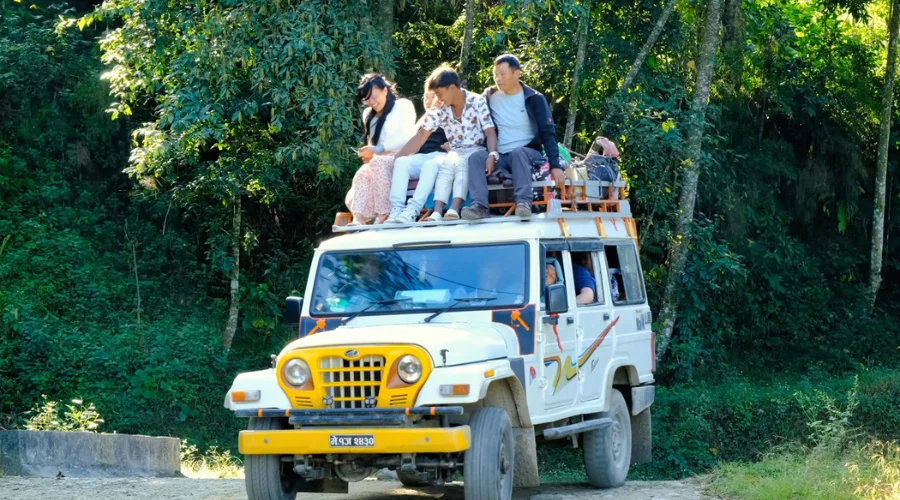
Transportation: Flight/Bus/Jeep
Trek Category: Difficult
Permits: KCAP and RAP
Highlights of the Kanchenjunga Circuit Trek
Cultural Immersion with local Sherpa and Limbu communities
Glacial Lakes such as Ghunsa and Kambachen
Monastic Visits to Ramtang and Oktang Monasteries
Challenging Terrain with varied landscapes
Base Camp Adventures at Kanchenjunga North (5143 m) and South (4780 m)
High Passes like Sele La (4290 m) and Mirgin La (4480 m)
Rich Biodiversity in Kanchenjunga Conservation Area
Traditional Villages showcasing local architecture and lifestyle
Breathtaking Sunrises and Sunsets over the Himalayas
Unique Trekking Routes through lush forests and alpine meadows
Opportunities for Photography of stunning landscapes and wildlife
Local Cuisine tasting traditional Nepali dishes along the trek
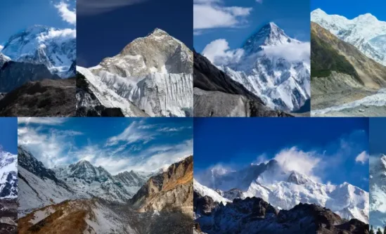
List of Mountains Visible During Kanchenjunga Trek Nepal
Kanchenjunga (8,586 m/ 28169.29 ft),
Yalung Kang (8,505 m/ 27903.54 ft)
Kambachen (7,903 m/ 25928.48 ft),
Jongsong (7,462 m/ 24481.63 ft),
Kabru (7,412 m/ 24317.59 ft),
Janu/ Kumbakarna(7,710 m/ 25295.28 ft),
Twins (7,350 m/ 24114.17 ft)
Where is Mount Kanchenjunga located?
Kanchenjunga is in eastern Nepal, near the border with the Indian state of Sikkim. It is part of the Himalayas, which stretches across Nepal, India, Bhutan, and Tibet. Kanchenjunga is the third-highest mountain in the world, standing at 8,586 meters (28,169 feet) tall. In the Tibetan language, its name means “Five Treasures of Snow,” referring to its five distinct peaks. The region around Kanchenjunga is known for its stunning landscapes, rich biodiversity, and unique culture of the local communities.
Culture and Wildlife on Kanchenjunga Circuit Trek
Some ethnic groups in the Kanchenjunga region include Sherpa, Rai and the Limbus. They have rich cultures, which are well exhibited through their festivals, dances and even the traditional dress code. Interacting with these communities allows trekkers to value addition to these people’s lifestyles.
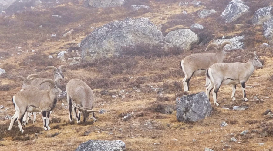
Himalayan Blue Sheep at Kanchenjunga Circuit Trek
This region is home to many species of animals, most of which are very hard to find in the wild, such as the snow leopard, Blue Sheep, and flesh-skinned red panda. Trekkers may also encounter Himalayan black bears and birds, including blood pheasants.
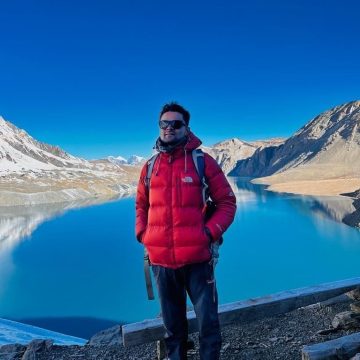
Benefits of Booking with Himalayan Masters
Himalayan Masters stands out as one of the most emerging trekking companies that provides the best and most affordable packages.
Himalayan Masters has various channel briefings through Zoom, social media, and even offline briefings at Thamel, Kathmandu.
We provide complimentary services like sleeping bags, down jackets, andtrekking poles, which must be returned after the trek.
We also provide free complimentary services like water purification tablets, water bottles, Himalayan Masters brand T-shirts, duffle bags, and caps.
We also have 24/7 communication services on various social media channels and email.
You will have one of the most experienced guides during the trek.
Your safety is prioritized the most with Himalayan Masters.
Himalayan Masters provides free luggage or baggage storage at the office in Thamel, Kathmandu.
A Typical Day on the Kanchenjunga Circuit Trek
A day at Kanchenjunga Circuit Trek starts early in the morning when the trekker wakes up and has his/her breakfast at the teahouse or camp. Full of these tasty foods, they prepare their equipment for a day of fun and frolic. Trekking parties tend to start early in the morning to cover a larger part of the distance before darkness sets in.
The amount of hiking per day may vary between 4 and 5 hours. Snacks are taken midmorning, and lunch is at a vantage point or at teahouses, which offer a break in the journey. During the day, trekkers travel, reaching a certain place where they spend the night at an inn or another shelter.
In the evenings, there is often dinner with other travelers, time to discuss the day’s impressions, and beautiful views of the mountains before the night’s sleep.
Notes to Remember for the Kanchenjunga Trek
Obtain necessary permits before trekking
Ensure good physical fitness and stamina
Pack appropriate clothing for varying weather conditions
Stay hydrated and acclimatize properly
Respect local customs and traditions
Carry a first aid kit and personal medications
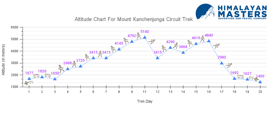
Day Wise Altitude Gain During Kanchenjunga Circuit Trek
20-day Itinerary Outline of Kanchenjunga Base Camp
Day
Route
Sleep Altitude
Duration
1
Fly to Bhadrapur and Drive to Phikkal
1677 m
3-4 hrs
2
Drive from Phikkal to Taplejung
1820 m
6-8 hrs
3
Drive to Sekathum or Japantar
1650 m
8-9 hrs
4
Sekathum or Japantar to Amajilosa
2498 m
4-5 hrs
5
Amajilosa to Gyabla (Kyapra)
2725 m
4-5 hrs
6
Gyabla (Kyapra) to Ghunsa
3415 m
4-5 hrs
7
Acclimatization Day at Ghunsa
3415 m
–
8
Ghunsa to Khangpachen (Khambachen)
4145 m
6 hrs
9
Acclimatization Day at Khangpachen (Khambachen)
4145 m
–
10
Khangpachen (Khambachen) to Lhonak
4792 m
4-5 hrs
11
Lhonak to Kanchenjunga North Base Camp (5140 m) & back to Lhonak
4792 m
7-8 hrs
12
Lhonak to Ghunsa
5140 m
7-8 hrs
13
Ghunsa to Sele Le
4290 m
4-5 hrs
14
Sele Le to Cheram/Tseram
3868 m
9 hrs
15
Cheram/Tseram to Ramche
4610 m
3 hrs
16
Ramche to Kanchenjunga South Base Camp (4840 m) & back to Tseram
3868 m
3 hrs
17
Cheram/Tseram to Tortong/Torangdin
2980 m
4 hrs
18
Tortong/Torangdin to Yamphudin
1692 m
8 hrs
19
Yamphudin to Illam
1627 m
8 hrs
20
Illam to Bhadrapur (91 m) to Kathmandu (Drive & Fly)
Beginning Point: Kathmandu (1400 m/4593 ft.) Ending Point: Phikkal (1595 m/5232 ft.) Lunch: On the way Kathmandu to Bhadrapur Distance: 297 km via flight Bhadrapur to Phikkal Distance: 58 km/ 36 miles Total Ascent: 195 m/ 639.7 ft. Overnight: Phikkal
Early in the morning, a driver picks us up from the hotel and drives us to the domestic terminal of the Kathmandu airport. Soon, we hop onto a flight, taking us above the mountains. Flying above the lush green hills and many perennial flowing rivers, we land in Bhadrapur, Jhapa, in about 1 hour.
From Jhapa, we move to the higher altitude of Illam. Driving along the stunning, hilly, winding roads, we can see the beautiful tea farms of Illam. You will drive along with Kanyam, one of the most beautiful villages in Illam. The weather there is unpredictable, which you can even feel during the drive. Taking some amazing photos, we will stop at a local guesthouse in Illam.
The services and the facilities of the guesthouse at Phikkal are good and comfortable.
Kanyam, Illam, Nepal.
Meal : Breakfast, Lunch and Dinner
Accommodation : Guest House
Walking / Driving : 45 mins flight and 3 hours drive
Day 02: Drive to Taplejung from Phikkal
Beginning Point: Phikkal (1595 m/5232 ft.) Ending Point: Taplejung (1800 m/ 4730 ft.) Lunch: On the way Taplejung to Phikkal Distance: 186 km/ 115.5 miles
Total Ascent: 153 m/ 501 ft. Overnight: Taplejung
We will wake up early to witness the spectacular sunrise at Illam before starting the real Kanchenjunga Circuit trek. Although the drive to Kanyam is not included in our itinerary, arrangements can be made. After breakfast, we plan to drive further north along the terraced fields.
After midday, we reach Taplejung, a beautiful town in the hills. Here, we visit different Buddhist gompas with butter lamps that have been burning continuously for more than 400 years. After a peaceful evening, we return to the hotel.
Meal : Breakfast, Lunch and Dinner
Accommodation : Guest House
Walking / Driving : 5-6 hour driving
Day 03: Drive to Sekathum or Japantar from Taplejung
Beginning Point: Taplejung (1800 m/ 4730 ft.) Ending Point: Sekathum (1650 m/ 5413 ft.) Lunch: On the way Taplejung to Sekathum Distance: 39 km/ 24.23 miles Total Ascent: 150 m/ 492 ft.
Overnight: Sekathum
Jeep from Taplejung to Sekhathum
On the third day, you will also drive to either Sekathum or Japantar. It would help if you stayed at Sekathum, an 8-9 hours drive from Taplejung. Today’s path is all off-road. You will drive along the rivers. You will have some lunch and snacks on the way to your destination.
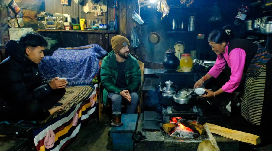
Sekathum is just a teahouse area. You will stay in Sekathum’s teahouse.
Teahouse in Sekathum:
– The services of the teahouses are very basic.
– You will not find wifi, electricity, hot showers, or towers.
– There is only one teahouse at Sekathum; if the teahouse is full and we have no place to accommodate, we will go up to Japantar for our stay.
Meal : Breakfast, Lunch and Dinner
Accommodation : Tea House
Walking / Driving : 8-9 hours driving
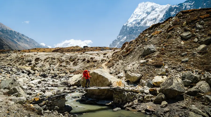
Day 04: Trek from Sekathum to Amjilosa
Beginning Point: Sekathum (1650 m/ 5413 ft) Ending Point: Amajilosa (2498 m/ 7933 ft) Sekathum to Amjilosa Distance: 9 km/ 5.59 miles Total Ascent: 848 m/ 2782 ft Overnight: Amajilosa
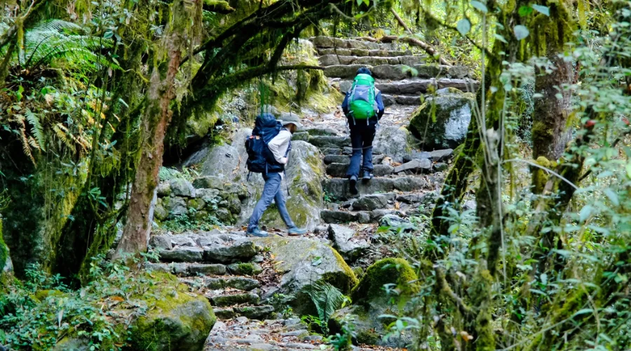
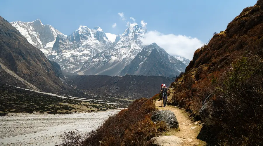
Mossy trail route of Kanchenjunga Trek
On the fourth day, we will begin our trek. Our destination today is Amjilosa. On the fourth day of the trek to Kanchenjunga, we walk beyond the wonderful waterfalls and suspension bridges. However, once we reach the Sherpa village of Amjilosa, we get lost in its charm. The path has steep ascents, and you can even find small streams.
Some local people are also engaged in raising yaks for commercial purposes. While staying there, you can taste the yak milk and yak cheese the locals produce. Local Bhotey dogs can also be seen often, and goats, yaks, and sheep are also on the way. You will then descend to reach via a bamboo forest to reach Amjilosa. You will pass through many rivers and waterfalls.
Today, there is a high chance of encountering a red panda on the way.
About Amjilosa:
Amjilosa is a small village located on the way to the Kanchenjunga Trek. Most of the people residing in the area are Gurung and Sherpa. There are around 5-7 local teahouses in the area. The people of the area are involved in cardamom farming and cattle raising. If you are lucky, you can also get a chance to drink yak milk.
Teahouses in Amjilosa
– There are 2 teahouses in Amjilosa.
– You will find limited food items, such as vegetarian and egg foods; no meat products can be found in the region.
– The area is very remote; hence, there are only solar services and no electricity.
– There are no facilities for a hot shower or attached bathroom.
– For hot water, you will need to pay extra charges like Rs.200 to Rs.300. You will get to charge your devices but need to pay extra.
Meal : Breakfast, Lunch and Dinner
Accommodation : Tea House
Walking / Driving : 4-5 hrs
Day 05: Trek from Amjilosa to Gyabla
Beginning Point: Amajilosa (2498 m/ 8195 ft) Ending Point: Gyabla (Kyapra) (2725 m/ 8940 ft ) Amjilosa To Gyabla Distance: 8 km/ 4.9 miles Total Ascent: 227 m/ 744.5 ft Overnight: Gyabla
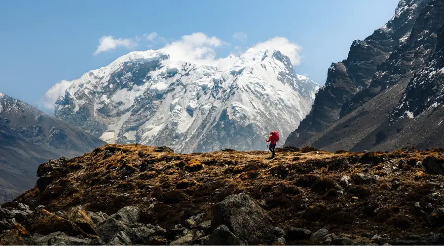
Moving above the Amjilosa, we start to see the western side of Kanchenjunga. Walking via the oak and bamboo forest, you cross many suspension bridges and rivers. The weather is very unpredictable while reaching Gyabla. The route on this day is narrow. During the spring season, the whole trek route is filled with rhododendrons.
The path has a gradual ascent, and you will pass through dense forest. The Kanchenjunga routes are not so good, so be careful during the monsoon season. The river will be your best friend this day because until you reach Gyabla, the river will walk along with you. On this day, you will also have the chance to encounter a red panda if you are lucky enough.
With some suspension bridges, more streams, and colourful flags on the way, you will reach Gyabla. Gyabla is most like a teahouse area instead of a village-like one. You can find some teahouses along the way that offer very basic services.
Teahouses in Gyabla:
– There are three teahouses in Gyabla.
– In Gyabla, there is also no electricity or wifi.
– There are also very basic like the teahouse in the area as the area is really remote.
Meal : Breakfast, Lunch and Dinner
Accommodation : Tea House
Walking / Driving : 4-5 hours
Day 06: Trek From Gyabla To Ghunsa
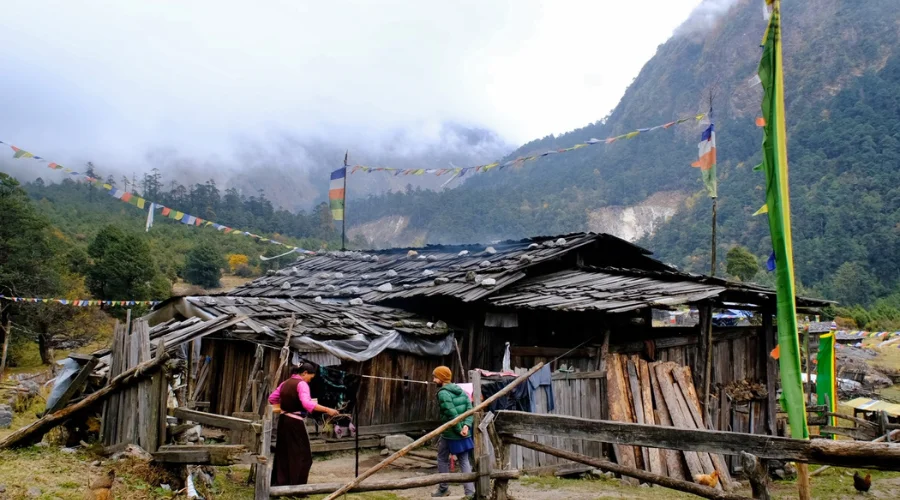
Trek Route: Gyabla → Phale → Ghunsa Beginning Point: Gyabla (Kyapra) (2725 m/ 8940 ft) Ending Point: Ghunsa (3415 m/ 11204 ft) Gyabla To Ghunsa Distance: 10.7 km/ 6.64 miles Total Ascent: 2035 m/ 6676 ft Overnight: Ghunsa
Local women doing Puja
On this day, you will trek to one of the most beautiful villages on the way to Kanchenjunga Circuit Trek. You can meet many local people along the way to Ghunsa. The day has a gradual ascent, which passes through many suspension bridges.
There are no iron bridges and suspension bridges for small streams. Instead, you will walk over a wooden bridge made by the local people. The weather is very unstable, and you can feel it while on the trek. It’s another long and exciting day in the mountains.
First, we will walk through the forest to get to Phale Village, where we will have our lunch. Phale is a Tibetan refugee camp that started almost a decade ago after fleeing from the communist regime in China. The path has a steep ascent while reaching Ghunsa.
After 6 hours of hike, you will reach Ghunsa, a beautiful village on the way to KBC.
About Ghunsa:
Ghunsa is a village you will encounter while moving towards the trek route. It has primary-level schools, a police checkpoint, and even a health post. There are around 30 local houses in the area.
Teahouses in Ghunsa:
– There are around 9-10 teahouses in Ghunsa.
– The teahouses have electricity but will charge you for such facilities.
– Rather than that, you will have basic services at the teahouse.
– You will also have services like wifi, hot showers, and electric and gas geysers.
– You will also have firewood services.
– Western toilets are also available in Ghunsa.
Meal : Breakfast, Lunch and Dinner
Accommodation : Tea House
Walking / Driving : 6 hours
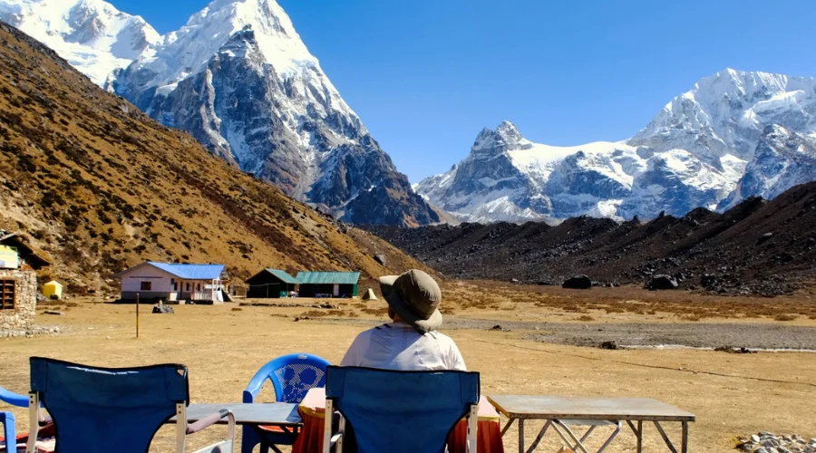
Day 07: Acclimatization Day at Ghunsa
Beginning Point: Ghunsa (3415 m/ 11204 ft) Day Hike: Janu Himal Viewpoint/ Ghunsa Distance: 3.8 km/ 2.3 miles Overnight: Ghunsa
Since we live at 3,500 meters above sea level, it’s essential to stop for a day for acclimatization. Ghunsa is the most developed settlement here, making it ideal for this stop. On this day, we will hike up to where you can see Janu Himal.
The total duration of the trek on this day is around 5 hours roundtrip. You can see a clear and magnificent view of the Jannu Himal from this area. You will also encounter Blue Sheep on the way.
There are two ways to go from Ghunsa: to the Sele Le and Dudh Kunda. Even during the peak season, you can find snow in this region. The path has rocky terrain, like a gravelled one. It is called Dudh Kunda because the place mostly has snow, and dudh means milk in Nepali so that we can relate it to Milk Lake. After exploring Dudh Kunda, we will return to Ghunsa.
But as the local people say, the Dudh Kunda trip is lengthy for the rest of the day so that we will hike up to the viewpoint of the Jannu Himal Base camp. You can also explore a nearby Gumba/ monastery in the area.
Meal : Breakfast, Lunch and Dinner
Accommodation : Tea House
Walking / Driving : 5 hours
Day 08: Trek from Ghunsa to Kambachen
Beginning Point: Ghunsa (3415 m/ 11204 ft) Ending Point: Khambachen (4145 m/ 14599 ft) Ghunsa to Kambachen Distance: 11.2 km/ 6.9 miles Total Ascent: 730 m/ 2395 ft Overnight: Khangpachen
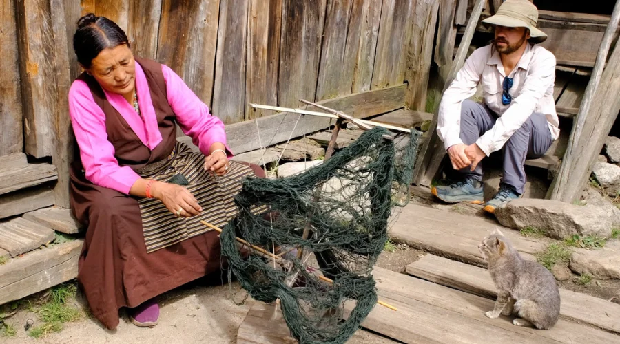
Local people weaving local products at Kanchenjunga
After a relaxing day, it’s time to move further away from the mountains. Today, we can witness the Jannu Himal as we walk along the gentle path. Here, we can see the beautiful green glacier valley. You will begin your hike along the mane walls and beautiful rivers. The path has gradual ascent and descent.
After crossing some bridges and streams, you will reach Chhermalung, located at 3740 meters. The distance from Ghunsa to Chhermalung is 3.8 km. It takes around 1.5 hours to reach here from Ghunsa. You have a little rest at Chhermalung.
Then, you will walk towards Labuk, located at 3797 meters. There are a few teahouses, and they are mostly for lunch and breakfast only. After lunch and resting for a while, we will trek to Khambachen. The route is a landslide-prone, mostly sloppy trail like the Tilicho Lake route.
You will find many suspension bridges and rivers along the way to reach Khambachen. In 5–6 hours, we reach Kambachen. If you look into the alpine area, you might also spot blue sheep and snow leopards.
Teahouses in Khambachen:
– You will find teahouses and camps.
– There are only 4 teahouses in the area.
– There is no electricity, no wifi, and no cellphone tower.
– You can find a bucket, hot shower, and hot drinking water, but you must pay extra.
– You will have local food with limited menu items.
Meal : Breakfast, Lunch and Dinner
Accommodation : Tea House
Walking / Driving : 6 hours
Day 09: Acclimatization Day at Khambachen
Beginning Point: Khangpachen (4145 m/14599 ft ) Ending Point: Jannu Himal Base Camp (4500 m/ 14763 ft) Overnight: Khangpachen
Before we head further upwards in a challenging section of the tour, we let our bodies rest for another day. Since we plan to have fun, there’s no need to rush for Kanchenjunga Circuit trekking. On this day, we will hike up to Janu Himal Base Camp. You will also get the chance to explore the glacier. On this day, as there is no place to have lunch, we will pack our lunch.
The view from the Base camp is majestic. The whole route and area are covered with snow. You can see the Kumbakarna, the 32nd highest peak in the world. You will also see a holy place where Kirat people worship their god. After exploring for a while, we will walk back to our teahouse.
Meal : Breakfast, Lunch and Dinner
Accommodation : Tea House
Walking / Driving : 6 hours
Day 10: Trek from Khambachen to Lhonak
Beginning Point: Khangpachen (4145 m/ 14599 ft) Ending Point: Lhonak (4792 m/ 15721 ft) Khambachen to Lhonak Distance: 9.6 km/ 5.96 miles Total Ascent: 647 m/ 2122 ft Overnight: Lhonak
Traditional mountain flags and local house
From Khambachen, we first walk via the rocky path leading to Khando Waterfall. Today’s hike is around 6 hours and will take us to the highest altitude of 4756 meters. Walking west of the Kanchenjunga Glacier allows us to take some amazing pictures. The route is very landslide-risky and consists of very large pebbled stones all over the path.
You will also find a beautiful waterfall named Khando Waterfall, located at a height of 4381 meters. Then, we will stay for lunch at Randamg. The temperature in this area is really cold. We reach Lhonak village in the evening, which is decorated with large stone huts. From Lhonak, we can see Wedge Peak, Mera Peak, Nepal Peak, and the Twins.
Teahouse in Lonak:
– 4 teahouses in the area.
– No Wi-Fi, electricity, cell phone towers, or local food every day.
Meal : Breakfast, Lunch and Dinner
Accommodation : Tea House
Walking / Driving : 4-5 hours
Day 11: Trek to North Base Camp and back to Lhonak
Beginning/Ending Point: Lhonak (4792 m/15721 ft) Day Hike: Kanchenjunga North Base Camp (5140 m/ 16863 ft) Distance: 16.7 km/ 10.37 miles Total Ascent: 348 m/ 1141 ft Overnight: Lhonak
This is the most exciting day of your Kanchenjunga North Base Camp trek as we will make the final push-up to the base camp. First, we will pass through Syjango, which has a very snowy path during the peak season. Climbing beyond the moraine of Kanchenjunga Glacier, we head towards the northern base camp of Kanchenjunga.
Kanchenjunga North Base Camp
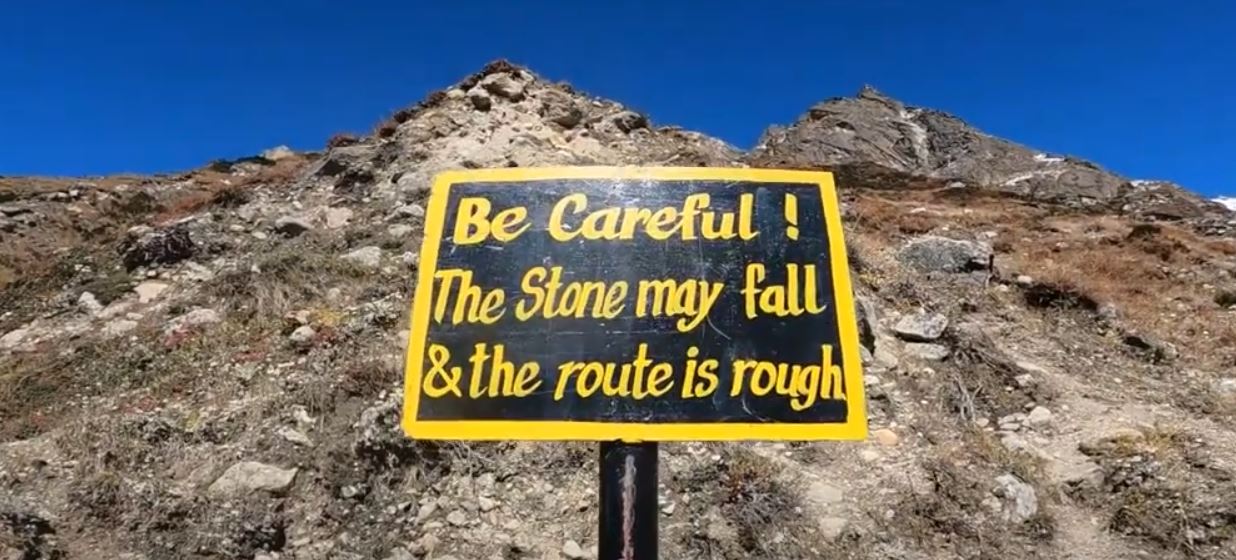
The climb to Kanchenjunga would be very challenging, but the tranquillity and stunning views of the mountain vistas make you forget everything. The route has a high risk of landslides.
The Kanchenjunga North Base Camp trek is also called the Panpema View base camp. The altitude of the Kanchenjunga North Base Camp trek is 5140 meters.
We will have a packed lunch with us since there will be no teahouses or teashops when we reach the base camp. The total duration of our trek is around 7-8 hours.
We enjoy the beauty of the Kanchenjunga North Base Camp trek for a few hours and then walk down to Lhonak for the night. Our Kanchenjunga base camp trek is going to be a wonderful experience.
Meal : Breakfast, Lunch and Dinner
Accommodation : Tea House
Walking / Driving : 7-8 hours
Day 12: Trek from Lhonak to Ghunsa
Beginning Point: Lhonak (4792 m/15721 ft) Ending Point: Ghunsa (3415 m/ 11204 ft) Lhonak to Ghunsa Distance: 21.6 km/ 13.42 miles Total Descent: 1377 m/ 4517 ft Overnight: Ghunsa
Walking via the pebbled route, we walk down from the Lhonak and head towards the Kambachen Village. East of the Tamor River, we can enjoy a beautiful night in Ghunsa. It’s a relaxing day on the Kanchenjunga base camp trek.
As we descend from height, our path today will be much easier than expected. The total duration of this day’s trek is around 7-8 hours. At night, we will stay at Ghunsa.
Meal : Breakfast, Lunch and Dinner
Accommodation : Tea House
Walking / Driving : 7-8 hours
Day 13: Trek from Ghunsa to Sele Le
Beginning Point: Ghunsa (3415 m/11204 ft) Ending Point: Sele Le (4290 m/14074 ft) Ghunsa to Sele Le Distance: 7.5 km/ 4.6 miles Total Ascent: 875 m/ 2870 ft Overnight: Sele Le
Walking beyond the forest of Ghunsa in the morning, we can again see the alpine grassland. The colourful vegetation and the awesome views of the mountain take your heart away. As the view of Phale villages gets smaller, we climb to Sele Le, situated at a height of 4355 meters.
The view from Sele Le is amazing. One should not miss the chance to trek to Sele Le. Some camps are also seen on the way. There is an upper and a lower Sele Le region, and we will stay at our pace.
Teahouse at Sele Le:
– There are only 2 teahouses at Sele Le.
– There is no electricity or a hot shower in the area.
– The NTC sim works a bit in the area.
– The food and dining service is really basic in the area.
Meal : Breakfast, Lunch and Dinner
Accommodation : Tea House
Walking / Driving : 4-5 hours
Day 14: Trek from Sele Le To Tseram
Beginning Point: Sele Le (4290 m/ 14074 ft) Ending Point: Cheram/Tseram (3868 m/12690 ft) Sele Le To Tseram Distance: 10.5 km/ 6.5 miles Total Descent: 622 m/ 2040 ft Overnight: Cheram/Tseram
We leave the Sele Le quite early in the morning and head for the most difficult walk of the journey. We commence by climbing Sinion La Pass at 4,450m and then Mirgin La Pass at 4645 m. After a short stop here, we must cross Sinelapche La pass (4,830m); the difficulty of the Kanchenjunga trek keeps increasing.
Along the way, we will see yaks carrying loads, and we can also see Chhuchhung thanga lake, which is beautiful. Finally, after 8 to 9 hours of walking, we reach Tseram at night. Tseram is a small village along with teahouses in it. One can have a view of a beautiful sunset from Tseram village.
Teahouse at Tseram:
– There are 2 teahouses in Tseram.
– There are no extra facilities, excluding food and lodging.
Meal : Breakfast, Lunch and Dinner
Accommodation : Tea House
Walking / Driving : 9 hours
Day 15: Trek from Tseram to Ramche
Beginning Point: Cheram/Tseram (3868 m/ 12690 ft) Ending Point: Ramche/Ramchaur (4610 m/ 15124 ft) Tseram to Ramche Distance: 7 km/ 4.34 miles Total Ascent: 742 m/ 2434 ft Overnight: Ramche/Ramchaur
On this day, we will start our trek from Tseram to Ramche. The path is steep as we gain some altitude. The route to the ranch is gravelled or pebbled, and there is a risk of landslide in the area.
After trekking for around 3 hours, we will reach Ramche. On the way, you will have the chance to spot blue sheep. You will have your lunch at Ramche only, as you will just walk for a few hours that day.
Meal : Breakfast, Lunch and Dinner
Accommodation : Tea House
Walking / Driving : 3 hours
Day 16: Trek to South Base Camp and back to Tseram
Beginning Point: Ramche/Ramchaur (4610 m/ 15124 ft) Ending Point: Back to Cheram/Tseram (3868 m/ 12690 ft) Distance: 9 km/ 5.59 miles Total Descent: 742 m/ 2434 ft Overnight: Cheram/Tseram
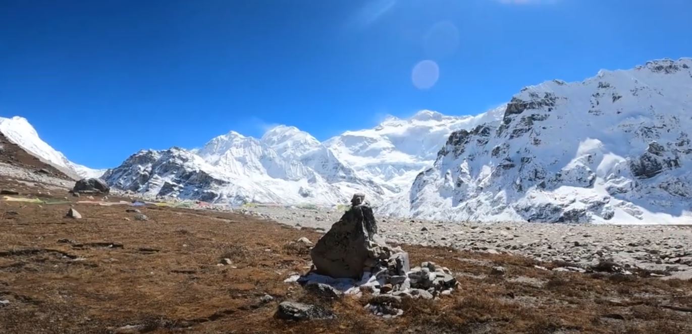
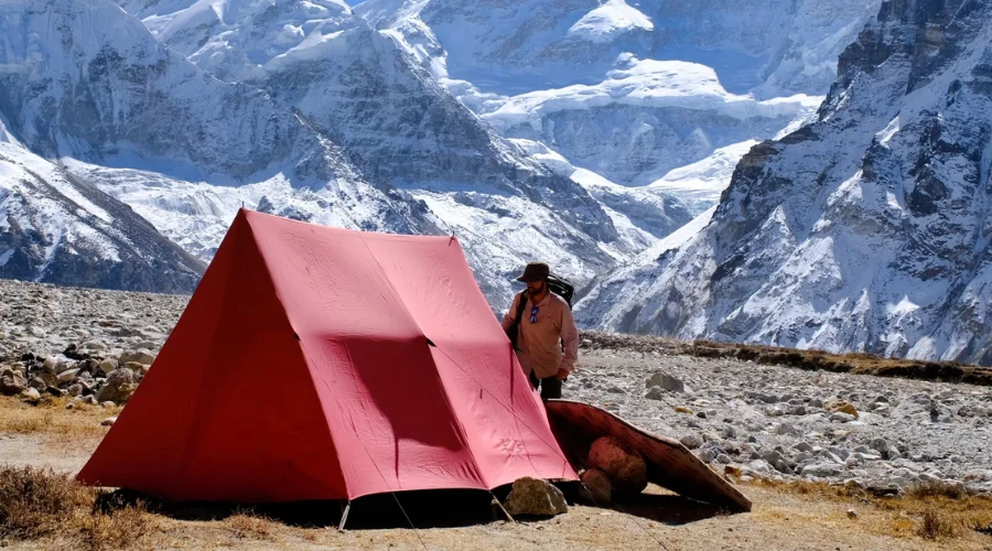
Tent at Kanchenjunga Base Camp
After breakfast at Ramche, we walk to the Kanchenjunga South Base Camp trek for less than an hour. This trek, decorated with colourful prayer flags, is on the glacier’s edge.
After amazing photos and a peaceful time on the Kanchenjunga South Base Camp trek, we returned to Tseram.
Meal : Breakfast, Lunch and Dinner
Accommodation : Tea House
Walking / Driving : 3 hours
Day 17: Trek from Tseram to Tortong
Beginning Point: Cheram/Tseram (3868 m/ 12690 ft) Ending Point: Tortong/Torangdin (2980 m/ 9776 ft) Tseram to Tortong Distance: 13 km/ 8.07 miles Total Descent: 888 m/ 2913 ft Overnight: Tortong/Torangdin
Now, we start moving towards the lower altitude. Walking downwards from the gorge, we get to the area prone to landslides. Moving down, we see the sub-tropical forests during this Kanchenjunga National Park trek.
In the late evening, we get to Tortong, the only settlement we can see all day. The Tortong side is the border side for the Indian face; just opposite the mountains lies the Leh Ladakh area of India.
Teahouses at Tortong:
– There are only 2 teahouses in the area.
– There is no electricity, wifi, or network towers.
Meal : Breakfast, Lunch and Dinner
Accommodation : Tea House
Walking / Driving : 4 hours
Day 18: Trek from Tortong to Yamphuding
Beginning Point: Tortong/Torangdin (2980 m/9776 ft) Ending Point: Yamphudin (1692 m/5551 ft) Tortong to Yamphuding Distance: 9 km/ 5.59 miles Total Descent: 1288 m/ 4225 ft Overnight: Yamphudin
As we head downhill from Tortong, the mountains start to appear. In the morning, we first walk towards the Lasiya Bhanjyang.
After lunch in Lasiya Bhanjyang, our path goes steeply downhill to the forest. Finally, we reach the big village of Yamphuding. It’s an important stop on the Kanchenjunga base camp trek map.
Teahouse at Yamphudin:
– There are 3 teahouses in the area.
– The area has facilities for electricity, wifi, a phone, and a hot shower (bucket).
Meal : Breakfast, Lunch and Dinner
Accommodation : Tea House
Walking / Driving : 8 hours
Day 19: Drive from Yamphudin to Illam
Beginning Point: Yamphudin (1692 m/ 5551 ft) Ending Point: Illam (1627 m/ 5337 ft) Lunch: On the way Taplejung to Sekathum Distance: 67.1 km/ 41.6 miles Total Descent: 150 m/ 492 ft Overnight: Sekathum
Now, we have come to the end of our trek. We will descend for one hour and then reach a point from where we can get the jeep to Illam. One should note that we will not get the direct jeep to Illam. You will need to take another jeep from Ganesh Chowk.
On this day, you will travel a lot, which will take 8-9 hours overall. You will come in a shared jeep. You will stay at one of the best hotels in Illam.
In Illam, you do not need to worry about the services and facilities you can get; since it is an urban area, you will have top-notch services.
Meal : Breakfast, Lunch and Dinner
Accommodation : Hotel
Walking / Driving : 8-9 hours
Day 20: Drive to Bhadrapur and fly to Kathmandu
Drive Route: Illam → Bhadrapur Flight Route: Bhadrapur → Kathmandu Beginning Point: Illam (1627 m/ 5337 ft.) Ending Point: Kathmandu (1400 m/ 4593 ft.) Bhadrapur to Kathmandu Distance: 297 km via flight Illam to Bhadrapur Distance: 58 km Total Descent: 227 m / 744 ft. Overnight: Kathmandu
We will drive to Bhadrapur in a private vehicle. The jeep ride along the off-road hills is quite interesting. On the way, we will pass many beautiful tea farms and villages. After a few hours of driving, we will reach Bhadrapur.Finally, it’s time to head back to Kathmandu. The driver will take us to the Bhadrapur airport, and in less than one hour, we will be walking through the streets of Kathmandu. When you return to Thamel, you will have enough time for souvenir shopping.In the evening, it’s time for the farewell dinner. We celebrate the wonderful Kanchenjunga trek in Nepal, which we conquered together.Although wonderful, this is Nepal’s most dangerous and long trekking route. An expert team of Himalayan Masters will help make your stay even more exciting. So, book your trip with us here.
Meal : Breakfast, Lunch and Dinner
Accommodation : Hotel
Walking / Driving : 2 hr driving and 35 min flight
include / exclude
Trip Cost Includes
International and domestic airport pickup and drop-off by private car
Kathmandu to Bhadarapur and back by flight; all airport taxes are included. 4.
All the ground transport is by public jeep as per the itinerary.
Guide for 20 days with his (Food, salary accommodation and insurance)
Guide flight ticket
all necessary permits during the trek
Breakfast, lunch and dinner during the 20 days of trekking
Three cups of hot drinks (Tea or coffee a day)
19 nights of accommodation during the trek (During the drive in a guest house and other nights in a teahouse)
al. government taxes and company service charges
Trip Cost Excludes
International Flight Ticket
Nepal visa fee
Tips for guide and potters
One porter for 20 days, USD 490 (Optional)
Private jeep USD 400 (Optional)
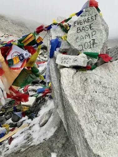
Gallery
useful info
Best Time to do Kanchenjunga Circuit Trek
The most suitable months for the Kanchenjunga Circuit Trek are March to May and September, October and November. These seasons offer good weather conditions, with sunshine and moderate temperatures appropriate for trekking.
Spring also features beautiful flowers, particularly rhododendrons, thus adding beauty to the makes; autumn has wonderful colours of leaves toward mountainous backgrounds.
When trekking during these peak seasons, you will enjoy good weather and the chance to experience some of the local cultural festivals held by different communities along the trekking route.
Trekking Experience of Kanchenjunga Circuit Trek
Based on their experience trekking on the Kanchenjunga Circuit, this experience is exceptional in terms of stunning views and cultural destinations in several scattered villages along the trail.
When trekkers join different areas traversed by forest, hills, mountains, and sometimes meadows with wildflowers, they are blessed by beautiful views of towering mountains.
Furthermore, interacting with local people helps one understand their lifestyle—travellers can join natives during dances or communicate with members of the families who cook meals for trekkers in the teahouses along the path. This combination of natural facets with cultural aspects makes every single part of this trek fascinating.
The Kanchenjunga Circuit trek covers a range of terrains and geographical regions that may result in confusing weather patterns; thus, hikers should expect changes in weather conditions during the trek.
During the day, in the lower altitudes, early spring and late autumn, it may be relatively warm during hikes. Still, the temperature could also be extremely freezing at night when coming from higher altitudes.
Trekkers should check the weather reports frequently before the start of a new day of trekking. They should also ensure adequate clothing for the warmer daytime and cold nights, which come with stars at night.
Difficulty of Kanchenjunga Circuit Trek
Some factors that make the Kanchenjunga Circuit Trek difficult include the area’s remoteness, rigorous terrains, and high altitudes on the trail. It takes about three weeks and stretches around 200 kilometers with significant elevation and declines, lasting up to 4 to 5 hours of hiking daily.
Altitude sickness remains high, for elevations are often above 5000 meters. Moreover, weather factors make the trail slippery during the monsoon and winter months. This trek requires appropriate physical fitness and acclimatization before attempting it.
Parts of this trek involve walking on roads, and most of the terrain is relatively rough, with steep ascents and descents—it is easy to get lost or stuck during long days of hiking. Thus, trekkers should commence their exercise regimes and map/route studies before the actual trekking adventure to avoid mishaps on these single trails into higher altitudes.
Distance (From Famous Places)
Kathmandu to Bhadrapur: Approximately 450 km
Bhadrapur to Taplejung: Approximately 244 km
Trip Grade: Fitness Level, Medical & Health
Walking inside this area requires reasonable physical fitness alongside moderate fitness, which is needed because most days involved in a trek are spent climbing over rough terrain —trekkers should, therefore, have physical training regimes that build up towards the time of the start of the trek.
The pre-adventure medical examination enables hikers to be in a position to handle or prevent health complications that may occur during high-altitude undertakings.
Special Training for Kanchenjunga Trek
Engaging regularly in cardiovascular exercises strengthens muscles used during long hikes while improving overall stamina needed throughout demanding trail conditions encountered along the way.
Altitude Sickness During Kanchenjunga Circuit Trek
A major drawback of the Kanchenjunga Circuit Trek is altitude sickness, mostly experienced at high altitudes; the highest trekking Point is the Kanchenjunga Base Camp, at 5140m.
As they advance through the trail, trekkers find themselves in areas with an altitude of more than 3,000m, where the air becomes thinner, and the amount of oxygen is low, causing exposure to altitude sickness.
Trekkers should also be alert for symptoms that signal the beginning of altitude sickness and keep their bodies well-hydrated throughout the trek.
Emergency and Evacuation
Safety measures are essential, particularly when trekking the Kanchenjunga Circuit Trek, which is relatively challenging and located in a very hard area. Dangerous altitude sickness and accidents may require emergency measures, so travel insurance is compulsory for a medical regime and helicopter rescue.
The risk of altitude sickness increases after reaching 3,000 meters, specifically near the 5,140-meter Kanchenjunga Base Camp. Trekkers should also consider sudden weather changes, carry a first aid box, and know how to evacuate in an emergency.
Travel Insurance for Kanchenjunga
Having travel insurance for medical emergencies, trip cancellations, and evacuation costs is very important for trekkers on Kanchenjunga Circuit Trek.
Some of the best options are World Nomads, which is good for North American hikers who need coverage for high-altitude rescues; Snowcard, which is common with UK travelers due to its coverage for activities up to 6000 meters; and MAIF for any traveler from France.
Firstly, HanseMerkur is preferred by German trekkers, while Cover-More has good, balanced plans for Australians. Among Indian insurance companies, Tata and Reliance offer various benefits at reasonable prices.
Kanchenjunga Circuit Trek Cost
The Kanchenjunga Circuit Trek costs $1900 per person. The expenses depend on the number of days spent, the number of people in the group, and facilities like permits, accommodation, food, and transportation, which must be booked in advance. Proper budgeting enables trekkers to enjoy the experience without financial hardships, which can reduce enjoyment levels.
Additional Expenses
Extra expenses may include tips for the guides/porters/snacks taken during trekking days and other personal expenses on the way. By making a budget and setting priorities for spending in advance, enough money will be available to cover all expenses throughout the whole time.
ATM on the Kanchenjunga Trek Route
ATMs are absent along most of the trek; therefore, it is advisable to take enough cash from larger towns such as Taplejung.
Money Exchange
Some services, like currency exchange, are restricted to certain areas; therefore, it is wise to exchange money in Kathmandu before the trek. This ensures that adequate cash is available to meet all expenditures throughout the entire period without being hampered by a lack of access to exchange services that may be encountered later down the line.
Permits for Kanchenjunga Circuit Trek
To trek the Kanchenjunga Circuit, trekkers need two main permits: the Kanchenjunga Restricted Area Permit and the Kanchenjunga Conservation Area Project Permit.
The Restricted Area Permit can be obtained by paying $10 per person for the first four weeks and $25 per person for each subsequent week.
The Conservation Area Permit costs about $20 per person, and a TIMS (Trekkers’ Information Management System) card, also about $20, is necessary.
Packing List for Kanchenjunga Trekking
Body
Base layers (thermal tops and bottoms)
Insulating layer (fleece or down jacket)
Waterproof and windproof outer layer (hiking jacket)
Hiking pants (quick-dry)
Waterproof pants
Warm hat/beanie
Buff or neck gaiter
Sunglasses (UV protection)
Sunscreen (high SPF)
Lip balm with SPF
Footwear
Sturdy trekking boots (waterproof)
Lightweight camp shoes or sandals
Thick hiking socks (wool or synthetic)
Liner socks (optional)
Hands
Insulated gloves or mittens
Lightweight gloves for dexterity
Hand warmers (optional)
Backpack and Accessories
Trekking backpack (50-70 liters)
Daypack for shorter hikes
Trekking poles (collapsible)
Hydration systems or water bottles
Miscellaneous
Camera or smartphone for photos
Power bank or solar charger
Travel insurance documents
Maps and guidebooks
Cash in local currency (Nepalese Rupees)
Accommodation in Kanchenjunga Trek
The accommodations on the Kanchenjunga circuit trek are really basic. Only in the driving areas can you get a really good accommodation hotel. But you will not find a very comfortable teahouse in the trekking route area. The teahouses of the trekking routes are very basic. They are just made for sleeping and eating only.
Common breakfast options include porridge alongside tea/coffee. A hearty start to the day is filled with adventures waiting to be discovered throughout the trail ahead.
Lunch
Lunch typically consists of dal bhat (rice served with lentils) and noodle soups. Do not expect a delicious meal; this is a remote trek, and you will not have high-quality food services.
Dinner
Dinner also includes the same Nepali Dal Bhat; non-veg items cannot be found because the area is very remote, and it isn’t easy to store the meat.
Electricity & Battery Recharge
Most of the Kanchenjunga Trek does not have access to electricity. Only a few parts of the area have electricity, like the Illam, Phikkal, Bhadrapur, Kathmandu, and Khambachen areas. The trek area is remote.
Solar panels can be found in most areas, but they cannot be relied on solely due to the cold temperatures and lack of sun. Also, you need to pay extra costs for electricity usage and charging while on the trek.
Water During Kanchenjunga Trek
The water during the trek can also be contaminated, so you must carry a purification tablet to purify it and drink safe water. Himalayan Masters provides complimentary water purification tablets for your well-being during the trek.
Communication on the Trek
Mobile networks may be accessible but unreliable; hence, satellite phones may be a useful alternative in emergencies.
Some places have network coverage of local SIM cards like NTC and Ncell, but the connection and coverage are too poor.
Safety and Security
Several precautions must be taken when hiking in the Kanchenjunga region. Group hiking is always preferable, as it helps the group members keep an eye on each other. It is important to let someone know your planned schedule before going out.
This way, other people know where you are going and when you should be getting there, making the process less stressful and ensuring your safety throughout the journey.
Porters vs. No Porter
Arranging for a porter can ease the challenge of carrying large backpacks, given that Kanchenjunga is a high-altitude trek. However, if you consider hiring porter services, ensure they are adequately remunerated.
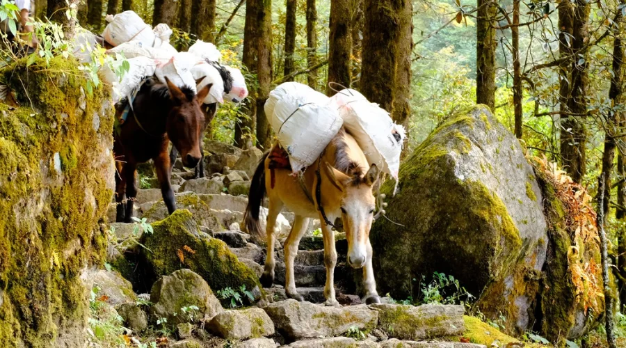
Horse carrying loads at Kanchenjunga Trek
Hiring locally sourced porters helps you carry the load and guides you through the trails since they know all the areas well. As mentioned before, even though it is possible to do so, carrying a heavy weight will, after some time, prove to be a bit strenuous without the assistance of a porter.
Tips on Hiring a Porter for Kanchenjunga Trek
It is good practice to ensure the individual hired to be a porter has prior experience trekking at high altitudes. Guides and porters experienced with these trails’ workload understand how to handle rough terrain and the effects of such high altitudes.
Tipping the Guide and Porter
Guides and porters normally follow tipping habits at the end of the trekking experience. While echoing tips, they are recommended to vary between $10 and $20, depending on the services’ quality. They are responsible for your trekking success and pleasure; therefore, it is proper to reward them by giving them a fair tip.
Alternative Trekking Routes
However, other treks differ from the main Kanchenjunga circuit available to trekkers and take a shorter time in the region. You can go via Tseram at the beginning or even start trekking from
Extending the Trip
Some trekkers who want to experience more of Kanchenjunga can add more days to the trip. They can also go to neighbouring areas or extend their stay in the region to allow their bodies to adjust to high altitudes comfortably.
This way, you can spend more days on the tours and avoid altitude sickness, which may be due to a short acclimatization period.
You can extend your trip to other regions of Nepal, including the Kanchenjunga Region, Everest, Annapurna, and Dhaulagiri.
If you have trekked enough and want to roam and explore, you can choose Rara National Park, Bardiya National Park, Chitwan National Park, or a tour of Pokhara.
How to Book Kanchenjunga Trek
To organize and arrange a Kanchenjunga trek, it is advisable to use the services of a well-established trekking company such as Himalayan Masters, which operates in Nepal.
Making the bookings as early as possible, especially during the peak trekking seasons, ensures you get your preferred accommodation without any complications. Many of the best lodging options in the area are typically booked well in advance, so it is always wise to start your planning early.
How to Book a Last-Minute Trip
If you are planning to go on a tour at very short notice, try to approach trekking agencies directly, and the trek operators may be able to help you with any last-minute seats or cancellations. Generally, some agencies may have some openings due to some requirements that have been cancelled that will enable you to visit the Kanchenjunga region within a short while.
Why Choose Himalayan Masters
Himalayan Masters is famous for its well-experienced porters and customized approach to each tour. They know not only the culture of the area but also the physical landscape to guarantee a safe and productive trip.
From tweaks on the trail to handling difficult parts of the journey, our priority is to provide an experience that immerses us in the awe of the great Nepalese wilderness.
Feedback and Review
Himalayan Masters highly value feedback from trekkers. After you complete your Kanchenjunga trek, we would love to hear about your experience. Your reviews help us continuously improve our services and provide better experiences for future adventurers.
Reviews
I did my Kanchenjunga Circuit Trek with Himalayan Masters this October. Everything about the trek and their team was perfect. I wanted to do the Everest Base Camp Trek, but Sandip suggested I do the Kanchenjunga Circuit Trek as I changed my mind about the peaceful trek.
Our guide, Kanchan, did a great job during the 20 days of the Kanchenjunga Trek. There was never a single day where I felt bored. The local people of the area were very friendly and respectful. I must recommend the Kanchenjunga Trek to you.
James WastonEngland
FAQs
Can we trek to Kanchenjunga?
The Nepal government issued permits for all foreigners to trek to the Kanchenjunga base camp. There is a different route to take to Kanchenjunga North Base Camp and Kanchenjunga South Base Camp. Our Kanchenjunga Circuit Itinerary takes you to both base camps to complete one circuit. Almost all treks to Kanchenjunga start from Taplejung.
However, without a climbing permit, you cannot trek beyond the Kanchenjunga base camp. You will also need a special permit, climbing experts, and porters.
What is the third tallest mountain in the world?
Mount Kanchenjunga, situated in Nepal, is the third-highest mountain in the world, with an amazing height of 8586 meters.
How long does it take to Hike Kanchenjunga?
It takes around 20-22 days to the base camps of Mount Kanchenjunga where you can hike upto to the two camps of Kanchenjunga.
How high is Kanchenjunga death rate?
The death rate of Mount Kanchenjunga is 22%. It is somehow higher than even Everest because of frequent avalanches and changes in weather.
How difficult is the Kanchenjunga base camp trek?
Kanchenjunga trek can be called the most difficult base camp trek to Nepal. The trail is very remote, with many landscape-prone sections. Also, you will be hiking above 4000 meters for many days. Walking 6-7 hours daily in such rough mountain terrains for 22 days isn’t easy.
What kind of accommodation is available in Kanchenjunga?
A few years back, the Kanchenjunga Circuit trek was a camping hike route. These local guest houses, called tea houses in Kanchenjunga, provide a bed, washroom, and food. There is also Wi-Fi in some places. These local tea houses are not luxurious but comfortable enough to keep you warm and healthy.
What are Kanchenjunga trek permits?
The first is the Kanchenjunga Conservation Area Project Entry Permit, which costs about Nrs 2,000 per person. The next one is the Kanchenjunga Restricted Area Permit, which costs USD 10 per person per week. To issue this permit, book your trek for a licensed travel agency in Nepal like Himalayan Masters or hire a guide yourself. Also, you must be in a group of two people.
What is the height of Kanchenjunga?
Kanchenjunga, standing tall at an elevation of 8,586 meters (28,169 feet), is the third-highest mountain in the world. Its massive height and awe-inspiring presence make it a challenging yet alluring destination for climbers and adventurers seeking to conquer its peaks.
Which is the highest, K2 or Kanchenjunga?
K2, located on the China-Pakistan border, holds the title of the second-highest mountain in the world, surpassing Kanchenjunga in height. K2’s towering summit reaches an impressive elevation of 8,611 meters (28,251 feet).
What is the mystery of Kanchenjunga?
Kanchenjunga is surrounded by mystery and local folklore, with tales suggesting that it is home to a deity who guards the mountain’s treasures. Its name, which means “The Five Treasures of the Snow,” adds to its mystique and allure.
Why is Kanchenjunga so famous?
Kanchenjunga is famous for its stunning beauty, challenging climbing routes, and cultural significance. It is considered a sacred mountain by the local people, who hold various myths and legends about its origins and spiritual importance.
How much does it cost to trek Kanchenjunga Himal?
Climbing Mount Kanchenjunga costs around $1900 per person. These costs include permits, accommodation, food, transportation, guides, and other necessary expenses for a safe and successful trek.
What is the English translation of Kanchenjunga?
The English translation of Kanchenjunga is “The Five Treasures of the Snow,” a name that reflects the mountain’s grandeur and the hidden wonders within its peaks.
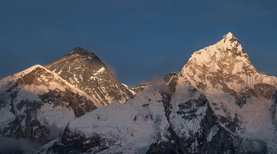
Can you see Everest from Kanchenjunga?
Yes, on clear days, the breathtaking view from Kanchenjunga offers a glimpse of Mount Everest, the highest peak in the world. This stunning vista showcases two of the most iconic mountains in the Himalayas.
How long does it take to climb Kanchenjunga?
Climbing Kanchenjunga is a challenging endeavor that requires careful planning and preparation. The expedition typically takes around 6 to 8 weeks to complete, depending on the chosen route and weather conditions.
Who is the oldest person to climb Kanchenjunga?
Carlos Soria, a Spanish mountaineer, holds the record as the oldest person to summit Kanchenjunga. He achieved this remarkable feat at the age of 75 in 2014, showcasing his exceptional skill and determination.
Why don't people climb Kanchenjunga as frequently?
Kanchenjunga’s remote location, challenging terrain, and technical difficulties make it a less frequently climbed mountain compared to Everest. Additionally, obtaining a permit for Kanchenjunga is more complex and costly, contributing to its lower climbing frequency.
Is Kangchenjunga harder than Everest?
Many experienced mountaineers consider Kanchenjunga to be more challenging than Everest due to its technical difficulty, unpredictable weather, and remote location. Climbing Kanchenjunga requires a high level of skill, experience, and physical fitness.
Is Kanchenjunga safe?
Climbing Kanchenjunga comes with inherent risks due to its extreme altitude and challenging terrain. However, with proper preparation, experienced guides, and adherence to safety protocols, climbers can mitigate these risks and safely summit the mountain.
Based on your preferences, location, timeframe, and budget, our team can design your dream trek based on our extensive knowledge and experience of the Himalayas. Get in touch with us for detailed information and assistance planning your dream trek. With our 97% success rate on trekking and climbing trips in 2022 and 2023 spring season, we will answer any questions you may have and guide you for an unforgettable experience.